Halls Gap and the Grampians
A village in a gap in the sandstone, with lookouts, rock pools and ancient rock art within a short drive, and kangaroos on the grass at dusk
The Grampians rise straight out of the western plains of Victoria, a line of tilted sandstone ranges, and Halls Gap sits in the valley between them, the only town inside the national park. From the main street you look up at the cliffs. Within twenty minutes’ drive you can stand at Boroka Lookout with the whole valley below, set out for the Pinnacle, walk to rock pools and waterfalls, or go to see paintings made by the Jardwadjali and Djab Wurrung, whose Country this is. In the evening the kangaroos come down to graze the open grass in the village.
How this page was madeWe have not yet been to Halls Gap or the Grampians. So this page is researched, from Parks Victoria, Visit Grampians, Northern Grampians Shire Council, V/Line, Victorian Places and the sources named at the end, checked on 12 November 2026. When we go, we will say so here.
Last updated 12 November 2026
A little background
Gariwerd, the Jardwadjali and Djab Wurrung name for the ranges, is their Country, and its rock shelters hold most of the Aboriginal rock art known in Victoria: hand stencils, animal tracks, people and birds, painted by Jardwadjali and Djab Wurrung people. Many places in the park now carry their Aboriginal names beside the English ones.
The English name came in 1836, when Thomas Mitchell, Surveyor General of New South Wales, crossed this country on his Australia Felix expedition and called the ranges the Grampians, it is generally said after the hills of his native Scotland. The painter Eugene von Guérard sketched his way along the range in 1856, and his Mount William and part of the Grampians in West Victoria (1865) is in the collection of the National Gallery of Victoria. The national park was declared in 1984.
The fires of the 2024–25 summer spread widely through the park, and in 2026 Parks Victoria is still rebuilding walks and visitor sites.
How the place fits together
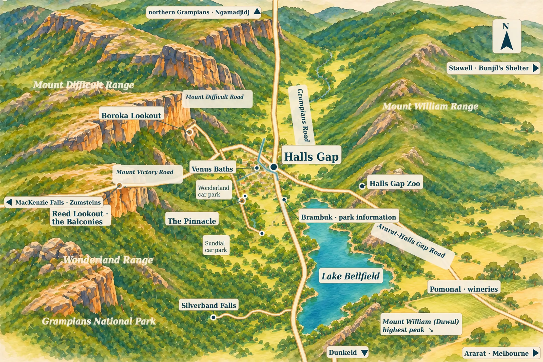
Halls Gap lies in a long valley between two ranges. To the west rise the cliffs of the Wonderland Range and Mount Difficult; to the east, Mount William, the park’s highest peak. Grampians Road runs down the valley floor, through the village and south past Brambuk to Lake Bellfield. Mount Victory Road climbs west out of the village towards Boroka (up Mount Difficult Road), Reed Lookout and the Balconies, and on to Zumsteins and MacKenzie Falls. The village is walkable; almost everything else is a short drive.
The village centre
the baseHalls Gap’s centre is a short run of shops, cafés and motels where Stony Creek crosses Grampians Road, with the cliffs straight above. The coach stops here, and the walks to Venus Baths and into the Wonderland Range start from the edge of the village, so you can leave the car parked all day.
The valley edges
for quietNorth along Mount Victory Road and south down Grampians Road towards Brambuk and Lake Bellfield, the beds spread out into the bush. Here you stay in a cabin, a cottage or a holiday park, with the mountains in view and kangaroos grazing outside in the evening.
Pomonal and the wine country
for winePomonal lies east of the Mount William Range among farms and small wineries, about 13 km from Halls Gap. It is quieter than the valley, with villas and cottages and some of the region’s cellar doors close by. Part of the area burnt in February 2024.
Places you don’t want to miss
Most of what people come for lies inside the national park, within half an hour of the village. None of it has a full guide of its own on our site yet, so these cards carry no links.
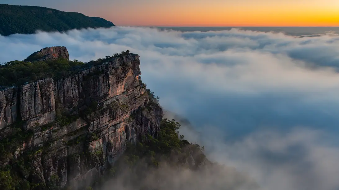
The Pinnacle
The Pinnacle is the rock platform you see from the village street, jutting out high above the valley. From the Sundial car park it is a walk of 4.2 km there and back, about an hour and a half, and Parks Victoria calls it suitable for young children. Walkers who want more of a climb start from the Wonderland car park and climb through the Grand Canyon and the narrow cleft of Silent Street.
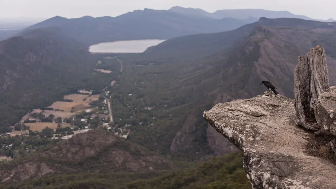
Boroka Lookout
A 20-minute drive up Mount Difficult Road and a short, level path bring you to the edge, where the whole valley is laid out below: the village among the trees, Lake Bellfield at the far end and the plains running away to the east. The path suits wheelchairs and prams, and early morning, with mist lying in the valley, is the time to come.
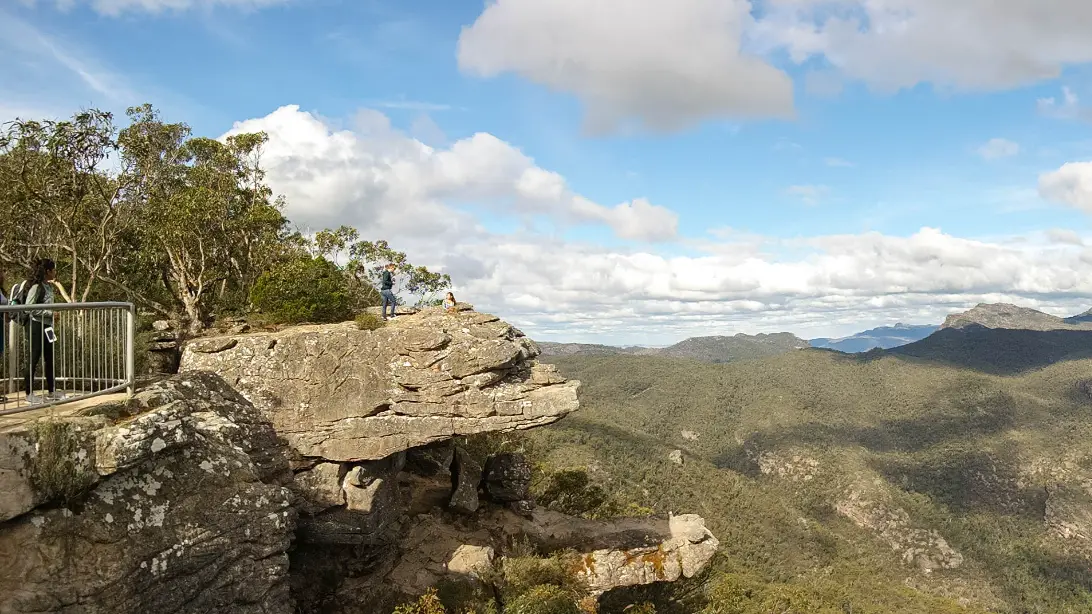
Reed Lookout and the Balconies
From Reed Lookout, a walk of about 2 km there and back leads through stringybark forest to the Balconies, two slabs of sandstone that jut out like the jaws of an animal, high above the Victoria Valley. Stay behind the barriers.
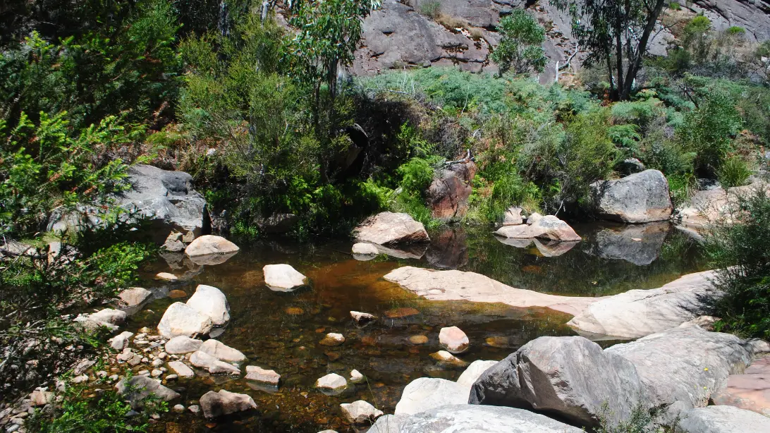
Venus Baths and Stony Creek
An easy walk from the village follows Stony Creek upstream through the botanic gardens to Venus Baths, a run of clear rock pools among smooth slabs of rock. The circuit is about 2.3 km. On a warm day people sit with their feet in the water.
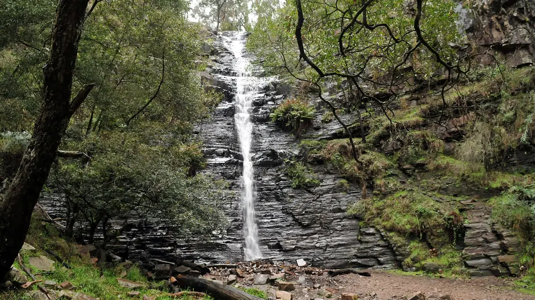
Silverband Falls
Ten minutes’ drive south of the village, a short track of about 1.5 km there and back runs through ferny forest to Silverband Falls, where Dairy Creek slides down a dark rock face and, with no pool at its foot, vanishes among the stones. It is fullest in winter and spring, and after rain.
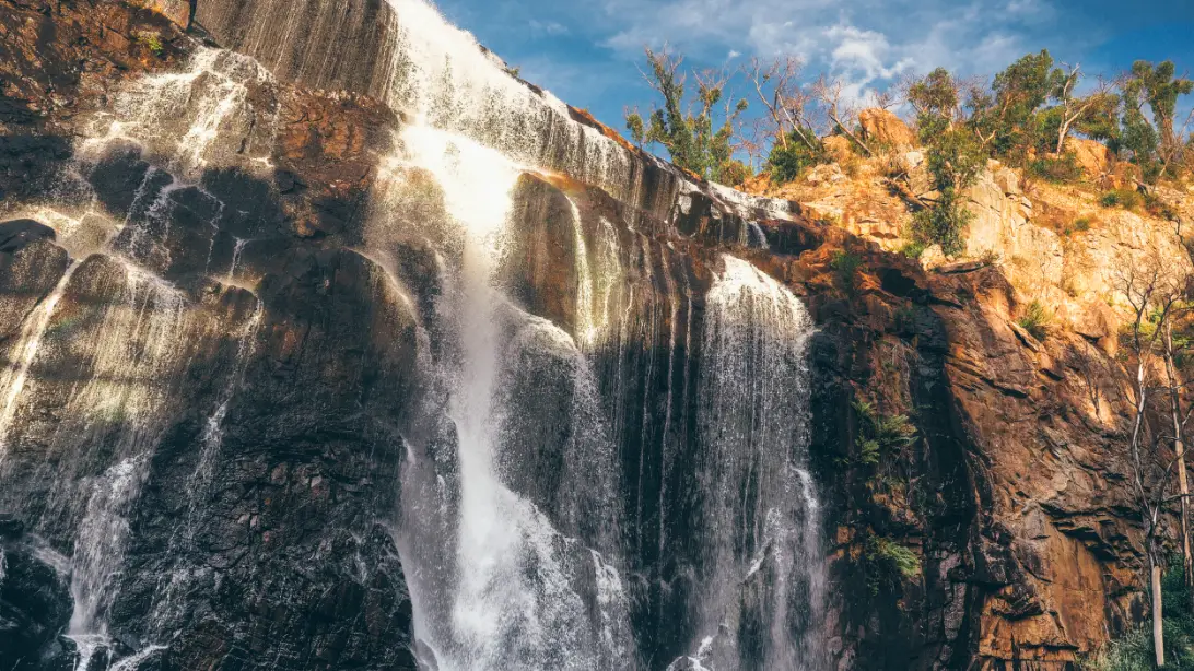
MacKenzie Falls, closed in 2026, and Fish Falls
MacKenzie Falls is one of the most visited places in the park, a broad fall over red cliffs and the only one in the Grampians that runs all year. The precinct has been closed since February 2026 for rebuilding. You can still walk from Zumsteins picnic area along the river to Fish Falls; Zumsteins is about half an hour’s drive from the village.
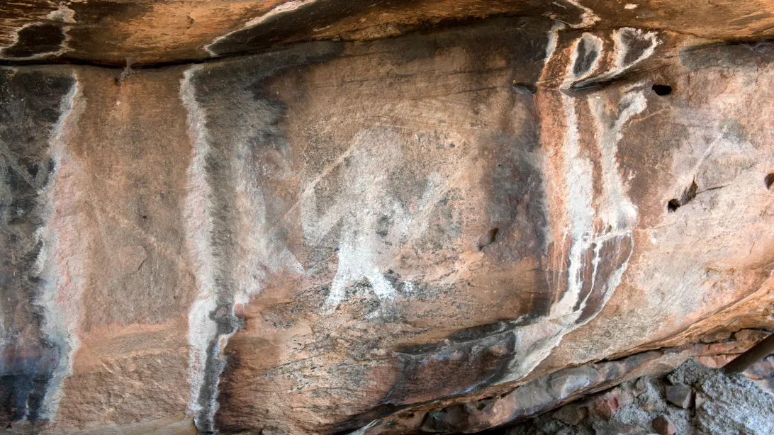
Bunjil’s Shelter and the rock art
In a granite overhang near Stawell, about half an hour from the village, Bunjil, the creator, is painted with his two dingoes. It is the only known rock painting of him, and its Traditional Owners have allowed visitors to keep coming; the walk from the car park is about 100 metres. Ngamadjidj Shelter, in the north of the park, is open too. Never touch the paintings.
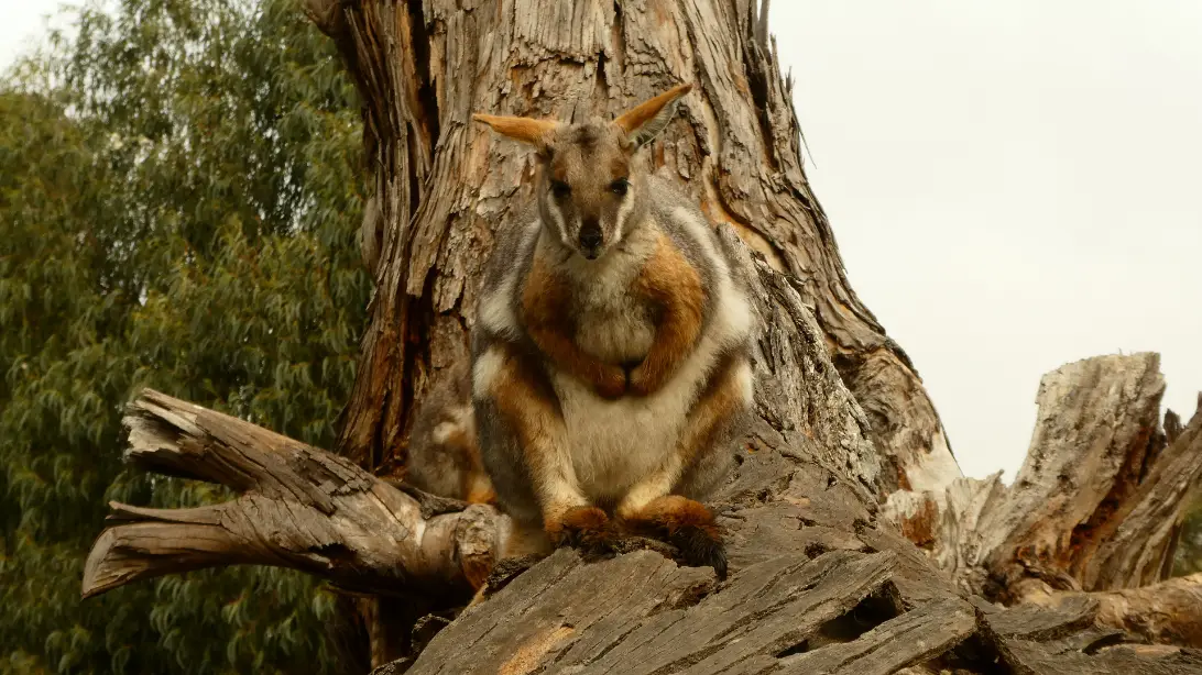
Halls Gap Zoo
Seven kilometres from the village, this private zoo has over 120 species, from meerkats to Tasmanian devils. Its 2.5 km gravel path suits prams and wheelchairs; allow two hours or more.
Come back to the village as the light goes and walk out onto the open grass by the recreation reserve. The cliffs above turn orange, then grey. One by one the kangaroos come out of the trees to graze, heads down, a joey close to its mother, the big males sitting up to watch you. Stand still and keep your distance, and listen to the grass being cropped as the first stars come out over Mount William.
Getting there and around
By car, the usual way from Melbourne is the Western Highway to Ararat, then north through Moyston and Pomonal into the valley; a little over three hours. Coming up from the coast, as on our loop, you drive north from Dunkeld through the middle of the national park, between the ranges.
| To or from | Distance | What to expect |
|---|---|---|
| Melbourne | About 250 km | A little over 3 hours, by the Western Highway and Ararat |
| Port Fairy | About 155 km | About 2 hours, by Hamilton and Dunkeld |
| Dunkeld | About 65 km | About 50 minutes, through the national park |
| Ballarat | About 140 km | About 2 hours, by Ararat |
| Stawell | About 25 km | About 25 minutes |
Planning estimates without stops, from OpenStreetMap routing, checked on 12 November 2026. On our Great Ocean Road and Grampians loop, Halls Gap is the stop for nights three and four, after Port Fairy and before Ballarat.
Without a car, take the V/Line train from Melbourne to Ararat or Ballarat, then a V/Line coach to Halls Gap by way of Stawell. Coaches stop at the visitor information centre in the village and at Brambuk. There are only a few a day, and they do not run on days of Catastrophic fire danger, so plan the connection with V/Line’s journey planner. You can walk to Venus Baths and the Wonderland Range from the village, but the lookouts and the falls need a car or a tour. See getting around Australia for car hire.
When to go and practical notes
Spring is the season the Grampians are known for, when the wildflowers are out and the waterfalls run full after the winter rain. At nearby Stawell, summer afternoons average about 29°C and winter ones about 12°C, with July nights near 4°C.
The lookouts, the Pinnacle, Venus Baths and Silverband Falls are open. Some walks are still closed after the 2024–25 fires, among them the Fortress, the Chimney Pots and the Billimina rock art walk. The MacKenzie Falls precinct has been closed since February 2026 for rebuilding. Parks Victoria’s own pages give different finish dates, from mid-2026 to the end of the year, so check before you plan around it. The Brambuk cultural centre building is closed for refurbishment, but the park information centre beside it is open from 9am to 4pm every day except Christmas Day. On days of Catastrophic fire danger the park closes.
Kangaroos and wallabies are on the roads at dawn and dusk, so drive slowly then, and try to arrive in daylight. For the history and culture of the people whose Country this is, see our guide to understanding Aboriginal and Torres Strait Islander Australia. With children, the zoo (open 10am to 5pm daily, except Christmas Day), Venus Baths, the Pinnacle from Sundial and the level path at Boroka make an easy two days (the rocks at Venus Baths are slippery when wet), and the village grass at dusk is free.
Where to stay and eat
Stay in the village to walk to dinner and the walks, on the valley edges for a cabin in the bush, or at Pomonal among the wineries. Halls Gap does not yet have separate stay and eat pages on our site, so our choices are here, researched on 12 November 2026. We could not load the operators’ own websites, so these details come from Visit Grampians and Northern Grampians Shire listings. Please confirm availability and opening hours directly before you rely on them.
Kookaburra Motor Lodge, 26–28 Heath Street, is a small motel of 14 ground-floor rooms in a quiet street in the middle of the village, a few minutes’ walk from the shops and the start of the Venus Baths walk. Breakfast can be ordered to your room, and kangaroos often graze outside.
Halls Gap Valley Lodges, 406–412 Grampians Road, is on the valley floor between the village and Lake Bellfield, on 28 acres beside the national park. Its two-bedroom self-contained cottages sleep up to five, with a terrace looking at the mountains: good for families and longer stays. You will want a car.
Pomonal Estate, 2079 Pomonal Road, Pomonal, is a family winery, brewery and cider house with seven self-contained villas among the vines, 10 to 15 minutes from the village. It is the choice for a quieter, more comfortable stay, with the estate’s restaurant a short stroll away.
Where to eat
Most of the village’s cafés and restaurants are on Grampians Road, around Stony Creek.
Flame Brothers, 10/97 Grampians Road, beside Stony Creek, cooks smoked meats and burgers in an American barbecue style, with vegetarian and vegan choices. It opens for dinner every day, and for lunch and breakfast later in the week; bookings are encouraged.
Halls Gap Hotel, 2262 Grampians Road, is the pub on the edge of the village, a short bush walk from the centre: a family bistro with a big veranda looking at the mountains, open fires in the cooler months and play areas for children. Lunch and dinner are served Wednesday to Sunday.
Iris, at Pomonal Estate, opened in May 2026 and serves regional dishes alongside the estate’s own wine and beer. It is the place for a longer meal out. Its hours were not published when we checked, so book ahead.
Nearby
Dunkeld, about 50 minutes south, is where the range ends in the two peaks of Mount Sturgeon and Mount Abrupt, and where the 160 km Grampians Peaks Trail, which passes through Halls Gap from Mount Zero, finishes. Ararat, 40 minutes east, has Gum San, the Chinese Heritage Centre, on the goldfield that Chinese miners found in 1857; check its opening days.
Further out, the Silo Art Trail of painted grain silos runs across the Wimmera plains to the north. Ballarat, two hours east, is the next stop on our loop; see our Ballarat guide, and our day trips from Melbourne for the Grampians as a long day out.
A final word on Halls Gap
Halls Gap is a base for the mountains, and a good one. Two nights give you a sunrise at a lookout, a climb to the Pinnacle, a cool hour at Venus Baths and an evening among the kangaroos, with time for the rock art or the zoo. Stay a third and you can walk further, or simply sit on a veranda and watch the cliffs change colour.
Andrew + Margaret
- Visiting Australia Overview
- Great Ocean Road and Grampians loop Journeys
- Port Fairy Overview
- Ballarat Overview
- Day trips from Melbourne Practical
- Getting around Australia Practical
- Parks Victoria — Grampians (Gariwerd) National Park Official
- Visit Grampians Official
- V/Line — trains and coaches Official
- VicEmergency — fire danger and warnings Official
- Halls Gap Zoo Booking
- Eugene von Guérard, Mount William and part of the Grampians in West Victoria (1865) Culture
How many nights should I spend in Halls Gap?
Two nights give you a full day in the park between your arrival and departure, enough for the lookouts, one good walk and an evening with the kangaroos. Add a third for a longer walk, a day at the rock art or a winery lunch.
Can I see MacKenzie Falls?
Not while the precinct is closed for rebuilding, which began in February 2026; Parks Victoria gives different finish dates, so check its site. The river walk from Zumsteins to Fish Falls is open.