Port Fairy
An old whaling port of stone cottages and Norfolk pines, where the fishing boats still tie up in the middle of town and seabirds fly in to the island at dusk
Port Fairy sits where the Moyne River meets the sea, at the western end of the Great Ocean Road country. Fishing boats tie up along the river under tall Norfolk pines, and behind them run quiet streets of bluestone cottages, old inns and shops, many of them more than 150 years old. Walk the wharf, cross the river to Battery Hill and the causeway to Griffiths Island and its lighthouse, and stay for the evening, when from spring to autumn the shearwaters come home from the sea. It is a small town, easy on foot, and twice named Victoria’s top small tourism town. It makes a gentle night’s stop after the Twelve Apostles.
How this page was madeWe have not yet been to Port Fairy. The one time we travelled the Great Ocean Road, friends drove us and our stop was the Twelve Apostles. So this page is researched, from Port Fairy & Region Visitor Information, Moyne Shire Council, Victorian Places, V/Line, the operators’ own pages and the sources named at the end, checked on 12 November 2026. When we go, we will say so here.
Last updated 12 November 2026
A little background
This is Peek Whurrong Country, and the Eastern Maar are its recognised Traditional Owners. The frontier here was violent in the 1840s, and the Indigenous Massacres Memorial at Railway Place is where the town now gathers each 26 January to remember.
Sealers and whalers came first. The crew of the cutter Fairy, under Captain James Wishart, reportedly named the bay in 1828, and in 1835 John Griffiths set up a whaling station on the island that now bears his name. In 1843 James Atkinson, a Sydney lawyer, bought the land by special survey and laid out a town. It was called Belfast and the river the Moyne, both Irish names from his birthplace. By 1857 more than 2,000 people lived here, and for a while it was one of the busiest ports in the colony. In 1887 the town took back the old name, Port Fairy.
Its stories still draw writers. Robert Gott’s crime novel The Port Fairy Murders (2015) is set partly in the town in 1943, and each September the Port Fairy Literary Weekend fills the Reardon Theatre with authors and readers.
How the place fits together
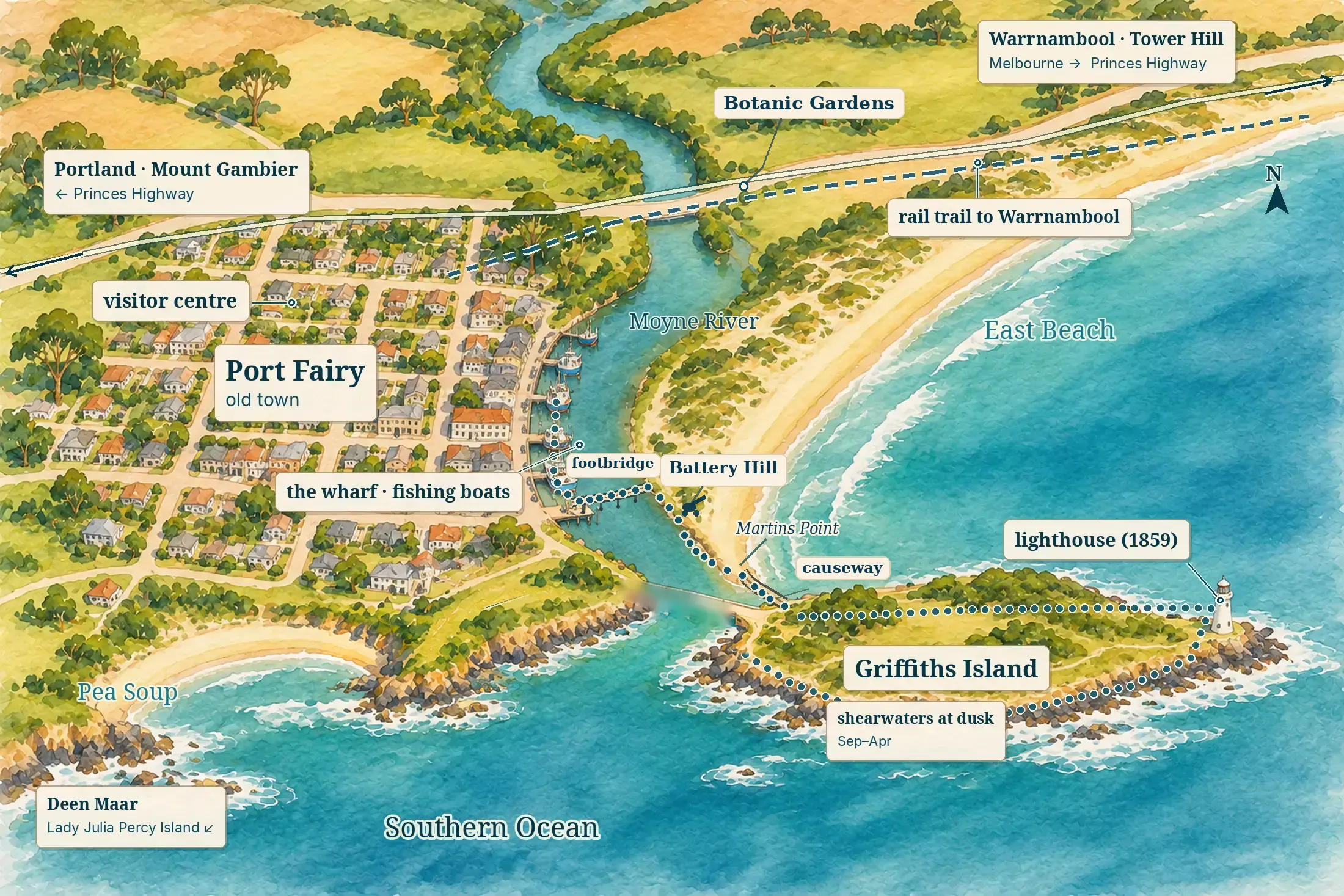
Port Fairy is a small town between a river and the sea. The old town lies on the west bank of the Moyne, with the Princes Highway passing along its edge. Gipps Street follows the wharf along the river. On the far bank, reached by a footbridge or the road bridge, are Battery Hill, the causeway to Griffiths Island and East Beach. Everything is within a walk of everything else; you need a car only to leave.
The old town
the baseWest of the river, a few streets of shops, pubs and nineteenth-century cottages make up the centre, with Sackville and Bank Streets at its heart. Many of the bed and breakfasts and guest houses are here, in old stone buildings. The visitor centre and the coach stop are on Bank Street, and the river is a few minutes’ walk away.
The river and the wharf
for the boatsGipps Street runs along the Moyne, where the fishing boats tie up beneath tall Norfolk pines, past the old courthouse and stores. A footbridge crosses to Battery Hill, and from there the path leads on to the causeway and the island. There are fewer beds here than in the old town, but this is the Port Fairy of the postcards.
East Beach
for the seaAcross the river, East Beach runs north-east from the river mouth, a long sweep of sand backed by dunes, holiday houses and the botanic gardens. The town’s surf lifesaving club is here. It is the choice for a beach holiday, and still close enough to walk into town for dinner.
Places you don’t want to miss
Port Fairy’s pleasures are close together, and most of them are a walk along the river. None of them has a full guide of its own on our site yet, so these cards carry no links.
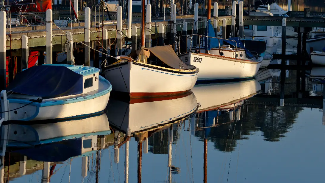
The Moyne River and the wharf
Port Fairy is still a fishing port, and its boats tie up along the Moyne in the middle of town, bringing in crayfish, snapper and tuna. Walk the wharf on Gipps Street in the morning, when the boats are working, past bluestone stores and the 1859 courthouse, now the town’s museum. The path follows the river all the way to the sea.
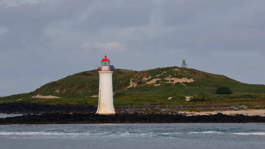
Griffiths Island and the shearwaters
Cross the footbridge from the wharf and follow the path to the causeway onto Griffiths Island, where a loop of about 3 km leads to a bluestone lighthouse built in 1859. Swamp wallabies graze among the dunes. From late September to April, short-tailed shearwaters nest here in burrows, and at dusk they fly in from the sea in their thousands, having wintered near Alaska. Keep to the tracks, as the burrows collapse underfoot.
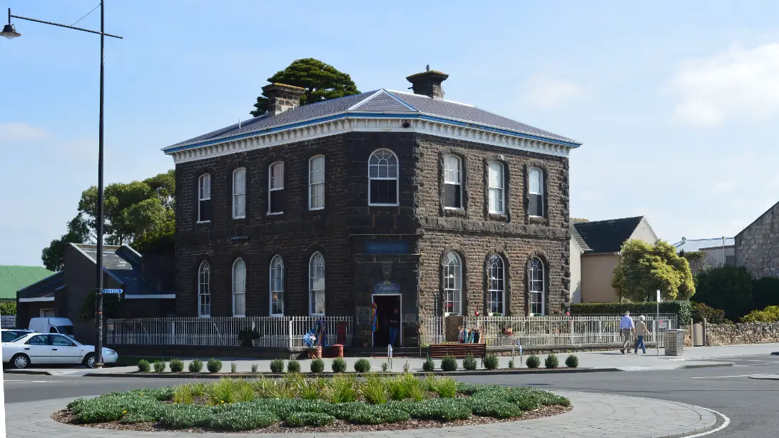
The old stone streets
Port Fairy has kept its colonial streets almost whole: about 50 of its buildings are classified by the National Trust. Walk them with the historic walks map from the visitor centre, from small whalers’ cottages to the Merrijig Inn of the 1840s and the old Stag Inn of 1847. Look for the stone mile post on the Merrijig’s Campbell Street front.
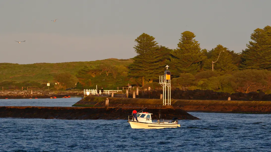
Battery Hill and the river mouth
Across the footbridge from the wharf, Battery Hill still has its cannons and the stone and concrete emplacements built in 1886–87, when the colony feared a Russian attack. From the top you look over the river mouth to the island and out across the bay where the whale boats once worked. In January the big cannon is fired on Sunday mornings.
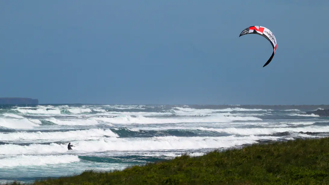
East Beach and Pea Soup
East Beach is the long surf beach on the far side of the river, home to the town’s surf lifesaving club, with room for walkers, surfers and kites. Pea Soup, on the town’s south-west side, is small and sheltered, and a favourite with families. It is a place of meaning for local Aboriginal people too, with a sightline to Deen Maar, the island offshore.
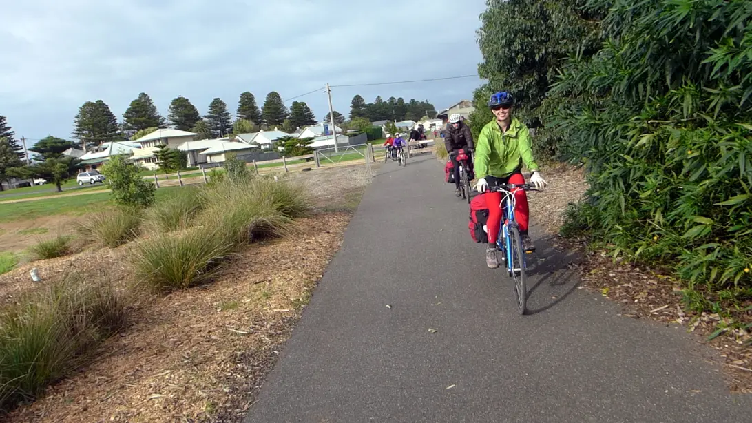
The rail trail to Warrnambool
The railway reached Port Fairy in 1890, and the last train left in 1977. Its line is now a 37 km rail trail to Warrnambool, through dairy country and past the wetlands of the Merri River. Ride a few kilometres out and back, or the whole way to Warrnambool.
Walk out to the island as the sun goes down and stand still near the viewing platform. At first there is only the wind and the sea on the rocks. Then the first dark birds come in low over the water, and more behind them, until the air above the dunes is full of them. They have flown here from the far north Pacific, and they drop into the dunes, each bird to its own burrow. Walk back slowly in the dark, with the town lights across the river.
Getting there and around
By car, the quickest way from Melbourne is inland on the Princes Highway, by Geelong and Warrnambool. On a Great Ocean Road trip, you arrive the slow way along the coast, by the Twelve Apostles and Warrnambool, and Port Fairy makes a natural night’s stop at the end of that day. Going on west, the highway leads to Portland and Mount Gambier.
| To or from | Distance | What to expect |
|---|---|---|
| Melbourne | About 285 km | About 3¾ hours on the Princes Highway |
| Apollo Bay | About 185 km | About 2¾ hours, by the Twelve Apostles and Warrnambool |
| Twelve Apostles | About 100 km | About 1½ hours |
| Warrnambool | About 27 km | About 30 minutes |
| Mount Gambier | About 160 km | About 2 hours, into South Australia |
Planning estimates without stops, from OpenStreetMap routing, checked on 12 November 2026. On our Melbourne to Adelaide via the Great Ocean Road itinerary and our Great Ocean Road and Grampians loop, Port Fairy is the second night’s stop, after Apollo Bay.
Without a car, take the V/Line train from Melbourne to Warrnambool, then a V/Line coach west to Port Fairy, about half an hour on. Coaches stop on Bank Street, in the middle of town. Book a seat on the train, and plan the connection with V/Line’s journey planner, as coach times change. Once here, you can walk everywhere. See getting around Australia for car hire.
When to go and practical notes
From late September to April the shearwaters are on the island, and summer brings warm days on the beaches; book early for the January holidays. The Port Fairy Folk Festival fills the town on the Labour Day weekend in March, and the 50th festival runs from 5 to 8 March 2027. The town fills up that weekend, so book well ahead, or come another week for a quieter stay. Winter is quiet and often wild, good for storm-watching from Battery Hill and long walks on empty beaches.
The birds are worth planning a trip around. They usually reach Griffiths Island within a day or two of 22 September, and the adults leave in mid-April, with the young following into May. Outside those months the island is still a fine walk, but the dusk flight will not happen. Go out in the last hour of light, with a windproof layer and a torch for the walk back.
Over summer the Country Fire Authority declares a fire danger period, and roads and parks can close on bad days, so check VicEmergency and VicTraffic if you are driving on. For the history and culture of the people whose country this is, see our guide to understanding Aboriginal and Torres Strait Islander Australia. With children, the sheltered water at Pea Soup, the wallabies on the island and an easy ride along the rail trail all make a good family day.
Where to stay and eat
Stay in the old town to walk to everything, by the river for the boats and the island, or at East Beach for a beach stay. Port Fairy does not yet have separate stay and eat pages on our site, so our choices are here, researched on 12 November 2026. Please confirm availability and hours yourself before you rely on them.
Merrijig Inn, 1 Campbell Street, on the corner of Gipps Street, looks over the wharf. Built in the 1840s, it calls itself Victoria’s oldest inn, and has a handful of rooms, some of them small attic rooms under the roof, with breakfast included. Its restaurant is below.
Seacombe House, 22 Sackville Street, in the centre of town, began as the Stag Inn in 1847. Today it offers rooms in the old guest house, historic stone cottages that include a former bank, and modern motel suites, so there is a choice of price and style under one roof.
Gardens Caravan Park, 111 Griffiths Street, is run by Moyne Shire Council beside the botanic gardens and the river, about 200 metres from East Beach and 600 metres from the town centre. It has cabins as well as caravan and camping sites, and dogs are welcome.
Where to eat
Most of Port Fairy’s cafés and restaurants are on Sackville and Bank Streets, a short walk from the river.
Merrijig Kitchen, at the Merrijig Inn, cooks with local produce in the inn’s old dining room. Dinner is from 6pm, Friday to Monday, and the front bar opens from 3pm; book ahead.
Coffin Sally, 33 Sackville Street, serves thin-crust pizzas in an old building that is said to have been a coffin-maker’s workshop. It opens in the late afternoon for dinner. We could not reach its own website, and listings disagree on its opening days, so check before you go.
The Mill, 42 Sackville Street, is a café in an old bluestone building with a courtyard, open for breakfast and lunch until about 3pm, with good choices for vegetarian, vegan and gluten-free diets. Its hours come from tourism listings rather than its own site, so check before you go.
Nearby
Tower Hill, 20 minutes east, is a volcanic crater whose floor is now a wildlife reserve, where emus, koalas and kangaroos are often seen from the walking tracks. Warrnambool, half an hour away, is the regional city, and from June to September southern right whales come to calve off Logans Beach.
Budj Bim, about an hour and a quarter north-west, is a World Heritage landscape where the Gunditjmara built stone channels and traps to farm eels thousands of years ago, and Gunditjmara guides lead tours there. It makes a long half-day from Port Fairy, or a stop on the way north to the Grampians. The Twelve Apostles, an hour and a half east, are beyond the easy day’s reach but on the way in from the coast road; see our Great Ocean Road guide.
A final word on Port Fairy
Port Fairy is a town to walk slowly. Its streets have changed little in a century and a half, its boats still work the river, and its island still fills with birds each summer evening. Stay one night and you will see the wharf and the lighthouse. Stay two and you can add Tower Hill, a ride on the rail trail or a day at Budj Bim.
Andrew + Margaret
- Visiting Australia Overview
- The Great Ocean Road Overview
- Melbourne to Adelaide via the Great Ocean Road Journeys
- Great Ocean Road and Grampians loop Journeys
- Apollo Bay Overview
- Getting around Australia Practical
- Port Fairy & Region Visitor Information Official
- V/Line — trains and coaches Official
- VicTraffic — road closures Official
- Port Fairy Folk Festival Booking
- Budj Bim Cultural Landscape Booking
- The Port Fairy Murders (2015): the novel Culture
When can I see the shearwaters on Griffiths Island?
From late September to April, at dusk, when the birds fly in from the sea to their burrows. Arrive half an hour before sunset and keep to the tracks. Numbers vary from year to year.
Is one night in Port Fairy enough?
One night is enough to walk the wharf, see the island at dusk and look round the old town. Two let you add Tower Hill, the rail trail or Budj Bim.