Port Stephens
Which bay to sleep in, and how to spend an afternoon and a morning between the headland and the dunes
Port Stephens is a wide, sheltered waterway two and a half hours north of Sydney, and the name also covers the towns and beaches along its southern shore. Most visitors stay near the mouth, where Nelson Bay and Shoal Bay sit under a steep headland. The ocean beaches and the Stockton dunes lie a short drive south. One night is enough for the headland or the dunes. Two nights give you both, and a boat trip as well.
We have driven through Port Stephens a few times but do not know it well, so this page is researched. It draws on NSW National Parks, Port Stephens Council, the region's own visitor information, the state marine parks agency and the Bureau of Meteorology. Where those sources leave something unclear, we say so rather than guess.
- One night on the coast drive: Nelson Bay or Shoal Bay
- Boat trips at your door: Nelson Bay, by the marina
- The beach under the headland: Shoal Bay
- Surf, and the dunes close by: Anna Bay & Birubi Point
Last updated 25 September 2026
A little background
This is Worimi Country. NSW National Parks describes Tomaree National Park as the traditional land of the Worimi people, and the beaches along it as routes the Worimi used to travel through their Country. The great dunes behind Stockton Bight are now the Worimi Conservation Lands, owned by the Worimi and managed jointly with the state.
James Cook passed the entrance in 1770 and named the port after Philip Stephens, a secretary of the Admiralty. In the Second World War the headland at its mouth was fortified, and Fort Tomaree's gun emplacements can still be reached on a short walk of their own.
The waterway and the coast outside it are now protected as the Port Stephens–Great Lakes Marine Park. The council opened its own koala sanctuary at One Mile in 2020.
Port Stephens is a holiday coast. The council counted 805,000 overnight visitors in the year to March 2019, staying 2.6 million nights between them, which is a little over three nights each. It is the most recent figure we have found. Our road trip north gives it one night.
How Port Stephens fits together
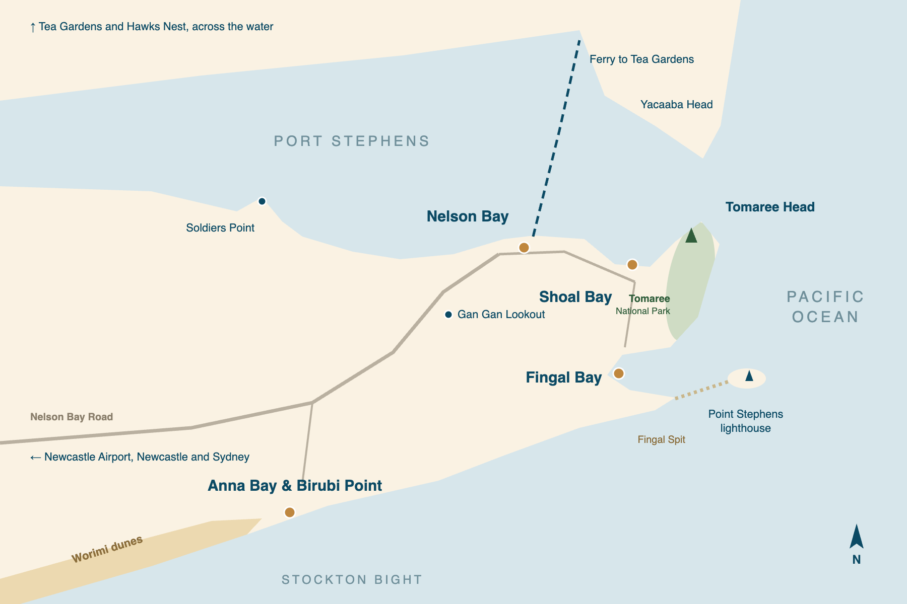
The waterway lies to the north, and the ocean to the east and south. The Tomaree Peninsula sits between them. Its north shore faces the calm water of the port, where Nelson Bay and Shoal Bay are. At its eastern tip Tomaree Head guards the entrance, with Yacaaba Head facing it across the water.
On the other side of the headland the coast turns south past a string of national-park beaches to Fingal Bay. From there it runs south-west past Boat Harbour and One Mile to Anna Bay and Birubi Point, where the long, straight beach of Stockton Bight begins.
For a visitor that makes four areas. Two of them face the port and two face the ocean. The first choice is which water you want outside the door. The panels below use the same names as the rest of our Port Stephens coverage.
Nelson Bay
the town and the marinaThe main town, above the marina at d'Albora, where the whale and dolphin cruises leave. It has most of the shops and restaurants. For one night without planning, it is the simplest choice: park once and walk to dinner.
Shoal Bay
the beach under the headlandA long beach running east from Nelson Bay to the foot of Tomaree Head. It faces the port, not the open ocean. Stay here to be close to the summit walk, and to climb it early, before the heat.
Fingal Bay
the quieter ocean bayA curved bay on the ocean side of the peninsula, with a surf club and a quieter village behind it. Fingal Spit runs out from it towards the lighthouse island, and NSW Parks warns against crossing the spit on foot, because the tide and the swell change quickly.
Anna Bay & Birubi Point
the dunes and the surfThe southern side of the peninsula, facing the open ocean. Birubi Point stands at the northern end of the Stockton dunes, and one of the entrances to the dune driving area is at Anna Bay. It suits a driver who wants the dunes first and does not mind driving back for dinner.
Places you don't want to miss
Four of these six are at the eastern end of the peninsula, within a few minutes of each other by car. The dunes are at the other end, and the boat trips need booking. The headland and the dunes each take half a day, so on a single night you will be choosing between them.
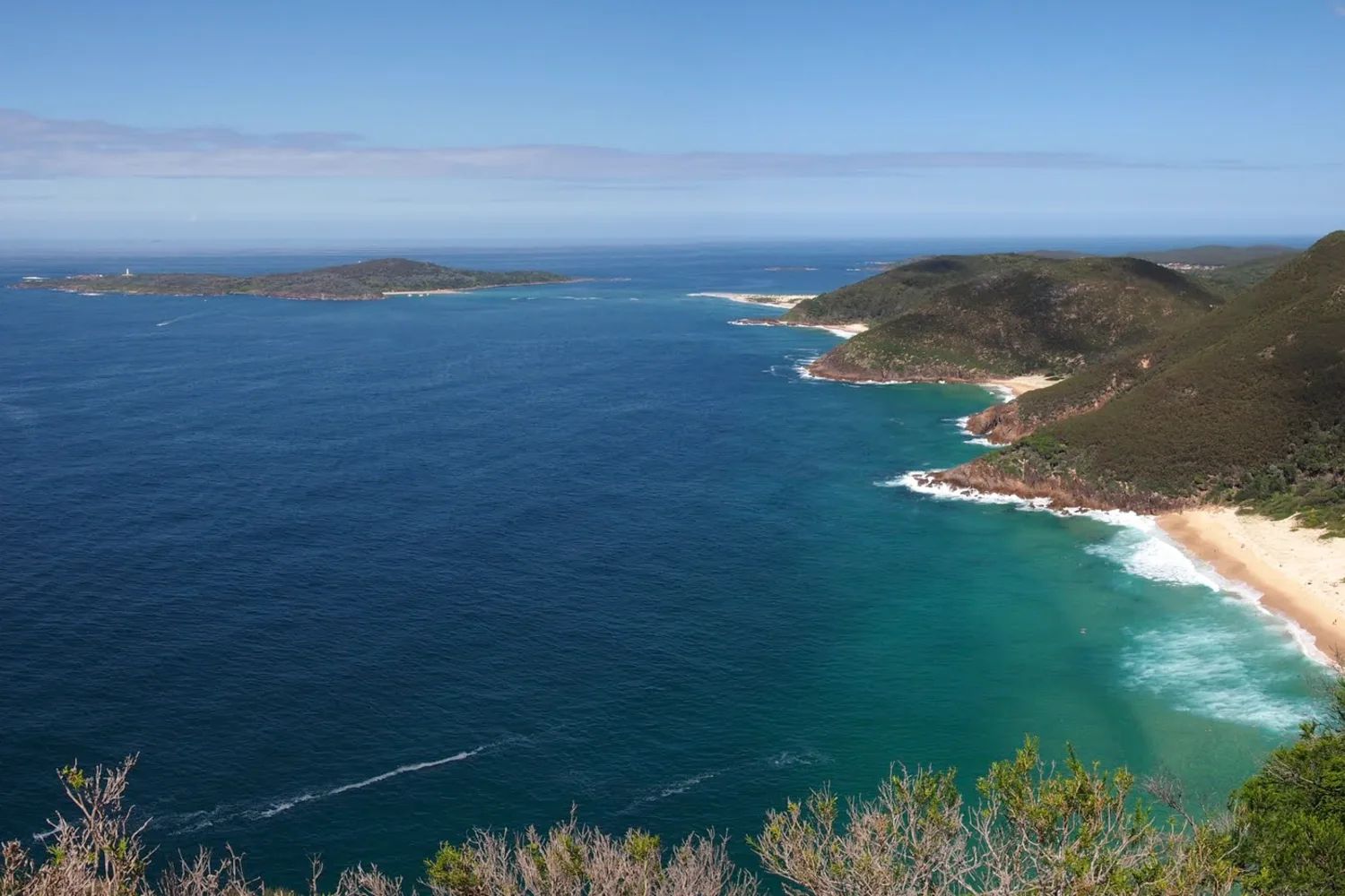
Tomaree Head
A steep, stepped 2.2 km return climb to two lookouts 161 metres above the port entrance. Allow 1½ to 2 hours.
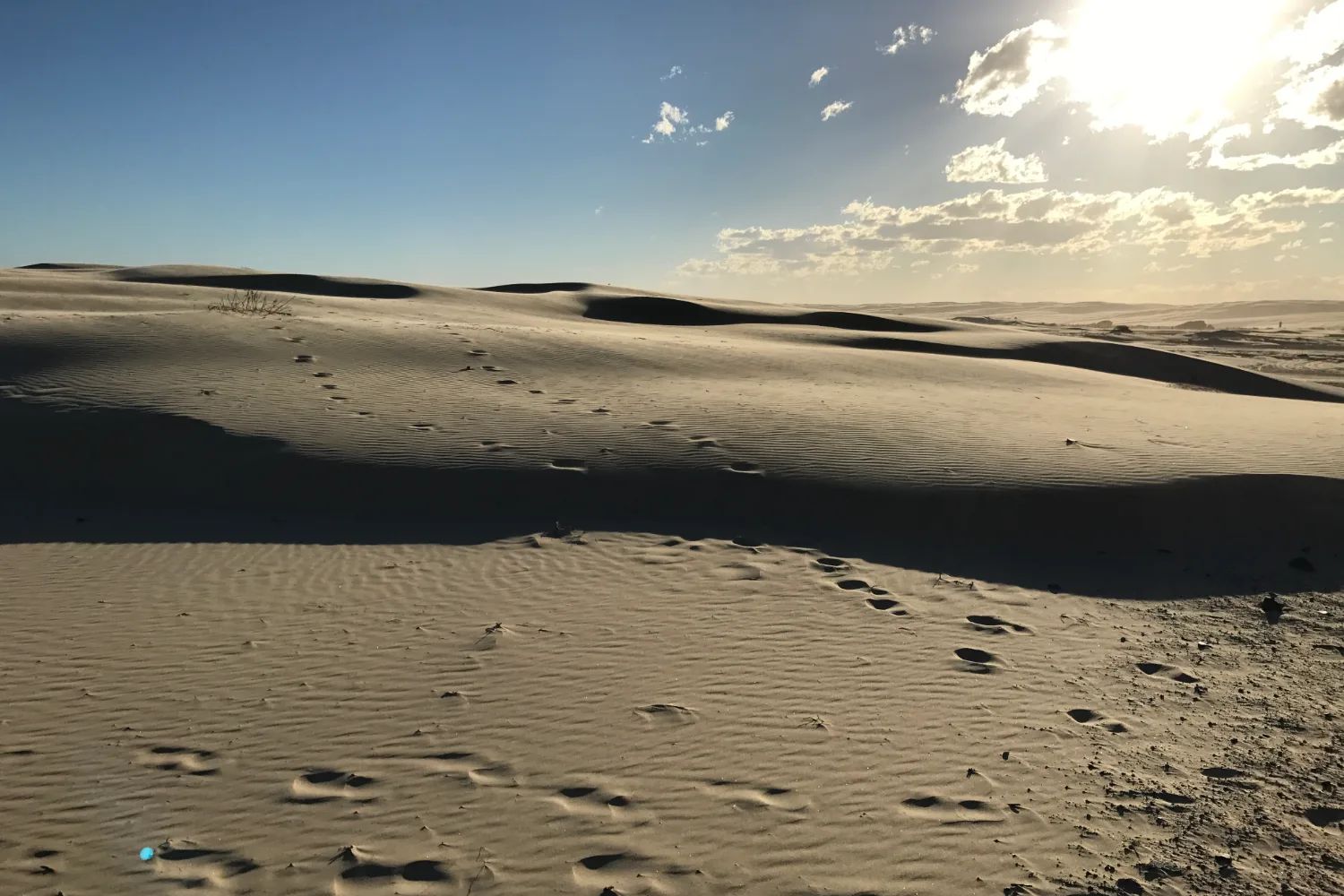
The Stockton dunes
The Worimi Conservation Lands: moving dunes over 30 metres high. You need a permit to drive on them; operators run tours, sandboarding and camel rides.
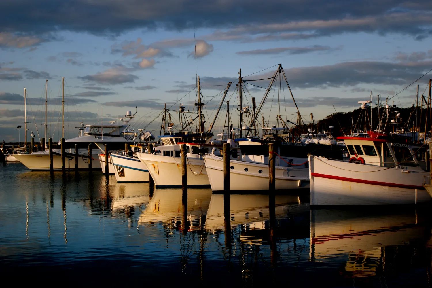
Dolphin and whale cruises
Boats leave the marina at Nelson Bay. A resident population of bottlenose dolphins lives in the port, and whales pass from May to November.
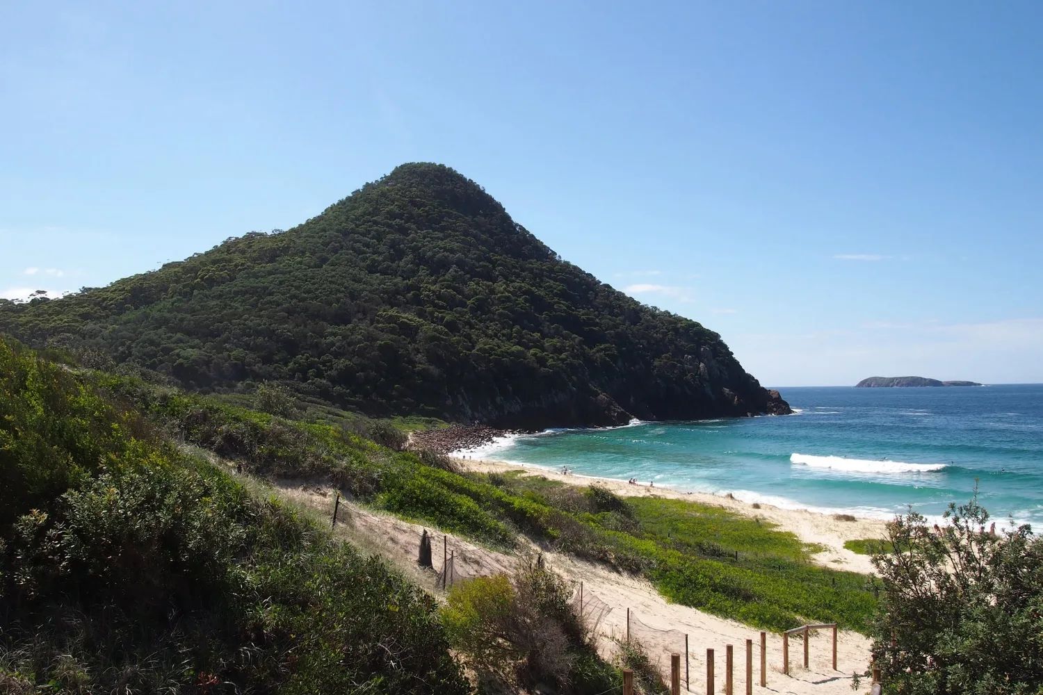
Zenith and the national-park beaches
Zenith, Wreck and Box beaches lie south of Tomaree, and the summit's south lookout looks down on all three. Zenith is in a marine-park sanctuary zone.
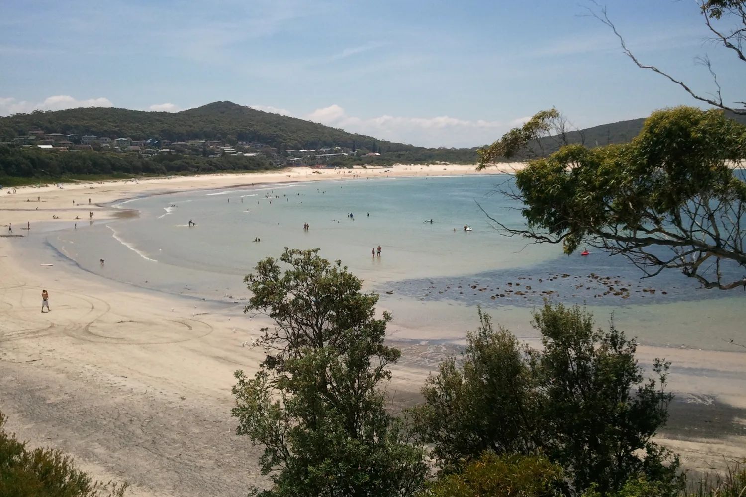
Fingal Bay
A curved ocean bay with a surf club, patrolled by lifeguards in the peak season, and the start of the spit to the lighthouse island.
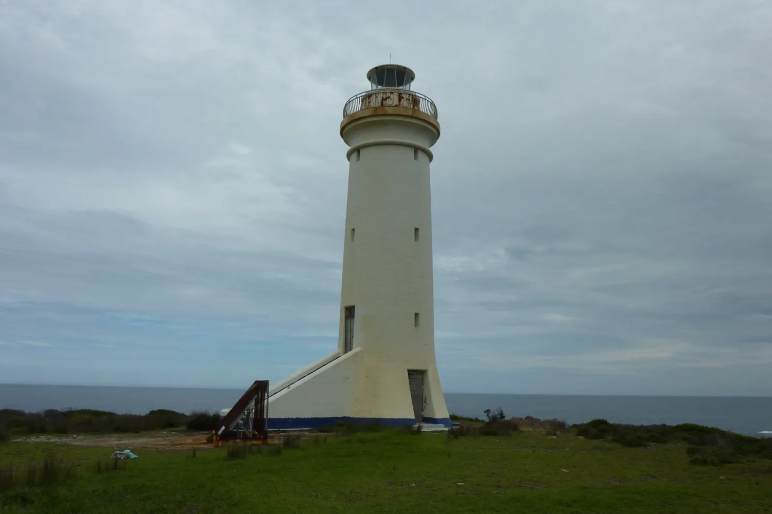
Point Stephens lighthouse
A lighthouse first lit in 1862 on Fingal Island, at the end of the spit. See it from the bay or from a boat. Do not walk the spit.
We have not yet written these places up individually. Their cards carry no link, rather than a link to nothing.
A resident population of bottlenose dolphins lives in the port. On a still morning, watch the water off the marina for ten minutes. Watch the water, not the boats, for a fin that rolls over rather than cuts through, and then for a second one beside it. Listen as well as look: a dolphin breathes out with a short, sharp puff. Then look east to the headland, and remember that the open ocean is just beyond it.
Getting there and around
The nearest trains stop at Newcastle. Most people come by road: the region's own visitor information puts it two and a half hours north of Sydney on the M1. Newcastle Airport, at Williamtown, is close: it takes domestic flights and a Jetstar service to Bali.
Port Stephens Coaches runs a daily coach from Sydney's Central Station, and buses seven days a week from Newcastle Airport and from the railway at Newcastle Interchange. Our Sydney to Brisbane road trip arrives from the south by the Central Coast, which takes longer.
| Arriving from | How far | Best for | The catch |
|---|---|---|---|
| Newcastle Airport | Under half an hour | Flights, including Bali | Hire a car, or take the bus |
| Sydney by car | About 2½ hours | A car for the dunes | Longer by the coast road |
| Sydney by coach | Direct from Sydney | No car | Check the timetable |
| By train | To Newcastle, then bus 130 | No car | A change at Newcastle |
Once you are here, you will want a car. Nelson Bay and Shoal Bay are close enough to walk between, and Port Stephens Coaches runs local buses, but the dunes, Fingal Bay and Anna Bay are spread out. If you are on the coast drive, you already have one.
When to go, and what the beaches allow
Port Stephens is warm in summer and mild in winter. At Williamtown, the nearest weather station, the average high is about 28°C in January and 17°C in July. Spring and autumn are the easiest seasons: warm enough to swim, with fewer people than the summer holidays.
The whales decide the rest. They pass from May to November: north in the early winter, and south again from September, some with calves. The cruises from Nelson Bay run daily in the season, and dolphins are in the port all year. Book ahead for school holidays and long weekends, when the bays fill.
Port Stephens Council says that in the peak season lifeguards patrol Birubi, Fingal and One Mile beaches. It does not publish a single calendar of patrol dates, and sends people to the Beachsafe app for current times. At other beaches, and outside those times, no lifeguards are on duty. Do not walk out along Fingal Spit: NSW Parks warns that the tide and swell change quickly.
Where to stay and eat
For one night, stay in Nelson Bay, by the marina and the restaurants. Our guide to where to stay in Port Stephens compares five places to sleep, from Nelson Bay and Shoal Bay to Fingal Bay, Anna Bay and the quiet western shore, with relative prices and places we would look at.
Where to eat
Port Stephens eats from the water: oysters from the farm gate at Salamander Bay, fish and chips on the sand at Shoal Bay, and a table by the marina in Nelson Bay. Our guide to where to eat in Port Stephens covers four food areas, what things cost, and a day built around the food.
Nearby, and further afield
Two short trips need no planning. Gan Gan Lookout, above Nelson Bay, can be reached by car and looks over the port, the headlands and the dunes. The Port Stephens Koala Sanctuary is at One Mile. Check its opening times and entry on its own site.
For walkers, the Tomaree Coastal Walk runs 27 km from Tomaree Head to Birubi Point. It opened in 2024 and takes two or three days. A passenger ferry crosses the port from Nelson Bay to Tea Gardens and Hawks Nest in about an hour; check the timetable before you plan a day around it.
The Hunter Valley vineyards are about 100 km inland, which makes them a long day from here. North up the coast, Port Macquarie is the next stretch of the drive, and Byron Bay is further on.
A final word on Port Stephens
On the coast drive north, one night in Port Stephens means choosing between the headland and the dunes. Climb Tomaree in the morning if you want the view, or go to Birubi in the afternoon if you want the sand. Stay in Nelson Bay or Shoal Bay, and book the dolphin boat if you have the time.
Andrew + Margaret
- Visiting Australia Overview
- Sydney to Brisbane road trip Journeys
- Where to stay in Port Stephens Decide
- Where to eat in Port Stephens Decide
- Port Macquarie Overview
- Byron Bay Overview