Canberra
A capital planned around a lake, with the nation’s collections free to walk into
We spent two nights in Canberra in September 2023, on the inland drive from Sydney to Melbourne. We gave our first afternoon to the National Gallery, and the next day a morning to the National Arboretum and an afternoon to the lake, riding family bikes with friends. That is how to see the city. Canberra was drawn on paper before it was built: a lake in the middle, wooded hills all round, and the national institutions set out along its shores. Once you can see that plan, the city makes sense, and two or three days fill themselves.
What is first-hand here, and what is not. The National Gallery, the Arboretum and the western shore of the lake are places we have been. Parliament House, the War Memorial, the other museums, Mount Ainslie, the areas to stay in and the day trips are researched, and so is anything that changes, like opening hours, fares and festival dates.
Last updated 29 October 2026
Why Canberra is worth the trip
People come for the nation’s collections, and stay for the setting. Canberra has a reputation as a quiet government town, and on a weekday evening it can be one. But no other Australian city holds the national gallery, museum, portrait gallery, war memorial and Parliament within a few kilometres of each other, almost all free to enter, around a lake with the bush on the hills above it.
The nation’s collections are free and close together. General entry to the National Gallery of Australia, the National Museum, the National Portrait Gallery, the Museum of Australian Democracy and the Australian War Memorial costs nothing; only some special exhibitions charge. At the Gallery we spent most of our time in the First Nations galleries, where the Aboriginal Memorial stands: 200 painted hollow log coffins made by 43 artists from Ramingining and neighbouring communities in Arnhem Land, one for each year of European settlement to 1988.
The city is a designed landscape. Canberra was won in an international competition in 1912, and the plan is still legible on the ground. A straight line runs from the summit of Mount Ainslie down Anzac Parade, across the lake to Parliament House. Stand at the lookout and you see the whole idea at once.
You can walk into the working Parliament. Parliament House opens to visitors 364 days a year, and entry is free after security screening. On sitting days you can take a seat in the public galleries for Question Time, the liveliest hour of the parliamentary day.
The bush comes into the city. Canberra’s town centres are separated by hills that were left wooded on purpose, and the lake has a path along almost all of its 40.5 kilometres of shore. We rode the western shore below Black Mountain, where the city falls away and there is only water, eucalypts and other cyclists.
A little background
Canberra stands on Ngunnawal Country. The limestone plains and the Molonglo River valley were home to Aboriginal people for many thousands of years before the first European settlers took up land here in the 1820s.
The capital was a compromise. When the colonies federated in 1901, neither Sydney nor Melbourne would accept the other as the capital, so a new city was to be built between them. Parliament chose the Yass–Canberra district in 1908, and the territory came into being in 1911. An international design competition followed, and in May 1912 it was won by the Chicago architect Walter Burley Griffin, whose entry was drawn with his wife and partner, Marion Mahony Griffin. On 12 March 1913 Lady Denman named the city Canberra.
Building was slow. Parliament first sat here on 9 May 1927, in the white provisional building that is now the Museum of Australian Democracy, and the city stayed small until the National Capital Development Commission was set up in 1957. The lake Griffin had drawn finally filled after Scrivener Dam closed in September 1963. The present Parliament House, built into Capital Hill, opened on 9 May 1988.
The fires are part of the story too. In January 2003 bushfires burned into the western suburbs and destroyed hundreds of homes. On burnt pine plantation above the lake the city planted the National Arboretum, which opened in 2013.
How Canberra fits together
The lake is the middle of everything. Lake Burley Griffin runs east to west through the centre, eleven kilometres long. North of it are Civic, the city’s commercial centre, and the inner suburbs of Braddon and Acton. South of it are Parliament and the national institutions. The Commonwealth Avenue and Kings Avenue bridges join the two shores, and those two avenues, with Constitution Avenue on the north side, frame the Parliamentary Triangle, with Parliament House at its southern point.
A straight line ties it together. Griffin’s land axis runs from Mount Ainslie in the north-east past the War Memorial, down Anzac Parade and over the water to Old Parliament House and Parliament House. Most of the places a visitor comes for sit on or near that line, within about five kilometres of each other.
The suburbs are a separate world. Beyond the centre, Canberra is a set of town centres, Belconnen, Woden, Tuggeranong and Gungahlin, divided by wooded hills. Visitors rarely need them. The light rail runs north from Civic to Gungahlin, but does not yet cross the lake: the extension to Commonwealth Park is expected in early 2028. South of the lake you go by bus, by bike or on foot. The five areas below are the ones a visitor uses.
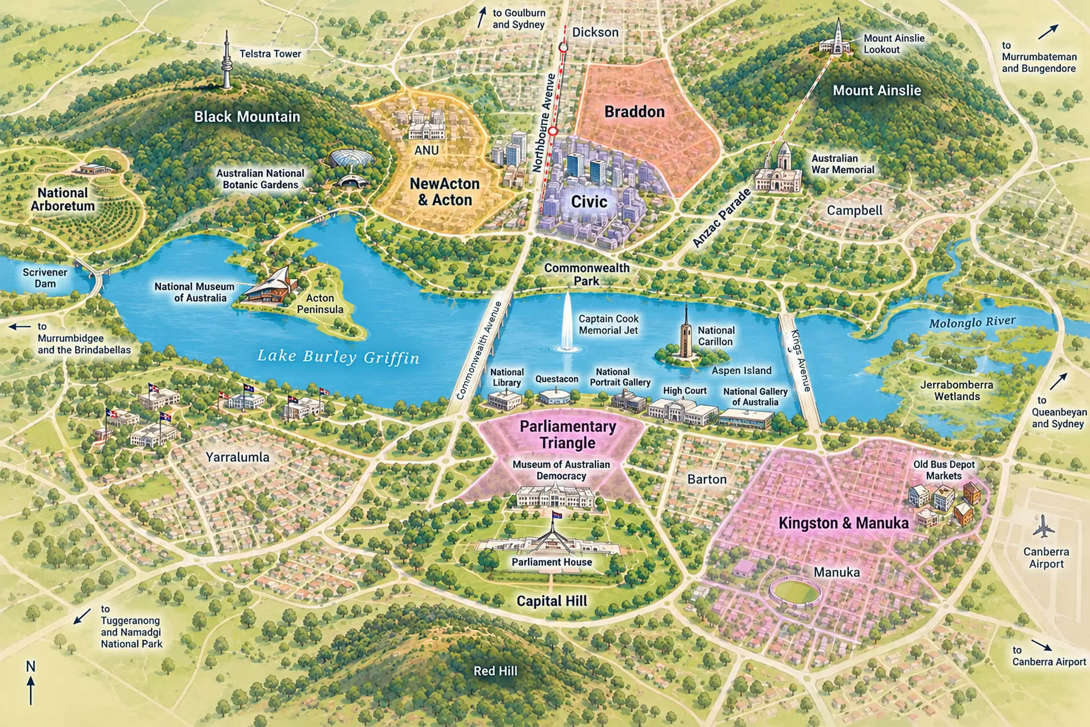
Civic
the city centreThe commercial centre north of the lake: City Walk, Garema Place, the Canberra Centre and Glebe Park. Most bus routes and the light rail run through here, and the airport bus ends here.
Braddon
Lonsdale StreetA short walk north-east of Civic, around Lonsdale and Mort Streets. Its streets of cafés, bars and small shops are where Canberra goes out.
NewActon & Acton
the lakeside precinctBetween Civic and the lake, with the Australian National University behind it and the Acton Peninsula, home of the National Museum, reaching into the water. The lake path is at the door.
The Parliamentary Triangle
the institutionsSouth of the lake: Parliament House on Capital Hill, the Museum of Australian Democracy below it, and the National Gallery, Portrait Gallery, High Court, National Library and Questacon along the shore. Its hotels stand on the Barton side, a walk from Parliament.
Kingston & Manuka
the south-side villagesTwo older villages east of the Triangle. Kingston runs down to a foreshore promenade on the lake and holds the Old Bus Depot Markets on Sundays; Manuka has its shopping streets and oval. The train from Sydney arrives at Kingston.
Places you don’t want to miss
Nine places, all on or near the lake. We have been to two of them and ridden a third; the rest are researched. Questacon, the science centre, is the one to add with children; it charges for entry.
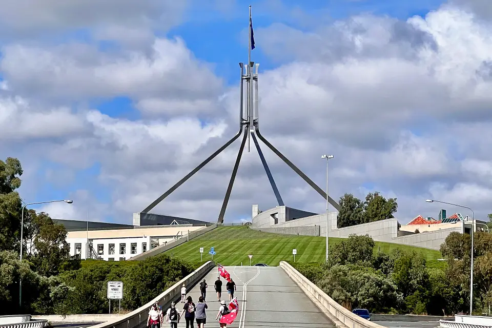
Parliament House
Built into Capital Hill and opened in 1988. Free to enter after screening; on sitting days, watch Question Time from the galleries. Some tours are free, some charge.
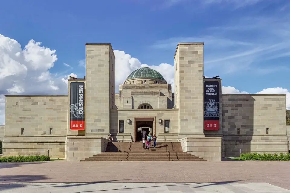
Australian War Memorial
Shrine, museum and archive at the head of Anzac Parade. Free; galleries open 10am to 5pm. Stay for the Last Post Ceremony at 4.30pm.
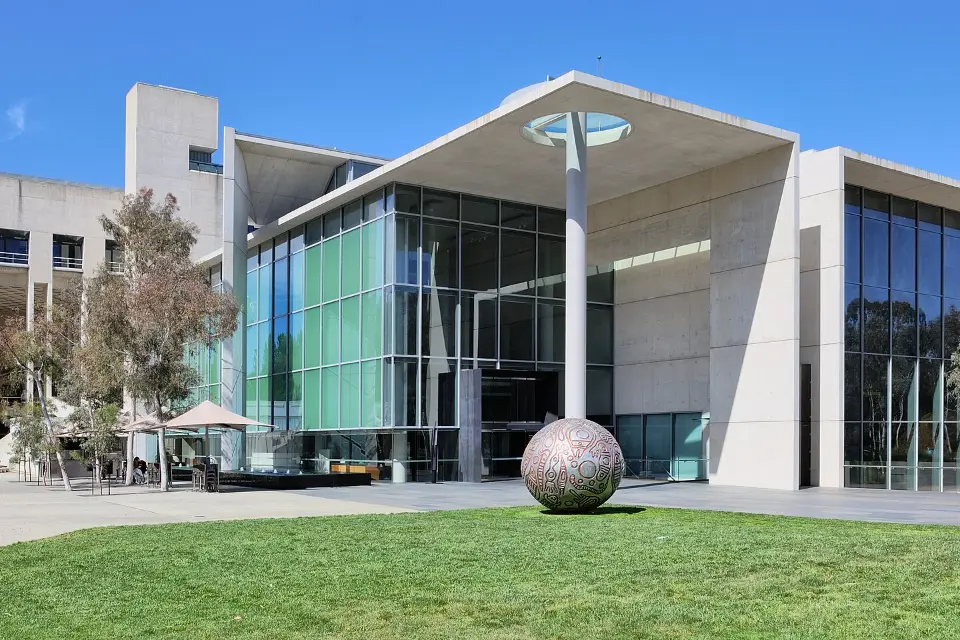
National Gallery of Australia
The national collection, with the Aboriginal Memorial and the world’s largest collection of Aboriginal and Torres Strait Islander art. Free entry ticket, online or at the door.
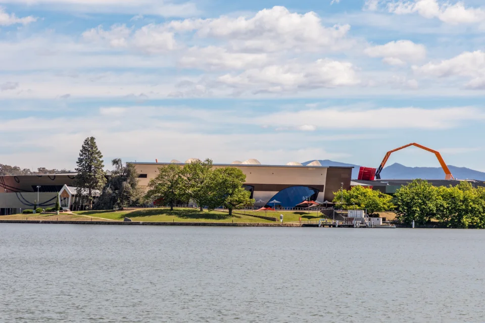
National Museum of Australia
Australia’s social history, on the Acton Peninsula, from First Nations stories to Phar Lap’s heart. Free general entry; open 9am to 5pm.
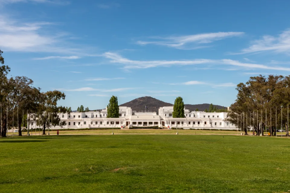
Museum of Australian Democracy
Old Parliament House, where Parliament sat from 1927 to 1988. Walk into the old chambers. Free; open 9am to 5pm, though some rooms are closed for building works.
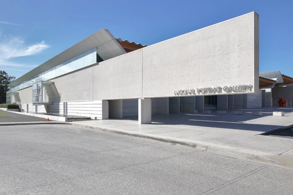
National Portrait Gallery
Portraits of the Australians who shaped the country, in a building beside the High Court on the lake shore. Free general entry; open 10am to 5pm.
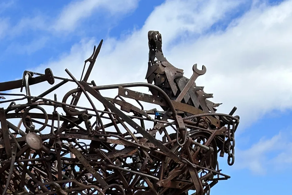
National Arboretum
250 hectares of young forests on the hills west of the lake, free to walk. Richard Moffatt’s steel eagle, Nest III, crowns Dairy Farmers Hill.
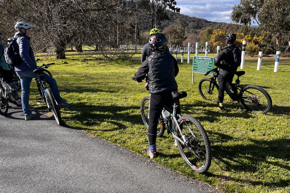
Lake Burley Griffin by bike
A shared path follows almost all of the shore. A full circuit is a long day’s ride; the western shore below Black Mountain is the quietest stretch.
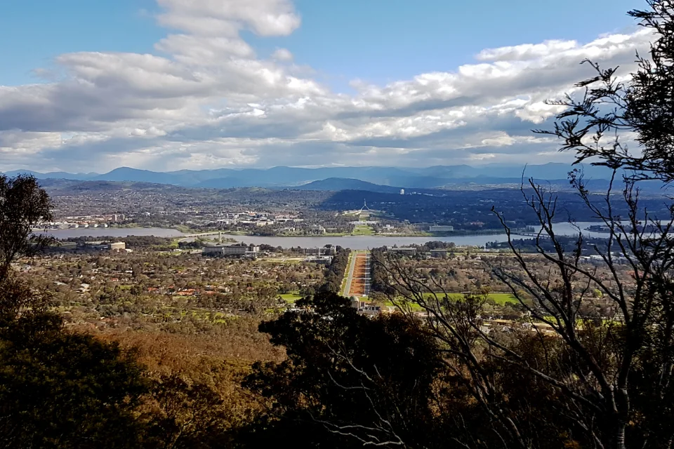
Mount Ainslie lookout
The summit view down Anzac Parade to Parliament House. Drive up, or walk the 4.5-kilometre return track from behind the War Memorial.
We have not yet written up these places on their own pages. Until we do, the cards carry no link rather than a link to nothing. Opening hours and prices were checked on each institution’s own site in October 2026.
The four practical questions
When should I visit Canberra?
Mild autumn and spring, frosty winter mornings, hot summers, and the festivals that fill the hotels.
See below ↓ Where to stayWhere should I stay in Canberra?
Six areas compared, from Civic for a first visit to Dickson for value, with the hotels we would look at.
Read the guide → Where to eatWhere should I eat in Canberra?
Six food areas, from Civic’s wine bars to Dickson’s Asian kitchens and the farms at Pialligo, with what to eat and what it costs.
Read the guide → Getting aroundHow will I get around?
Getting here by air, rail, coach or road; then buses, the light rail, bikes and your feet.
See below ↓When to visit
March to April and October to November are the months to aim for. Canberra sits about 580 metres above sea level and inland, so it has four real seasons, with cold nights in winter and hot days in summer. The figures below are the Bureau of Meteorology’s averages for Canberra Airport, 2008 to 2026.
| Months | Day | Night | What it means |
|---|---|---|---|
| December to February | 27–30°C | 12–14°C | Hot, dry days; Summernats in January |
| March to May | 25°C falling to 17°C | 11°C falling to 3°C | Clear, still and colourful: the best window |
| June to August | 13–15°C | 0–1°C | Frosty mornings, sunny days; the galleries come into their own |
| September to November | 18°C rising to 25°C | 3°C rising to 10°C | The other good window, with Floriade |
Autumn is Canberra’s season. The city was planted with deciduous trees from the northern hemisphere, and in April the streets and lake shores turn red and gold. The Balloon Spectacular usually falls in March. We came in early September, when the mornings were cold and the trees on the lake shore still bare, and the days were bright and good for cycling.
The festivals and Parliament decide the hotel prices. Summernats, Enlighten and Floriade fill the city; the dates are above. Parliamentary sitting weeks can fill the central hotels on weekdays, so check the sitting calendar before you book. The Folk Festival takes over Easter. For the rest of the country, see the best time to visit Australia.
Getting around
Getting here. By air, Canberra Airport has daily flights from Sydney, Melbourne and Brisbane, and, as of October 2026, direct international flights to Bali and Nadi; the Rapid 3 bus reaches Civic in under 20 minutes, every 15 minutes on weekdays and every 30 at weekends. By train, three NSW TrainLink services a day run from Sydney Central to Kingston in under four and a half hours. By coach, Murrays runs from Sydney to the Jolimont Centre in Civic in about three and a half hours. By road, Sydney is 285 kilometres away, about three hours; from Melbourne, our seven-day road trip via Canberra takes the scenic way through the mountains.
In the city, the plan is generous with distance. Places that look close on the map are often a long walk apart. Buses cross the lake where the light rail does not: R2 and R6 for the Gallery, Portrait Gallery and National Library, R57 and R58 for Parliament House and Old Parliament House, and R54 for the War Memorial. Pay with a contactless bank card or phone, or a MyWay+ card; the same works on the light rail.
A bike is the best way to see the centre, and the lake path and the city’s shared paths make it easy. A car is useful for the Arboretum, Mount Ainslie and anything beyond, and most institutions have parking, some of it paid. For the rest of the country, see getting around Australia.
Day trips
The country starts at the edge of the city. Four outings are worth a half-day or more, and all need a car or a tour; drive times are from Civic.
Tidbinbilla and Namadgi. Tidbinbilla Nature Reserve, about 45 kilometres and 45 minutes south-west, has walks and wildlife in the ranges; there is a vehicle entry fee, so buy a day pass. Namadgi National Park, beyond it, covers the mountains of the territory’s south, and its visitor centre near Tharwa is about the same distance.
The Murrumbateman wineries. About 40 minutes north, the Canberra District’s cool-climate vineyards cluster around Murrumbateman, best known for shiraz viognier. Arrange a driver or a tour.
Bungendore and Braidwood. Two old country towns to the east, about 40 minutes and an hour and a quarter away, with galleries, cafés and the nineteenth-century streets Canberra never had.
Further, for a long day or a night away. The Southern Highlands around Bowral are about two hours north-east, and the South Coast at Batemans Bay about two hours east. The Snowy Mountains are further still; our road trip via Canberra crosses them on the way north.
A final word on Canberra
Canberra rewards the visitor who takes it as it was meant to be seen: as a landscape first and a city second. Climb Mount Ainslie to see the plan, cross the lake to Parliament, give the National Gallery the time it deserves, and ride the shore when the light is low. Two days are enough to understand it. Three let you enjoy it.
Andrew + Margaret
- Where to stay in Canberra Practical
- Where to eat in Canberra Practical
- Melbourne to Sydney via Canberra Overview
- Melbourne to Sydney via the Princes Highway Overview
- Australia itineraries Decide
- Aboriginal and Torres Strait Islander Australia Culture
- Getting around Australia Practical
- Best time to visit Australia Decide
- Sydney Overview
- Melbourne Overview
- Visiting Australia Overview
- Transport Canberra — visiting Canberra Official
- Parliament House — visit Parliament Official
- National Gallery of Australia Official
- Australian War Memorial — plan your visit Official
- National Museum of Australia Official
- National Arboretum Canberra Official
- Bureau of Meteorology — Canberra forecast Official
- Paul Daley, Canberra (NewSouth, City series, 2012): the city’s story, told by a resident Reading