Meningie and the Coorong
A quiet lake town at the head of a lagoon more than 100 km long, where pelicans nest on the islands, white dunes hold back the Southern Ocean and the mullet on your plate was caught that morning
The Coorong is a long, shallow lagoon running south-east from the mouth of the Murray, held apart from the Southern Ocean by a ribbon of white dunes. It is Ngarrindjeri Country, a national park and the setting of Storm Boy, one of Australia’s best-loved stories, about a boy and a pelican. People come for the birds, for the light on the water and for the feeling of having a whole landscape to themselves. Meningie, a lakeside town of about a thousand people at the Coorong’s northern end, is where you stay, eat Coorong mullet and watch the sun go down over Lake Albert.
How this page was madeWe rode the length of the Coorong on our bicycles in 2009, on the way from Perth to Sydney: a day with the water on one side, scrub on the other and very little traffic. We have not been back to explore it. So this page is researched, from National Parks and Wildlife Service South Australia, the Department for Environment and Water, the Coorong District Council, the South Australian Tourism Commission, Stateliner and the sources named at the end, checked on 12 November 2026. When we go back, we will say so here.
Last updated 12 November 2026
A little background
The Ngarrindjeri call the lagoon Kurangk, usually translated as a long or narrow neck, and the English name comes from it. Their shell middens lie through the dunes, and the Ngarrindjeri hold a cultural duty to care for these waters that they take an active part in today.
The Coorong is where Australia’s biggest river system ends. The Murray flows into Lake Alexandrina and Lake Albert, then out to sea through the Murray Mouth, and the lagoon stretches south-east from there for more than 100 km. It grows saltier the further south you go. With fresh, brackish and salt water side by side, it is a wetland of international importance, and above all a place for birds.
Meningie was surveyed in 1866 as a staging post on the Coorong road, and it is still a small town of farmers and fishing families. The road past it is older still. In the 1850s, Chinese gold seekers avoiding Victoria’s landing tax travelled overland through South Australia to the goldfields; the best-known landed at Robe. Some came this way along the Coorong, and a stone well linked to them still stands near Salt Creek.
How the place fits together
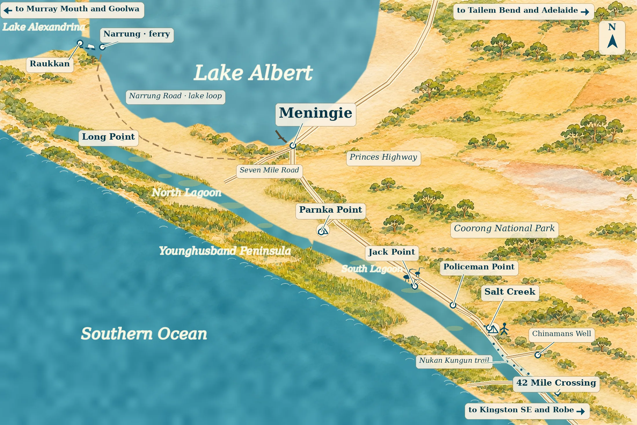
Meningie sits between two waters: Lake Albert to the north-west, and the Coorong lagoon to the west and south. The Princes Highway comes in along the lake front, then runs south-east beside the lagoon for about 145 km to Kingston SE. Almost every place in this guide is a turn-off from that road.
The Meningie lakefront
the baseThe Princes Highway runs along the lake shore through the middle of Meningie. The motels, cafés and information hub face a lawned foreshore, a playground and the jetty. Stay here to watch the sun go down over Lake Albert and walk to dinner.
The northern Coorong
for the waterWest and south of the town, the Long Point road and Seven Mile Road lead down to the lagoon, and the highway runs on to Parnka Point. The places to stay here are few and scattered, and the water is at the door. You need a car, and you will usually cook for yourself.
Salt Creek and the southern lagoon
for campingFurther south the lagoon narrows and grows saltier, and the national park’s campgrounds line the Loop Road and the crossings to the ocean beach. There is no shop or fuel here now. Bring everything you need from Meningie or Kingston SE.
Places you don’t want to miss
Everything here is in Meningie or within an hour’s drive south. None of it has a full guide of its own on our site yet, so these cards carry no links.
The Lake Albert foreshore
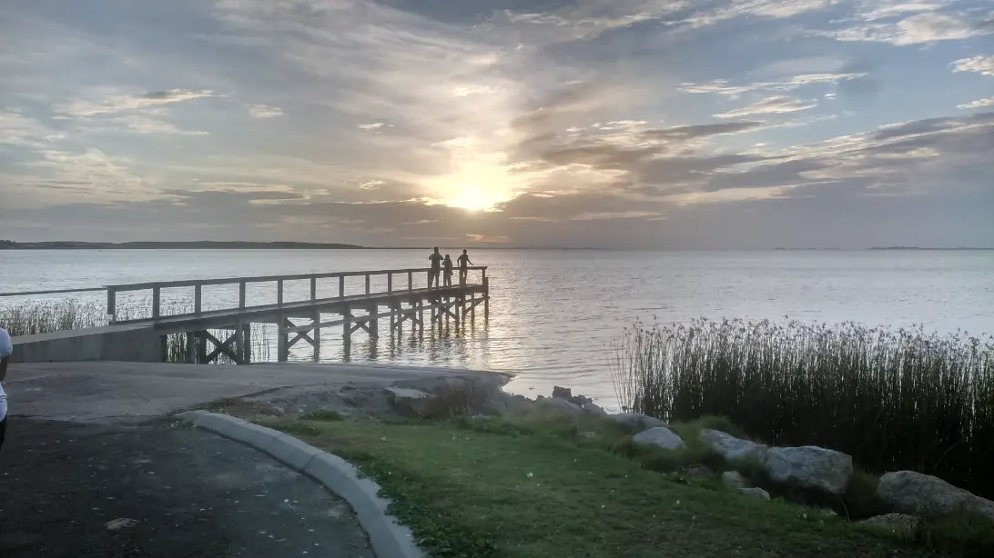
Meningie’s front garden is a lake. A walking and cycling path follows the shore past the jetty and the reeds, and pelicans cruise in close to see if anyone is cleaning fish. Lake Albert is fresh water, filled from the Murray by way of Lake Alexandrina, and wide enough that the far shore is a low line. Come at sunset, when the whole lake turns gold and then grey.
The museum in the old cheese factory
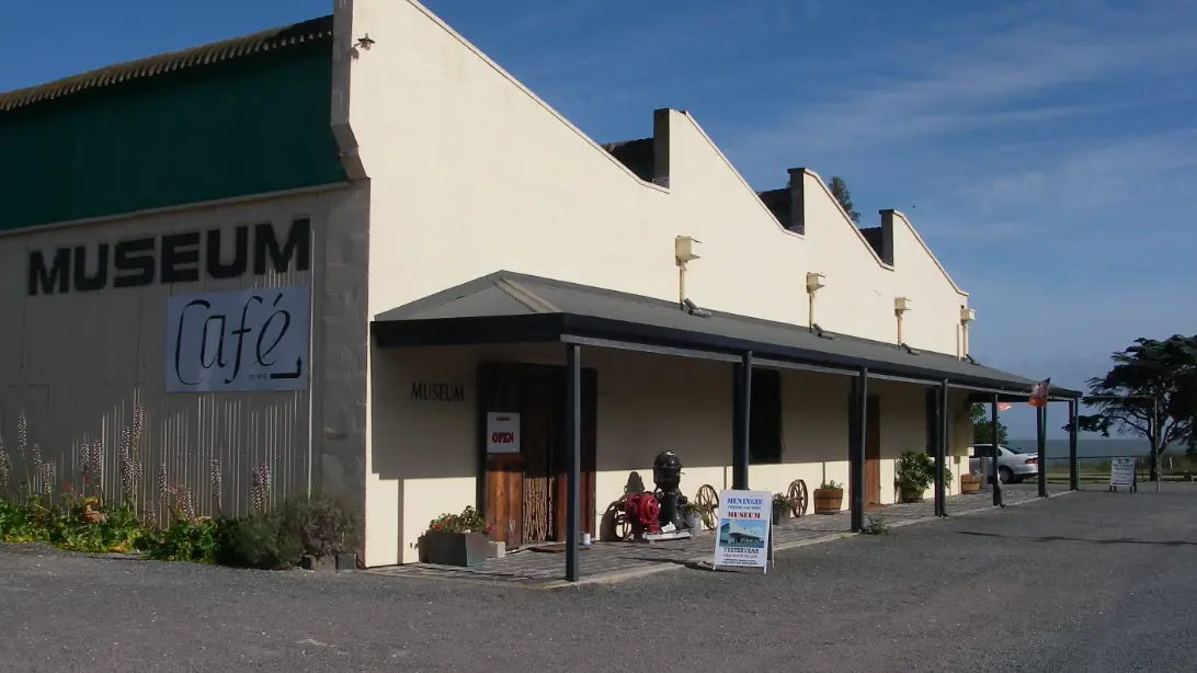
The old cheese factory on the lake now holds a restaurant and a volunteer-run museum. Inside are butter churns, farm tools and a century of household things from life on the lakes. Ask about Meningie’s favourite tale, of a bushranger said to have ridden an ostrich. Check the museum’s days before you go.
Parnka Point
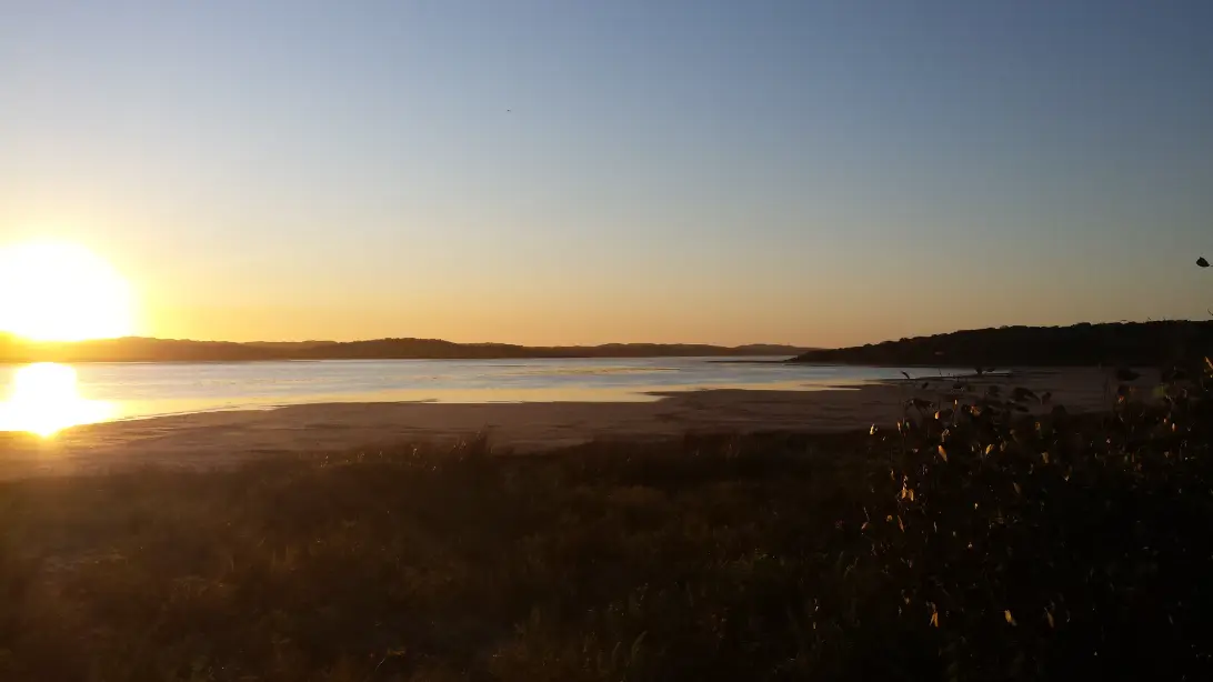
About 22 km south of Meningie, the two halves of the lagoon meet at its narrowest and deepest point. Birdwatchers come from overseas for it, and paddlers launch here into calm, shallow water. There is a small national park campground. In the evening the lagoon goes still, the dunes across the water turn pink, and the only sounds are birds.
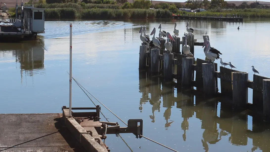
Pelicans and Jack Point
You will see pelicans everywhere here, on the jetty piles at Meningie and Narrung and gliding low over the lagoon. To see them nesting, go to Jack Point, about 50 km south. A ten-minute walk through the dunes, 1.2 km there and back, brings you to a hide facing the breeding islands. National Parks calls them home to Australia’s largest breeding colony of the bird. They breed from August to January. Bring binoculars.
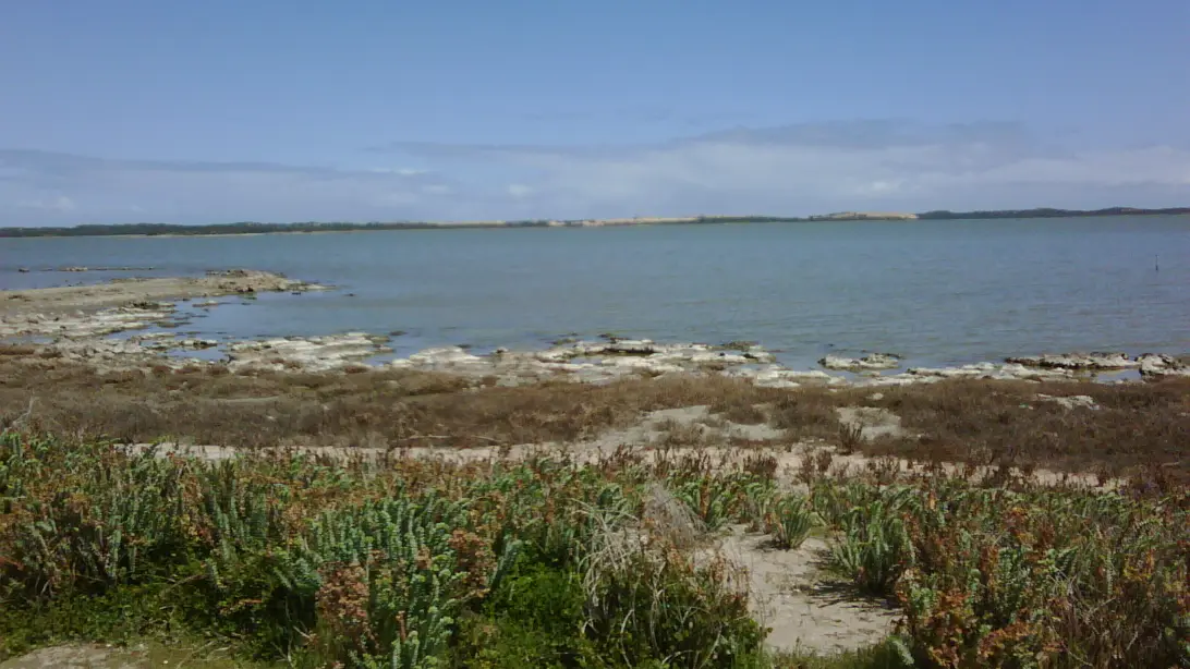
Salt Creek and Chinamans Well
Salt Creek is the gateway to the southern Coorong, with two short walks, the Ngrugie Ngoppun and the Lakes Nature Trail, among saltbush and small lakes. A replica drilling rig recalls the hunt for oil here in 1892, and a monument to the writer Colin Thiele carries his words about the Coorong. Sixteen kilometres south, a short unsealed road leads to Chinamans Well, a stone well believed to date from about 1856 and linked to the Chinese gold seekers who travelled this coast to Victoria.
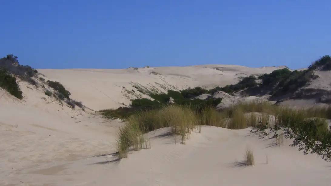
The dunes and the ocean beach
Between the lagoon and the Southern Ocean lies the Younghusband Peninsula, a ribbon of white dunes and, on its far side, an ocean beach more than 100 km long. Ngarrindjeri shell middens lie among the dunes. You reach it by boat, by four-wheel drive at the 28 Mile and 42 Mile Crossings, or on foot at the end of the 27 km Nukan Kungun trail from Salt Creek. Stand on the top of a dune and you see both waters at once.
Around Lake Albert. A loop drive west follows the shore to the small Narrung ferry and to Raukkan, the Ngarrindjeri community whose church is on the fifty-dollar note.
Camp Coorong, 11 km south of Meningie, was founded by the Ngarrindjeri brothers Tom and George Trevorrow in 1985 as a place to teach Ngarrindjeri culture. It has been closed to the public since 2018 while elders work to reopen it, and we could not confirm that it has. The Meningie Information Hub, on the highway in town, has displays on Ngarrindjeri history and culture.
Colin Thiele, who often fished these waters, set Storm Boy here in 1964. A boy living in a shack in the dunes raises an orphaned pelican, Mr Percival. Both films of the book, in 1976 and 2019, were shot on the Coorong, and generations of Australian children met this landscape through them. Lucy Treloar’s novel Salt Creek (2015) tells a darker story of a settler family by the lagoon in 1855, and of the Ngarrindjeri whose Country it was.
Stop at Parnka Point as the sun goes down. The lagoon is so shallow and still that it holds the whole sky. Across it the dunes go from white to pink to grey. A line of pelicans comes in low, wings barely moving, and settles without a sound. Listen, and under the birds you can just hear the ocean, the other side of the sand.
Getting there and around
By car from Adelaide, take the South Eastern Freeway and the Princes Highway through Tailem Bend, or come by Langhorne Creek and the free Wellington ferry over the Murray. Either way it is about 150 km.
| To or from | Distance | What to expect |
|---|---|---|
| Adelaide | About 150 km | About 1½ to 2 hours, by Tailem Bend or the Wellington ferry |
| Parnka Point | About 22 km | About 20 minutes, south on the Princes Highway |
| Salt Creek | About 60 km | About 45 minutes; no fuel or shop there now |
| Kingston SE | About 145 km | About 1¾ hours along the whole Coorong |
| Robe | About 190 km | About 2¼ hours, by the Coorong and Kingston SE |
Planning estimates without stops, checked on 12 November 2026. On our Melbourne to Adelaide drive, Meningie is the stop for night five, after Robe.
Without a car, Stateliner runs a coach from Adelaide to Mount Gambier by the coast, stopping in Meningie opposite the service station. On its timetable from July 2025, coaches leave Adelaide at 8.45am and 12.15pm and reach Meningie at about 11am and 2.30pm. Check the current timetable for the days each service runs. You will need a car or a tour to reach the Coorong itself. See getting around Australia for car hire.
When to go and practical notes
Spring, from September to November, is the time for birds: the pelicans are nesting and migratory waders arrive from the northern hemisphere. Autumn brings settled, mild days and calm water for paddling. Summer is hot, with flies, and brings the campers. Winter is windy and grey, but the lake sunsets are still there.
The Coorong’s worth is its water, and the water is under strain. Less fresh water reaches it from the Murray than it once did, and in 2025 a toxic algal bloom reached the northern lagoon and killed fish there. The region stayed open, and a 2026 study judges the risk of further blooms in the Coorong to be low. Before you swim or fish, check the state government’s algal bloom page and any signs, and keep out of discoloured or foamy water. Only four-wheel drives can use the ocean beach, which is closed to vehicles north of Tea Tree Crossing from 24 October to 24 December each year to protect nesting hooded plovers. Fill up in Meningie or Kingston SE: the roadhouse at Salt Creek has closed.
Driving into the national park is free. Camping costs from about $12 a night and must be booked and paid for before you arrive. With children, the foreshore playground, the short walk to the Jack Point hide and a boat trip make easy days. Many families read Storm Boy before they come. For more on the people whose Country this is, see our guide to understanding Aboriginal and Torres Strait Islander Australia.
Where to stay and eat
Stay on the Meningie lakefront for one night on the road, on the lagoon to the south to wake up beside the water, or in a national park campground if you are self-sufficient. Our choices were researched on 12 November 2026, mostly from tourism listings rather than the places’ own websites, so confirm availability and hours directly.
Lake Albert Motel, 38 Princes Highway, is in the middle of town opposite the lake and the park, with 14 rooms that sleep up to five, a spa suite and family rooms. Its tourism listing gives prices from about $115.
Lake Albert Caravan Park, on Narrung Road by the old cheese factory, has cabins, powered sites and tent sites on the lake shore, among lawns and shade trees. Dogs are welcome. Its office is not always staffed in winter, so book ahead.
Coorong Waterfront Retreat, on Seven Mile Road, is a self-contained house on the lagoon south of town for up to six, with kayaks, bikes and a spotting scope for the birds. It is listed from about $365 a night for two, so it suits a group or a longer stay.
Where to eat
Order the Coorong mullet. It is caught in the lagoon, it is sweet and tender, and every kitchen in town has its own way with it.
The Cheese Factory Restaurant, by the caravan park on the lake, serves steaks, schnitzels and mullet in the old factory’s big dining room, with views over Lake Albert. Visitor guides list it as open Tuesday to Sunday; check before you go.
Freshies Café, 3 Fiebig Road, is a waterfront café with a garden over the lake, fish and chips and vegan dishes. Its listings show it closed on Mondays and Tuesdays.
Breeze Café, 56 Princes Highway, is a family-run takeaway on the lake front, open every day, with Coorong mullet always on the menu or fresh to cook yourself.
On the water, Coorong Wildside Tours, run by a Meningie fishing family, has offered small-boat trips on the lagoon and the lake. Check that they are running when you plan.
Nearby
On the way to or from Adelaide, the free Wellington ferry crosses the Murray near its end, and the small wine region of Langhorne Creek has cellar doors among red gums. At Goolwa, on the far side of the lakes, boat cruises run down to the Murray Mouth and the northern Coorong.
South along the Coorong lie Kingston SE, on Lacepede Bay, and then Robe, the next base on the coast.
A final word on Meningie and the Coorong
Most people drive through the Coorong in an afternoon, and it rewards anyone who stops. Give it a night at least. Watch the sun set over Lake Albert, eat the mullet, and start early for the pelicans at Jack Point. Then climb a dune, with the lagoon on one side and the ocean on the other. Few places in Australia show you so plainly how big and quiet this country can be.
Andrew + Margaret
- Visiting Australia Overview
- Melbourne to Adelaide via the Great Ocean Road Journeys
- Robe Overview
- Getting around Australia Practical
- Understanding Aboriginal and Torres Strait Islander Australia Culture
- National Parks and Wildlife Service SA — Coorong National Park Official
- Department for Environment and Water — algal bloom updates Safety
- Coorong District Council — Meningie Information Hub Official
- Stateliner — coaches Official
- Colin Thiele, Storm Boy (1964) Reading
- Lucy Treloar, Salt Creek (2015) Reading
How long should I spend in Meningie and the Coorong?
One night on a touring trip lets you see the lake at sunset and the pelicans at Jack Point next morning. Two or three nights give you time for a boat trip, a paddle from Parnka Point or a day at Salt Creek and the ocean beach.