Jindabyne
A lake town at the foot of mainland Australia’s highest mountain, where the snow brings skiers in winter and the thaw opens the high country to walkers, riders and anglers
People come to Jindabyne to go up. In summer, the chairlift at Thredbo carries walkers into the alpine zone, where a track leads to the summit of Mount Kosciuszko, the highest point on the Australian mainland. As the snow melts, wildflowers spread across the high plains. In winter, the roads from town climb to the snowfields of Perisher and Thredbo. Back in town there is the lake: trout in its water, a trail along its shore and, beneath the surface, the ruins of the old Jindabyne. The town is about two and a half hours’ drive from Canberra. Give it two nights in summer, one day on the mountain and one by the lake.
How this page was madeWe have not yet stayed in Jindabyne. We have driven the Monaro Highway that leads to it, between Canberra, Cooma and Cann River, in September 2023. So this page is researched, from Visit NSW, NSW National Parks, the NSW fisheries department, Snowy Monaro council, the operators’ own pages and the sources named at the end, checked on 12 November 2026. When we go, we will say so here.
Last updated 12 November 2026
A little background
This is Ngarigo Country. The Monero Ngarigo people keep strong spiritual and cultural connections to the high country, and in 2016 they signed an agreement with the NSW Government on their part in managing Kosciuszko National Park. Settlers arrived from the 1840s, and a village grew up beside the Snowy River.
That village is under the lake. The Snowy Mountains Scheme, built between 1949 and 1974 by thousands of workers, many of them migrants from Europe, needed the river’s water. Old Jindabyne, home to about 300 people, was moved up the hill between 1962 and 1964, and the dam was finished in 1967. The skiers came soon after, and within three years the new town had doubled in size.
Two well-known Australian films are set here. In Cate Shortland’s Somersault (2004), a runaway teenager drifts into winter Jindabyne; the film won all 13 Australian Film Institute awards that year. Ray Lawrence’s Jindabyne (2006) moved a Raymond Carver story about a fishing trip to the river here, with a score by Paul Kelly.
How the place fits together
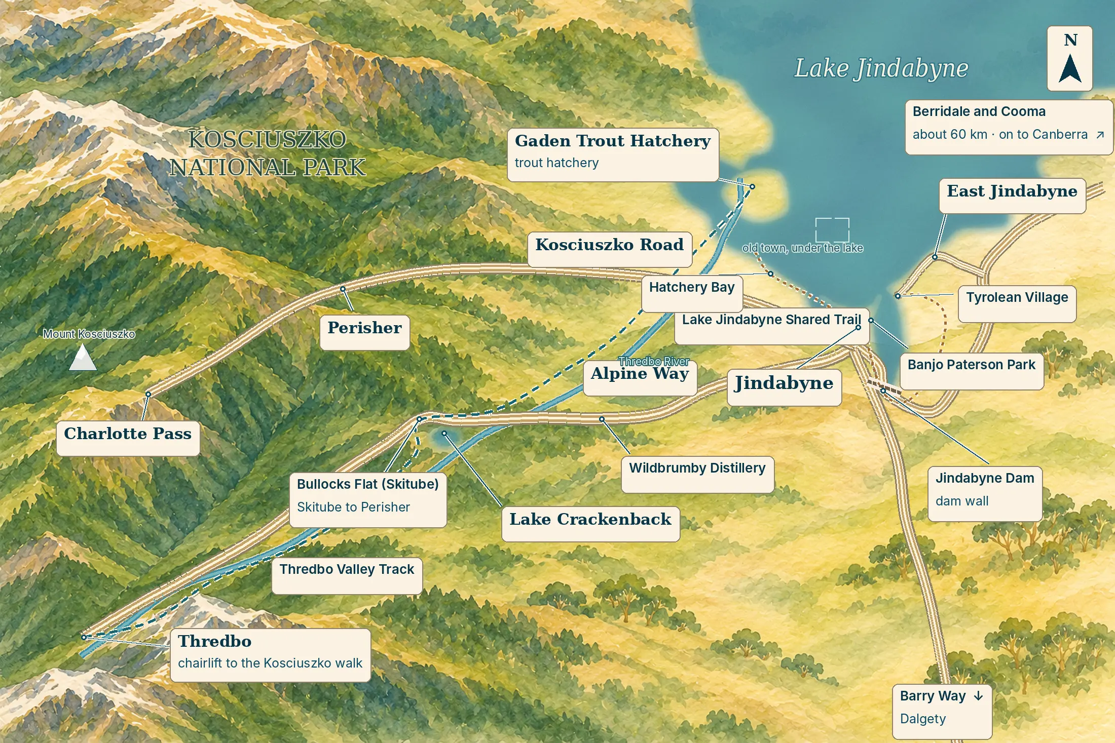
Jindabyne is a small town with big distances around it. The town sits on the south shore of the lake, with the dam wall just beyond it. Two roads lead into the mountains: Kosciuszko Road climbs west to Perisher and Charlotte Pass, and the Alpine Way runs south-west up the valley to Thredbo. Everything in the national park is a drive of 20 to 40 minutes, so choose your base by which way you will be heading.
Jindabyne town and the lakeshore
the baseThe town climbs the hill above the lake’s southern shore. Its shops and cafés gather around Nuggets Crossing and the start of Kosciuszko Road, and below them Banjo Paterson Park runs down to the water, where the shared trail sets off in both directions. Most beds are here, from the lakeside inn to holiday flats and lodges in the streets behind.
East Jindabyne and Tyrolean Village
the quiet sideAcross the water to the east, East Jindabyne and Tyrolean Village are mostly holiday houses and lodges looking back over the lake. The Tyrolean and Mill Creek mountain-bike trails start here, and the shared trail is being extended round to join them. Bring a car: the shops are back in town.
The Alpine Way and Crackenback
on the way upSouth-west of town, the Alpine Way runs up the valley of the Thredbo River towards the mountains. Along it sit the bigger resort stays, a schnapps distillery and, at Bullocks Flat, the Skitube station. It is closer to Thredbo and the snow, and further from everything else.
Places you don’t want to miss
Jindabyne’s best things are the mountains above it and the water at its feet, and which you choose depends on the season. We have not yet written full guides to any of them, so none of the cards below carries a link.
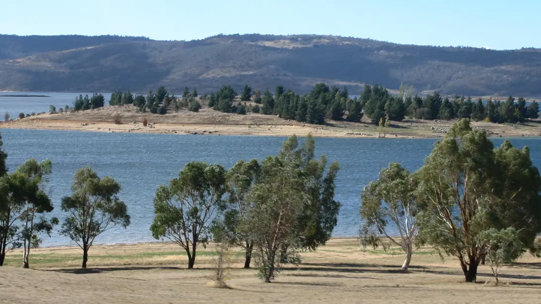
Lake Jindabyne and the shared trail
Walk or ride the shore of one of Australia’s highest lakes, its surface 930 metres above the sea. A shared trail leaves Banjo Paterson Park and follows the water past the dam wall towards Tyrolean Village, and west to Hatchery Bay. The council is still extending it, so some sections close during works. In summer, hire a kayak and go out on the water.
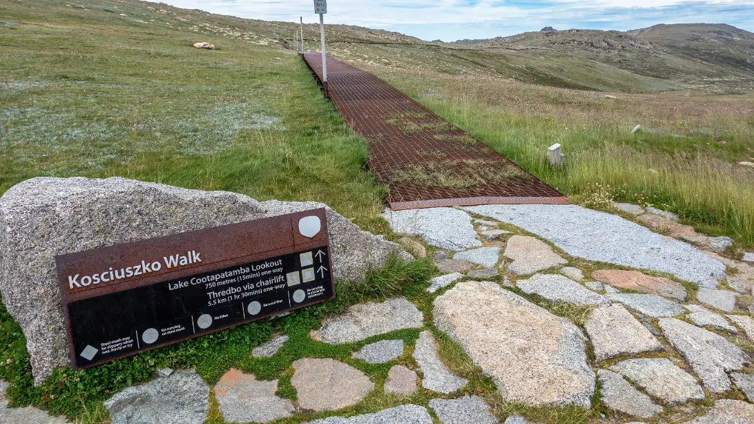
Mount Kosciuszko from Thredbo
Stand on the roof of the continent, 2,228 metres up. From Thredbo village, half an hour from town, the Kosciuszko Express chairlift lifts you into the alpine zone, and a raised metal walkway carries you on across granite and snow grass. The walk is 13 km there and back and takes four to five hours. The chairlift has a fare and its own season, so check Thredbo’s dates.
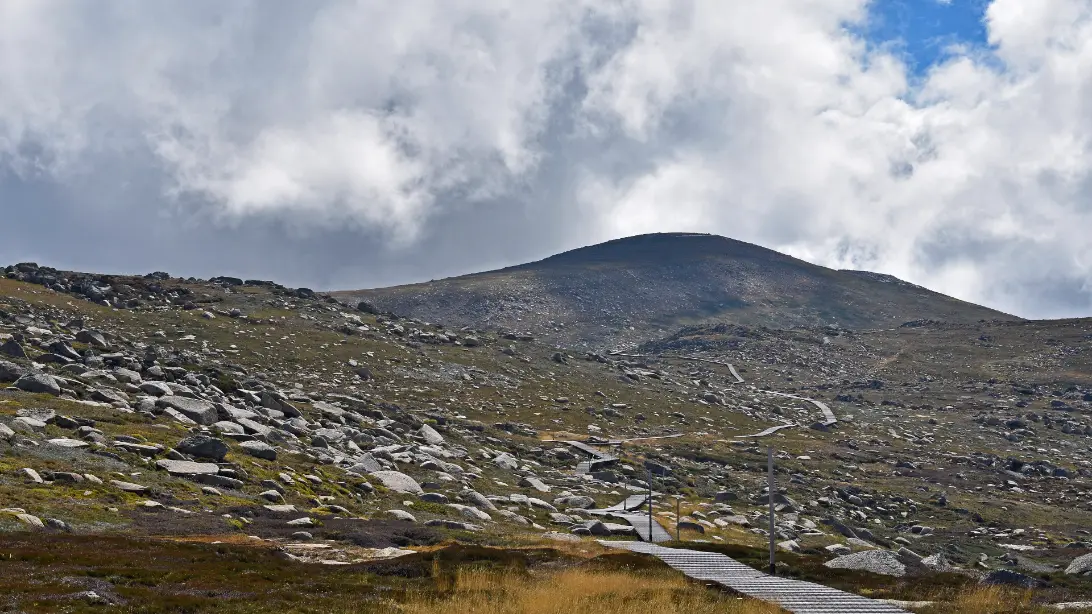
The high country on foot
Go further into the Main Range, where wildflowers follow the snowmelt. From Charlotte Pass, 40 minutes from town, the summit walk runs 18.6 km there and back along the old summit road, longer and quieter than the Thredbo route. The Snowies Alpine Walk, fully open since December 2024, strings 56 km of track from Guthega to Bullocks Flat over four days.
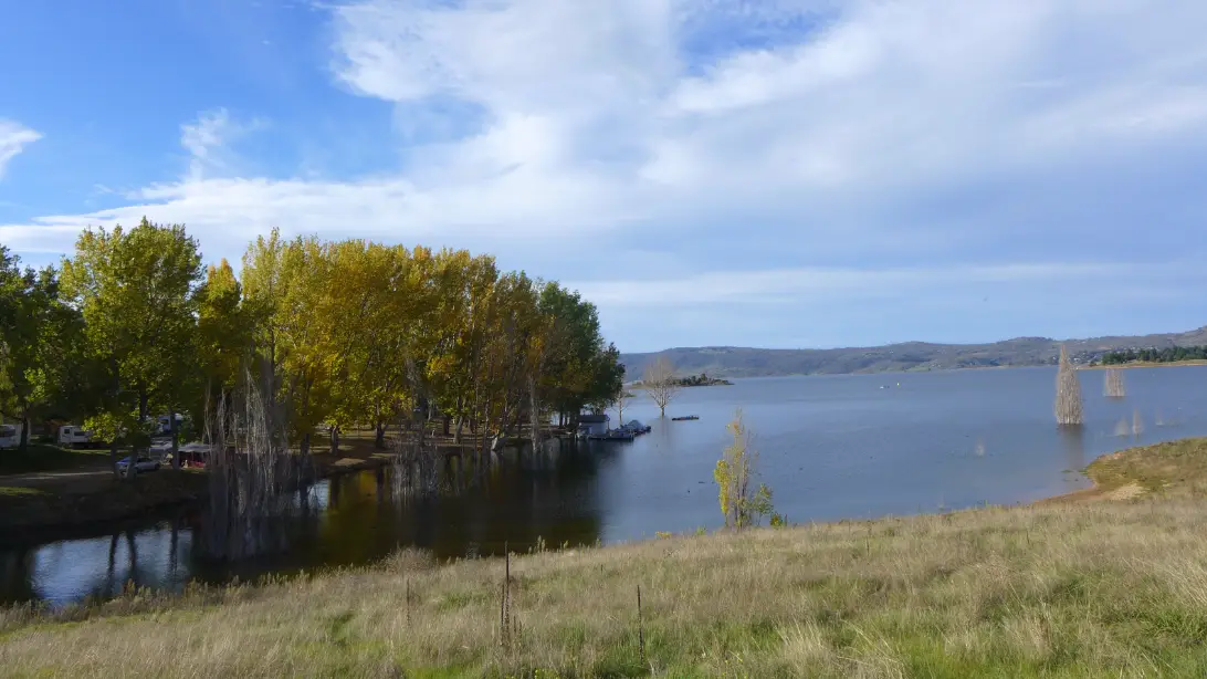
Trout on the lake, and the hatchery
Cast for brown and rainbow trout. The lake can be fished all year; the rivers close from the June long weekend to the October long weekend while the fish spawn, and a NSW fishing fee applies. Ten kilometres up Kosciuszko Road, the Gaden Trout Hatchery breeds trout and salmon on the Thredbo River and runs guided tours. Its own pages give different opening days and hours, so check before you drive out.
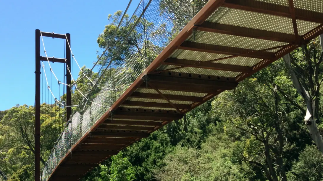
The Thredbo Valley Track
Ride downhill with the Thredbo River. The track follows the river 16.7 km from Thredbo to Bullocks Flat, then runs another 18.4 km through remote country to the hatchery, crossing the river on bridges along the way. Short sections suit families; the lower stretch has no exits and is for experienced riders. It is a summer ride, and parks may close parts of it to bikes, so check the alerts first.
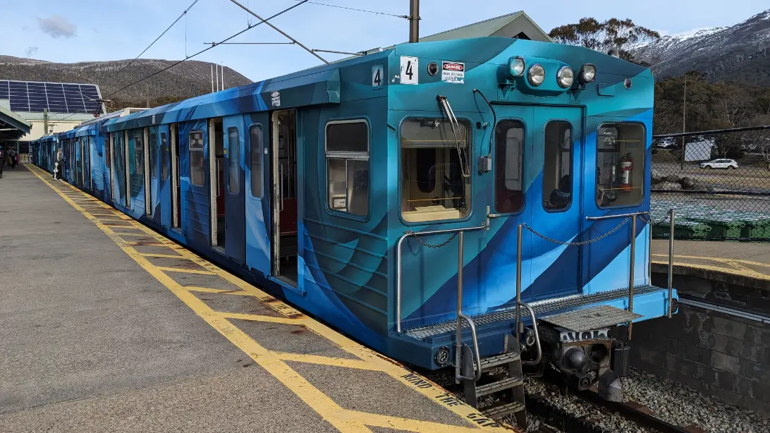
Winter: Perisher, Thredbo and the Skitube
Ride a train into the snow. In winter the Skitube runs from Bullocks Flat, 20 minutes from town, up to Perisher and Blue Cow, and you can leave the car below for free. Thredbo is half an hour up the Alpine Way. From the June to the October long weekends, two-wheel-drive cars must carry chains on the park roads.
Stand on the shore below the town on a still evening and look out over the water. Somewhere out there, under a lake up to 40 metres deep, is the site of the first Jindabyne and the road down to its bridge, blown up before the water came. In dry years, when the lake falls, the foundations of St Columbkille’s church come back into the air. Notice how new the town behind you is. Almost every building you see went up after the move.
Getting there and around
By car is the way most people come, and the drive is part of it. From Canberra the Monaro Highway runs south across the open Monaro plains to Cooma, then Kosciuszko Road climbs to the lake. We have driven the Monaro between Canberra and Cann River, and lost mobile coverage south of Canberra, so download your maps first.
| To or from | Distance | What to expect |
|---|---|---|
| Canberra | About 180 km | About 2½ hours, by the Monaro Highway and Cooma |
| Sydney | About 460 km | About 6 hours, via Canberra |
| Melbourne | About 530 km | About 7½ hours, depending on the route |
| Bairnsdale, by the coast | About 360 km | About 4¾ hours, by Bombala and Cann River; we have driven the Monaro stretch |
| Thredbo | About 36 km | About 30 minutes up the Alpine Way; park fee |
| Perisher | About 33 km | About 30 minutes up Kosciuszko Road; park fee |
Planning estimates without stops, from OpenStreetMap routing and NSW National Parks, checked on 12 November 2026. Mountain roads are slower than they look, so allow more. On our Melbourne to Sydney via Canberra itinerary, Jindabyne is the second base, for two nights, between Bairnsdale and Canberra.
Without a car, NSW TrainLink runs trains from Sydney to Canberra and coaches on to Cooma and Jindabyne. In the ski season the coaches run often, and buses link the town with Perisher and Thredbo; the rest of the year they thin out, so check the timetable before you plan around one. QantasLink flies from Sydney to Snowy Mountains Airport near Cooma, mainly in winter. See getting around Australia for car hire.
Park fees and chains: buy a vehicle pass for Kosciuszko National Park at the entry stations, from the visitor centre in town or in the Park’nPay app. From the June to the October long weekends, two-wheel-drive cars must carry snow chains on Kosciuszko Road, Guthega Road and the Alpine Way beyond Thredbo, and Kosciuszko Road between Perisher and Charlotte Pass is closed.
When to go and practical notes
Jindabyne has two seasons for visitors, and quieter months between. Summer is for the mountain: the Thredbo chairlift runs for walkers (check its dates), the snow has gone from the tracks, and the wildflowers bloom as it melts. Winter, from June to the October long weekend, is for snow, and the town is at its busiest. Spring and autumn are quiet, and the rivers reopen to trout fishers on the October long weekend.
The high country makes its own weather: a warm morning in town can turn to wind, cloud and cold rain on the Main Range. Carry a warm, waterproof layer on every walk, and turn back if the cloud comes down. In summer, the bush fire danger period usually runs from 1 October to 31 March, sometimes starting early; check the fire danger rating with the NSW Rural Fire Service before a day in the park.
For the history and culture of the people whose country this is, see our guide to understanding Aboriginal and Torres Strait Islander Australia. With children, the lakeshore trail, the hatchery’s ponds and picnic ground, and the short family sections of the Thredbo Valley Track all work well for a day out.
Where to stay and eat
Stay in town for the lake, the restaurants and the shortest drive to everything. Stay on the Alpine Way if you want the bush around you and the Skitube or Thredbo close by. In winter, book early and expect higher prices and minimum stays. Jindabyne does not yet have separate stay and eat pages on our site, so our choices are here, researched on 12 November 2026. Please confirm availability and hours yourself before you rely on them.
Banjo Paterson Inn, 1 Kosciuszko Road, is the lakeside pub hotel across the road from the water, with renovated rooms, some looking over the lake, and a brewery bar downstairs. That bar is busy, so ask for a quieter room if you sleep lightly.
Lake Crackenback Resort, 1650 Alpine Way, now run by Oaks, is the family choice: lake-view apartments and chalets in bushland in the Thredbo valley, a spa, and canoeing, mountain biking and golf in summer. Check-in is from 3pm, and you register online first.
Troldhaugen Lodge, 13 Cobbodah Street, is a small bed and breakfast in a quiet cul-de-sac, with eight double rooms, lake views, a garden in summer and a fire in winter. It takes adults only. Guests who need step-free access should ask the lodge before booking.
Where to eat
Most of Jindabyne’s eating is in the town centre, open all year, with the busiest tables in the ski season.
Birchwood, 3 Gippsland Street, is the breakfast and lunch café, open seven days, with a seasonal menu, a specials board, and gluten-free and vegan dishes. It does not serve dinner.
Embers Fireside Grill, in Horizons Lake Jindabyne, 1 Snowy River Avenue, is the most upmarket dinner in our research, with a grill menu built on local suppliers. It publishes no opening days, so book ahead by phone.
Wildbrumby Distillery, 36 Wollondibby Road, off the Alpine Way at Crackenback, makes schnapps and gin and serves Austrian-style lunches among its sculptures. Its listed lunch days differ between sources, so check before you go.
Nearby
Cooma, about 50 minutes north-east, is the home of Snowy Hydro, the company that runs the scheme. The free Snowy Hydro Discovery Centre, just north of town on the Monaro Highway, tells the story of the scheme’s dams, tunnels and power stations; it is open every day, with shorter hours at weekends. On the way you pass through Berridale, 25 minutes from Jindabyne.
Dalgety, half an hour south-east, sits beside the Snowy River below the dam, on the open plains of the Monaro, where the river that fills the lake runs on towards the sea. Charlotte Pass is 40 minutes up Kosciuszko Road and the start of the longer summit walk.
A final word on Jindabyne
Jindabyne is a new town on an old crossing, built for a lake and then found by skiers. Come in summer and it hands you the top of the country, a short drive and a chairlift away. Give it two nights. Spend one day high on the mountain and the other by the water, watching for the rise of a trout.
Andrew + Margaret
- Visiting Australia Overview
- Canberra Overview
- Bairnsdale Overview
- Melbourne to Sydney via Canberra Journeys
- Getting around Australia Practical
- Best time to visit Australia Practical
- Visit NSW — Jindabyne Official
- NSW National Parks — Kosciuszko alerts and fees Official
- Thredbo — chairlift and seasons Booking
- Gaden Trout Hatchery Official
- NSW TrainLink — coaches to the Snowy Mountains Booking
- Somersault (2004) and Jindabyne (2006): the films Culture
Is Jindabyne worth visiting in summer?
Yes. Summer is when you can walk to the summit of Mount Kosciuszko from the Thredbo chairlift, ride the Thredbo Valley Track and paddle the lake, and the town is quieter than in the ski season.
Should I stay in Jindabyne or at Thredbo?
Jindabyne has more beds and places to eat, and it sits between Thredbo and Perisher. Stay in Thredbo village if you want to walk out of the door onto the mountain.