Port Macquarie
A walk from the river to the lighthouse, a swim at Town Beach, and the surf beaches an hour to the north
Port Macquarie sits where the Hastings River meets the sea, halfway up the New South Wales coast. Its best thing is simple: a walk along the shore that starts at the river mouth and runs from beach to beach over the headlands to a lighthouse. Give it two nights. One day for the town and the walk; one for the beaches to the north, from Crescent Head to South West Rocks, which are some of the finest on this coast.
We have been to Port Macquarie two or three times over forty years of visiting Australia, most recently in February 2026, and we have stayed further up this coast at Kempsey and South West Rocks. The walk, the swim and the beaches to the north are ours. The history, the prices and the practical detail are researched, from NSW National Parks, Port Macquarie-Hastings Council and the Bureau of Meteorology, and where those leave something unclear we say so.
- Two nights on the coast drive: Town centre & Town Beach
- Quieter, and halfway along the walk: Flynns & Shelly Beach
- A long beach of your own: Lighthouse Beach
- Surf first, town second: South West Rocks or Crescent Head, an hour north
Last updated 25 September 2026
A little background
This is Birpai Country, and the Birpai people lived along the Hastings River and this coast long before the town was founded.
Port Macquarie began in 1821 as a penal settlement, a place of secondary punishment for convicts, and it stayed one until 1832. Its oldest buildings date from those years. St Thomas’ Church, built between 1824 and 1828, still stands in the town centre. The breakwall at the river mouth came much later, between 1897 and 1904, to make the bar safer for shipping.
The town’s best-known modern institution is its koala hospital, founded in 1973 by a local couple, Jean and Max Starr. In December 2024 it opened Guulabaa, a breeding and education centre in the state forest outside town. Port Macquarie today is a regional centre and a holiday coast, busiest in the summer school holidays.
How Port Macquarie fits together
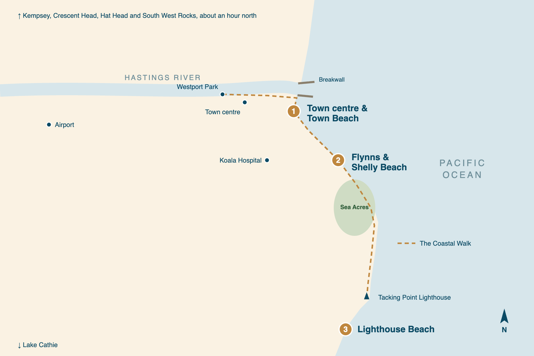
The river is at the top of the town, and the coast runs south-east from it. The Hastings River meets the sea at the northern end of Port Macquarie, between two breakwalls, and the town centre sits on its southern bank. Just round the corner from the river mouth is Town Beach.
From there the shore runs south-east in a line of headlands and small beaches: Flynns, then Shelly and the others backed by the Sea Acres rainforest, and finally Tacking Point, with its lighthouse. Beyond the point, Lighthouse Beach runs south for kilometres towards Lake Cathie. The Coastal Walk follows the whole of this line.
That gives three areas a visitor would sleep in, all on the same stretch of coast. The choice is how far along the walk you want to start. The panels below use the same names as the rest of our Port Macquarie coverage.
Town centre & Town Beach
the river and the townThe town centre on the river, the breakwall and Town Beach, all within a short walk. The Coastal Walk starts here, the council patrols Town Beach every day of the year, and the restaurants and the marina are close by. For two nights on the coast drive it is the natural base.
Flynns & Shelly Beach
halfway along the walkThe residential streets behind Flynns Beach and Shelly Beach, south-east of the centre along the Coastal Walk, with the Sea Acres rainforest close by. It is quieter than the town, a walk from the headlands in both directions, and a short drive from dinner.
Lighthouse Beach
the long beach in the southThe long beach that runs south from Tacking Point Lighthouse, at the far end of the Coastal Walk. It has the most room and the fewest people, and the lighthouse above it. Everything else, including dinner, is a drive.
Places you don’t want to miss
All six of these are on the Coastal Walk or just off it, which is the point of Port Macquarie: you can walk to most of what matters. The Koala Hospital is a short drive from the centre.
The Coastal Walk
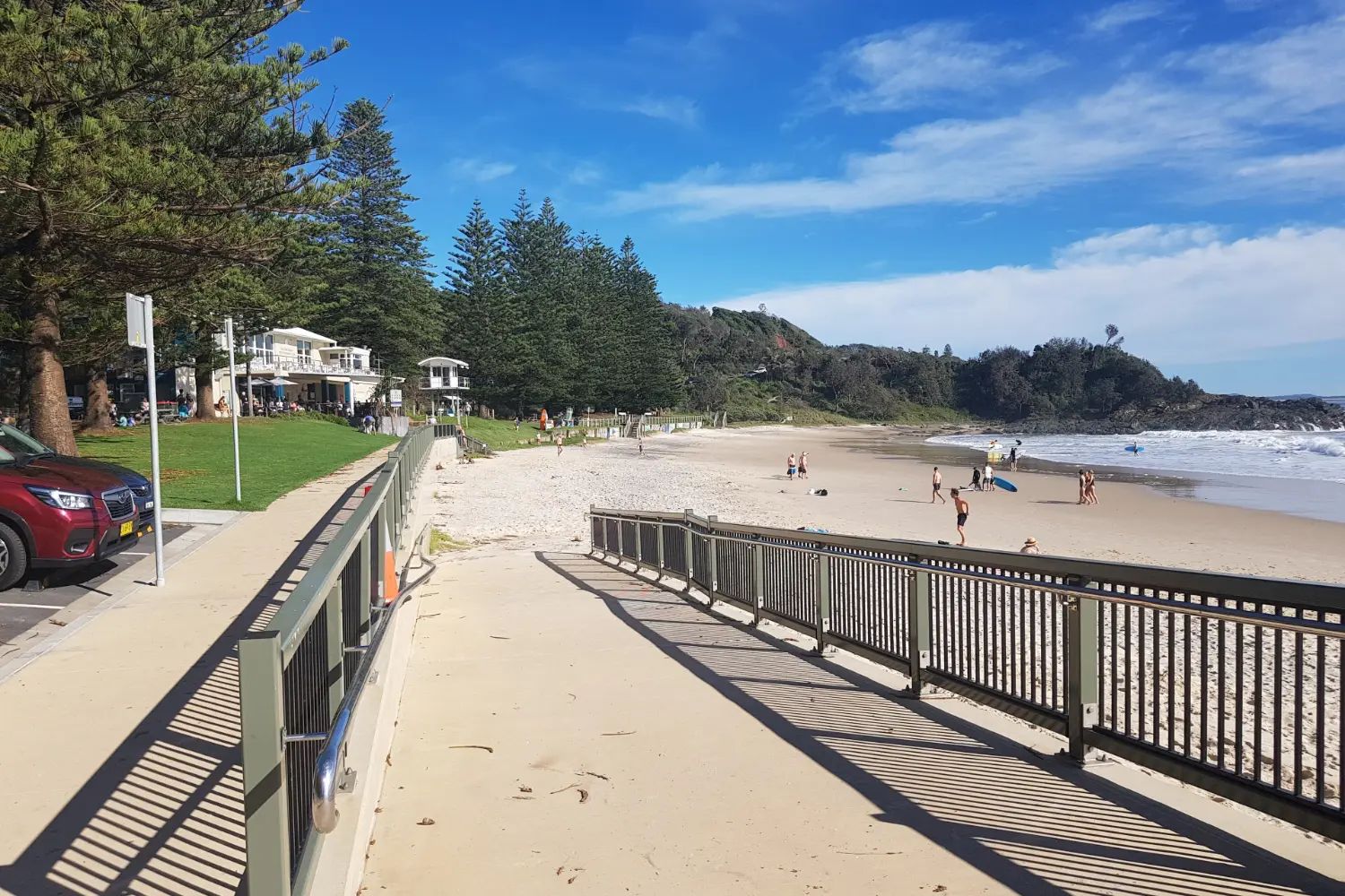
Nine kilometres from Westport Park by the river to Tacking Point Lighthouse, about three and a half hours one way, beach by beach over the headlands. Walk part of it and come back.
The breakwall and the river mouth
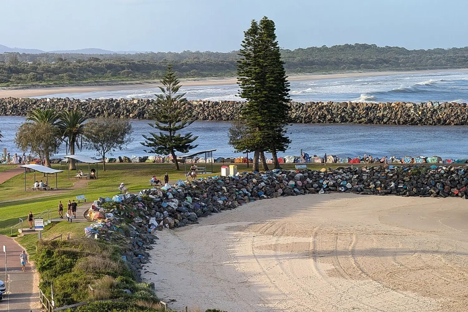
The walls at the mouth of the Hastings River, built from 1897. Many of the rocks on the town side have been painted by locals and visitors, and the walk begins beside them.
Flynns Beach
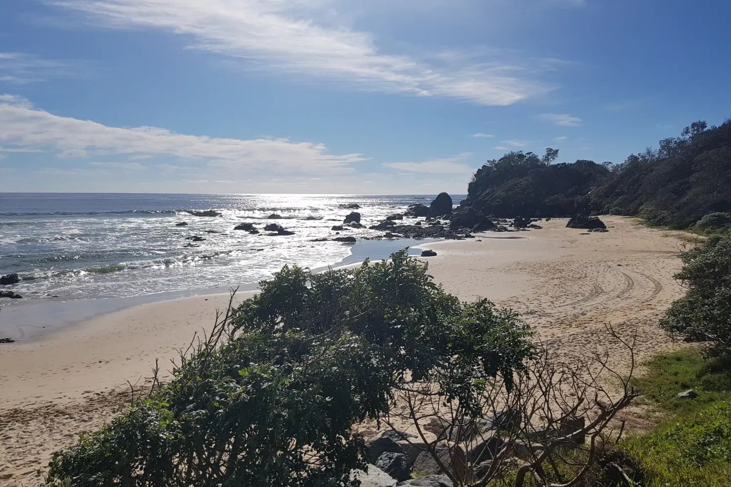
The next beach along the walk south-east of the centre, set between rocky points. It is patrolled by lifeguards in the peak season; check the council’s times before you swim.
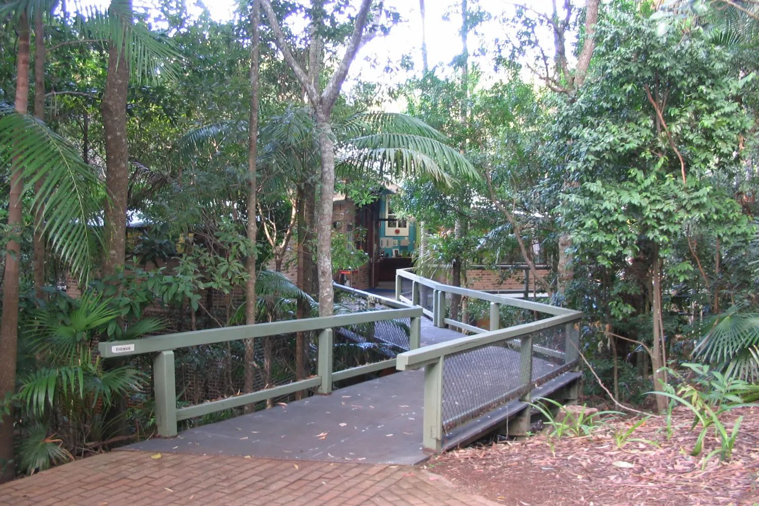
Sea Acres rainforest
A patch of coastal rainforest in Sea Acres National Park, beside the walk, with a 1.3 km boardwalk through the canopy. NSW Parks lists it as open.
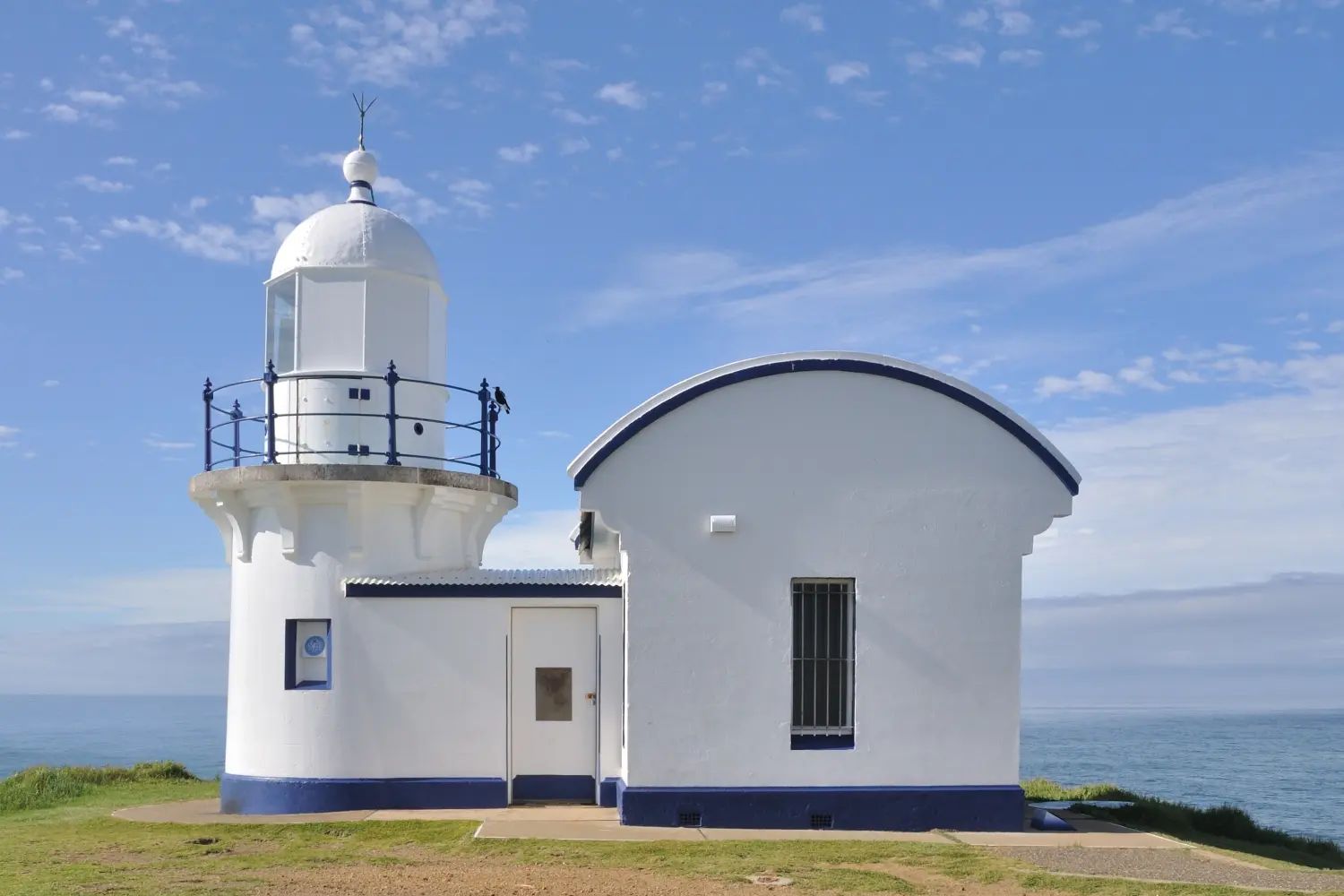
Tacking Point Lighthouse
A small white lighthouse on the point at the southern end of the walk, built in 1879. The headland looks north along the coast and south down Lighthouse Beach.
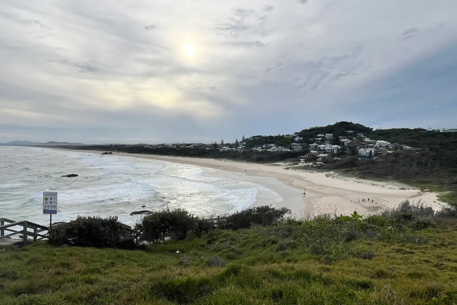
Lighthouse Beach
The long beach running south from Tacking Point, patrolled in the peak season. It is the place for a long walk on the sand at the end of the Coastal Walk.
We have not yet written these places up individually. Their cards carry no link, rather than a link to nothing.
In February we walked from the river round to Town Beach and on over the headlands, and then came back and swam. Do it in that order. Walk far enough that the town drops behind the first headland and all you have is the next beach, then turn round, and let the sea at Town Beach be the reward for the walk rather than the start of the day.
Getting there and around
Most people come by road. We drove from Sydney as far as Kempsey in February 2026, on the Pacific Highway, which is dual carriageway most of the way. Port Macquarie is about 390 km north of Sydney. Our Sydney to Brisbane road trip comes in from Port Stephens by the coast road through Old Bar, 272 km in about three hours, and spends two nights here.
Port Macquarie has its own airport, with domestic flights to Sydney and Brisbane. The nearest railway station is at Wauchope, inland, with a coach link into town; our guide to the NSW coast by rail covers that line. Once you are here, the town centre, the breakwall and Town Beach are on foot, and the Coastal Walk links the rest. For the beaches to the north you need a car.
When to go, and what the beaches allow
Port Macquarie is mild all year. The Bureau of Meteorology records an average high of about 26°C in January and 18°C in July, and February and March are the wettest months. Spring and autumn are the easiest seasons for the walk, and quieter than the summer holidays, when the whole coast books out.
The Coastal Walk is open all year, but sections can close for repairs or bad weather. NSW Parks posts alerts for the Sea Acres stretch, and part of the Miners Beach section was closed for two weeks in August 2026. Check before you set out.
The beaches are the reason to come. Town Beach is patrolled every day of the year, from 9am to 5pm, according to the council. Flynns, Lighthouse and a few other beaches are patrolled only in the peak season, on dates the council sets each year. Outside those beaches and times there is no lifeguard on duty.
Where to stay and eat
For two nights, stay in the town centre or near Town Beach, where the breakwall, the Coastal Walk and dinner are all on foot, and take an apartment rather than a room. Our guide to where to stay in Port Macquarie compares the four areas, with relative prices and places to look.
Where to eat
Eat in the town centre on foot, and give one lunch to the river. Our guide to where to eat in Port Macquarie covers the Hastings River oysters, the places that pass our five-year test, and the winery and strawberry farm fifteen minutes west. On the beaches day, eat lunch in South West Rocks.
The beaches to the north
Our road trip calls this the day to keep if you had to lose the rest. An hour north of Port Macquarie, inland through Kempsey and back out to the coast, is a run of beaches and headlands we know better than the town itself: we have stayed at Kempsey and at South West Rocks. The beaches here are spectacular, and there is a lot of variety around South West Rocks.
| Place | From Port Macquarie | Why go | Know before |
|---|---|---|---|
| Crescent Head | About 65 km, 50 minutes | The point break and the longboards | Go via Kempsey, not the coast track |
| Hat Head | About 80 km, an hour | The national park and its beaches | Vehicle fee to enter the park |
| South West Rocks | About 80 km, an hour | Beaches of every kind, and lunch | Busy in the school holidays |
| Trial Bay Gaol | Just past South West Rocks | A ruined gaol above the bay | Entry fee; open 9am to 4.30pm |
Crescent Head is one of the best surfing beaches in Australia, in our judgement, and it has the status to match: it was declared a National Surfing Reserve in 2008, the fourth in the country. It is known as a home of Australian longboarding, and the Malibu Classic is held there each May. Trial Bay Gaol, in Arakoon National Park, costs $11 for an adult and is open daily from 9am to 4.30pm. Drive times above are approximate, and the loop is about 215 km on sealed roads if you do it all in a day, as our road trip does.
North of South West Rocks, the next stop on the coast is Coffs Harbour. South, on the way in, the coast road passes Old Bar, whose beach we also know and would stop for.
A final word on Port Macquarie
Give Port Macquarie two nights. On the first day, walk from the river mouth over the headlands and come back for a swim at Town Beach. On the second, drive north to Crescent Head, South West Rocks and Trial Bay. Between them, they show the best of this stretch of coast.
Andrew + Margaret
- Visiting Australia Overview
- Sydney to Brisbane road trip Journeys
- The NSW coast by rail Journeys
- Coffs Harbour Overview
- NSW National Parks: Sea Acres Official
- Port Macquarie-Hastings Council Official
- NSW National Parks: Trial Bay Gaol Official
- Port Macquarie Koala Hospital Practical