Coffs Harbour
Which end of town to sleep in, and how to spend an evening and a morning between the jetty, the island and the hills
Coffs Harbour sits roughly halfway between Sydney and Brisbane, where forested hills come down close to the sea. At its heart is an old timber jetty, a small harbour and a breakwall that runs out to Muttonbird Island, with a marine park full of islands offshore. The highway runs through the town a little way inland, and most of what a visitor wants is at the water's edge. One night gives you the island, the jetty and dinner by the water. Two let you add the rainforest at Dorrigo.
We have not stayed in Coffs Harbour, so this page is researched. It draws on NSW National Parks, the City of Coffs Harbour, Visit NSW, Transport for NSW and the Bureau of Meteorology. Where those sources leave something unclear, we say so rather than guess.
- One night on the coast drive: the Jetty & foreshore
- A patrolled surf beach all year: Park Beach
- A resort and a quieter beach: the northern beaches
- A village with cafés and a creek: Sawtell
Last updated 25 September 2026
A little background
This is Gumbaynggirr Country. The island at the end of the breakwall is Giidany Miirlarl, which NSW National Parks translates as moon sacred place, and it remains a place of Dreaming stories for the Gumbaynggirr people.
The town's name is an accident. A shipbuilder, John Korff, sheltered here from a storm in 1847, and it became Korff's Harbour. A government surveyor recorded it as Coffs Harbour when land was reserved in 1861, and the misspelling stuck.
Timber built the town. The long wooden jetty was opened in 1892 so that ships could load timber from the forests behind, and it is now heritage-listed. Bananas came next, which is why the town's landmark is a giant banana, beside the highway since 1964.
Today Coffs Harbour is a regional city and a holiday coast. The council counted 885,000 domestic overnight visitors in 2023–24. We have found no figure for how long they stay.
How Coffs Harbour fits together
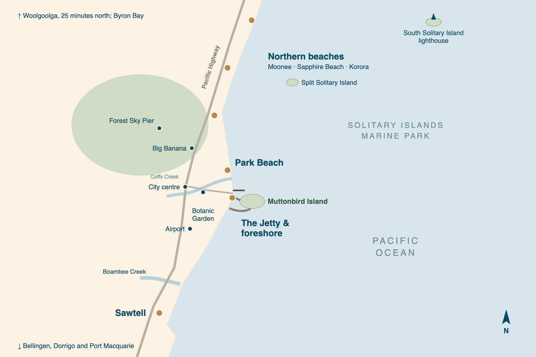
The coast runs north to south, with the ocean to the east. The harbour is in the middle of it. Breakwalls enclose the marina, and one of them runs out to Muttonbird Island. The old jetty stands just north of them, above Jetty Beach.
The city centre is a couple of kilometres inland, on the Pacific Highway. North of the centre, the highway climbs past the Big Banana, and the forested hills behind it hold the Forest Sky Pier. Along the coast to the north, Park Beach gives way to Diggers Beach and then to a string of quieter beaches. To the south, past the airport, is the village of Sawtell.
That gives four areas a visitor would sleep in. The first choice is simple: whether you want to walk to the island and to dinner, or to have a beach to yourself. The panels below use the same names as the rest of our Coffs Harbour coverage.
The Jetty & foreshore
the harbour endThe strip of Harbour Drive running down to the jetty, with the marina and the breakwall beside it. Most of the town's restaurants and cafés are here. For one night it is the obvious choice: park once, walk to Muttonbird Island at dusk, and walk back to dinner.
Park Beach
the town's surf beachThe long beach north of the mouth of Coffs Creek. The council patrols it every day of the year, which no other beach in the city can claim. It is close enough to walk to the Jetty Strip along the foreshore, and a good second choice if the Jetty end is full.
Northern beaches
Korora, Sapphire and MooneeA string of smaller beaches and resorts along the coast north of Diggers Beach. They are quieter than the town and closer to the Forest Sky Pier, but you will drive to everything else. They suit a longer stay better than a single night.
Sawtell
the village to the southA small village about fifteen minutes south, with cafés and restaurants along First Avenue under old fig trees. Boambee Creek is good for kayaking and swimming, and there is a rock pool below Bonville Headland. It is a place to stay rather than a place to pass through.
Places you don't want to miss
Three of these six are at the harbour, within a short walk of each other. The Big Banana and the Botanic Garden are a few minutes' drive inland, and Sawtell is fifteen minutes south. The islands need a boat. On one night you will see the harbour well and the rest in passing.
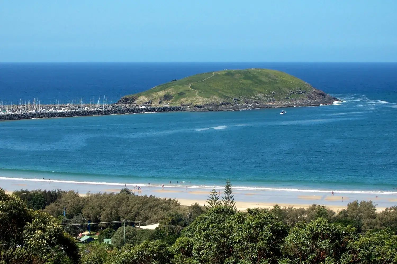
Muttonbird Island
Walk the breakwall from the marina, then a paved path over the island to a lookout facing the Solitary Islands. Thousands of shearwaters nest here from August to late April.
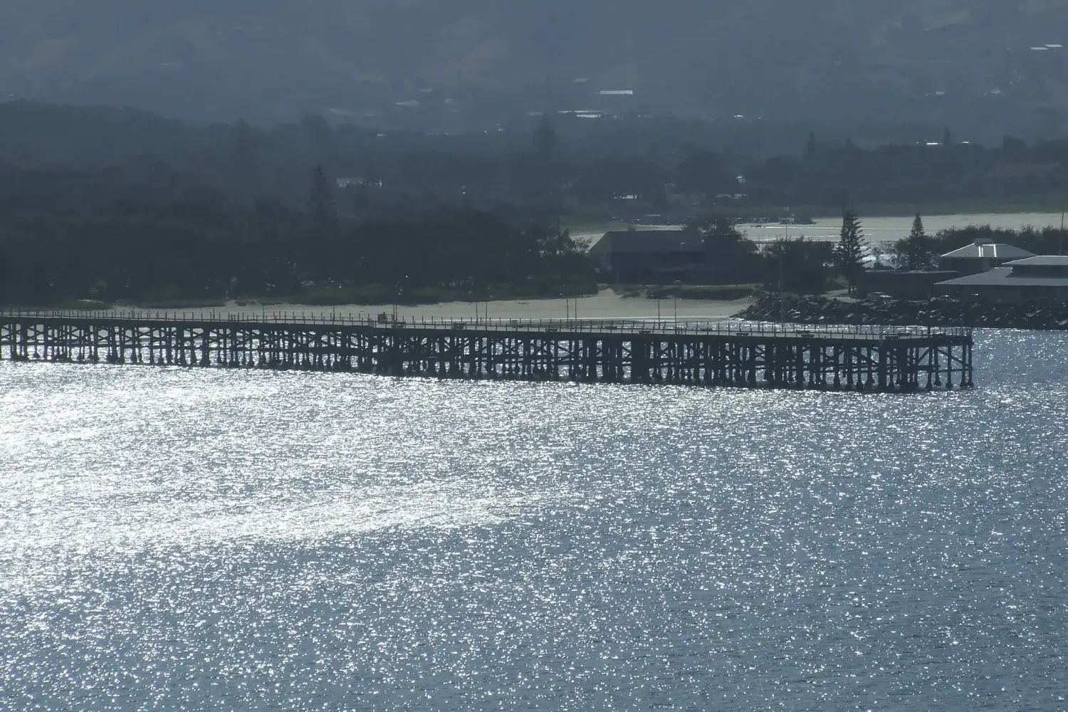
The jetty
A timber jetty opened in 1892 to ship out the forests' timber. It is heritage-listed, and you can walk out along it over Jetty Beach.
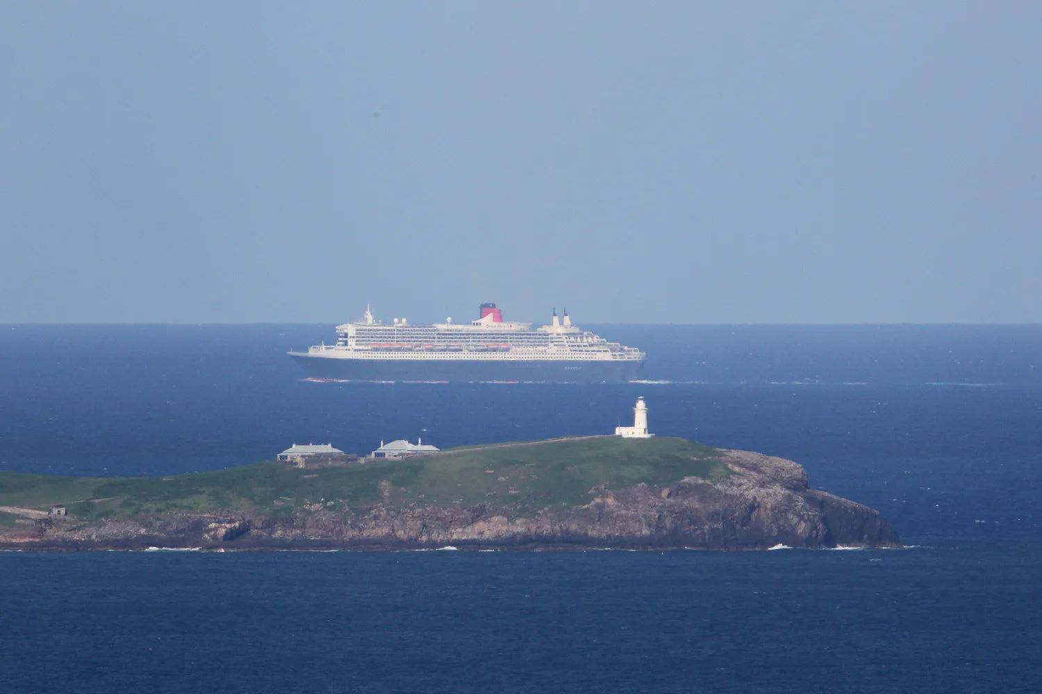
Solitary Islands Marine Park
More than 70,000 hectares of protected sea, where a warm current from the north meets cooler water, so tropical and temperate species live together.
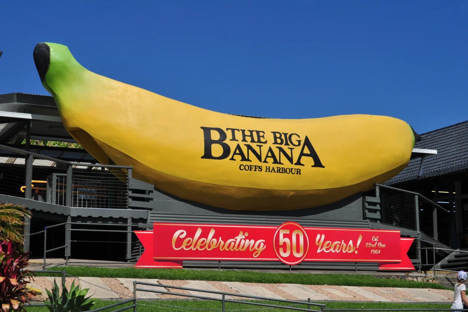
The Big Banana
A giant banana beside the highway since 1964, and now a fun park around it. It is free to see; the rides and attractions are paid.
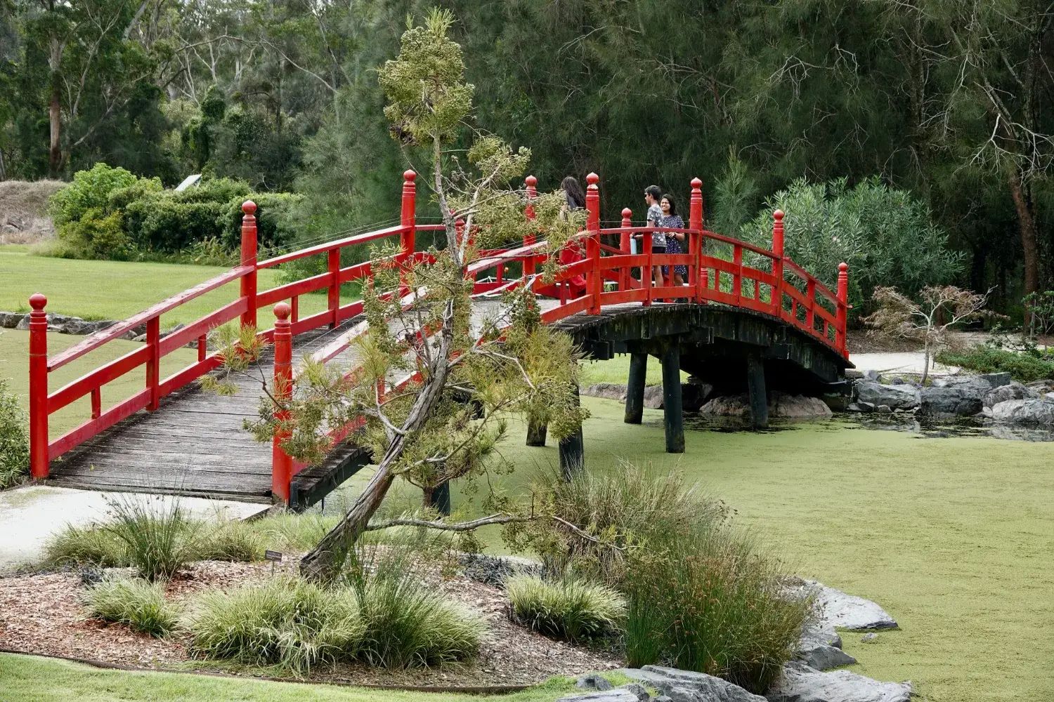
North Coast Regional Botanic Garden
Walks through coastal forest, rainforest and mangroves, with a tropical glasshouse, a few minutes from the city centre.
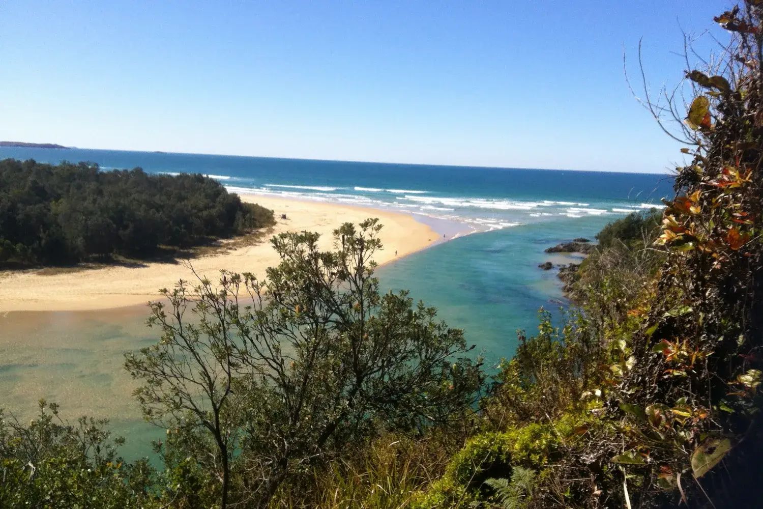
Sawtell and Boambee Creek
A village of cafés under fig trees, a creek for kayaks and paddleboards, and a patrolled beach, fifteen minutes south.
We have not yet written these places up individually. Their cards carry no link, rather than a link to nothing.
On the path across Muttonbird Island, look down rather than out. The ground on either side is honeycombed with burrows, and from August to late April each one belongs to a pair of wedge-tailed shearwaters, which come back to the same burrow every year. Stay on the path. Then walk on to the eastern side and look out to the Solitary Islands, and notice how close the town is behind you.
Getting there and around
Most people come by road. Visit NSW puts Coffs Harbour a little under six hours north of Sydney and just over four hours south of Brisbane. Our Sydney to Brisbane road trip arrives from Port Macquarie by way of Bellingen, 178 km in about two hours, and leaves for Byron Bay the next morning.
The town has its own airport, with Qantas and Rex flights to Sydney, Qantas to Melbourne and Link Airways to Brisbane. NSW TrainLink runs three trains a day from Sydney, and the fastest takes 8 hours 42 minutes.
| Arriving from | How far | Best for | The catch |
|---|---|---|---|
| Sydney by car | Under 6 hours | The coast drive | Better broken with a night |
| Brisbane by car | Just over 4 hours | A short trip south | Byron Bay is on the way |
| By air | Sydney, Melbourne, Brisbane | A short break | You will want a car |
| By train | Three a day from Sydney | No car | About nine hours |
The highway around the town is still being built. The 14 km Coffs Harbour bypass will take through traffic away from the town when it opens. Transport for NSW's July 2026 update had it in its finishing stages, with traffic restrictions running to the end of 2026. Until it opens, allow extra time through Coffs and check Live Traffic NSW on the day. Once you are here, the Jetty end is walkable. Sawtell, the northern beaches and the hills need a car.
When to go, and what the beaches allow
Coffs Harbour is warm most of the year. The Bureau of Meteorology records an average high of about 28°C in January and 20°C in July. February and March are the wettest months, and in March the average rainfall is over 300 mm. Spring and autumn are the easiest seasons: warm, drier and quieter than the summer holidays.
Two seasons are worth planning around. NSW Parks puts whale season at May to November, and the island is a good place to watch from. The shearwaters are at Muttonbird Island from August to late April. Book ahead for school holidays and long weekends, when the whole coast fills.
The beaches are part of the reason to come, and the council makes it simple. Park Beach is patrolled every day of the year. Jetty Beach, Diggers Beach, Sawtell Main Beach and three beaches further north are patrolled in summer only. The council publishes the times as a schedule. Outside those beaches and times, there is no lifeguard on duty. NSW Parks may also close Muttonbird Island in poor weather or when the fire danger is high.
Where to stay and eat
For one night, stay at the Jetty end or at Park Beach. Our guide to where to stay in Coffs Harbour compares all five areas, from the Jetty to the highway motels, with price bands and the places we would look at.
Where to eat
Most of the restaurants and cafés are at the Jetty end, and the fishermen's co-op sells fish and chips at the harbour. Our guide to where to eat in Coffs Harbour covers the three food areas, the markets and what meals cost.
Nearby, and further afield
Dorrigo National Park is the one to make time for. It is part of the Gondwana Rainforests World Heritage Area, and NSW Parks puts it an hour from Coffs Harbour, up the Waterfall Way from Bellingen. The Skywalk looks out over the rainforest canopy towards the coast. Check the park's alerts before you go. The Waterfall Way is down to one lane at Gordonville, and Transport for NSW says it can close at short notice in wet weather.
Woolgoolga is an easy 25 minutes north. Its white Guru Nanak Sikh Temple, built in 1969, reflects the town's Punjabi Sikh community, and its headland is one of the best whale-watching points on the coast.
Bellingen is on our road trip, on the way in from the south. North up the coast, Byron Bay is the next night of the drive, and Port Stephens is further back towards Sydney.
A final word on Coffs Harbour
On the coast drive, Coffs Harbour works best if you keep to the water. Sleep at the Jetty end or at Park Beach, walk out to Muttonbird Island as the light goes, and eat on the Jetty Strip. If you can give it a second night, go up to Dorrigo and the rainforest.
Andrew + Margaret
- Visiting Australia Overview
- Sydney to Brisbane road trip Journeys
- Byron Bay Overview
- Port Stephens Overview
- NSW National Parks: Muttonbird Island Official
- City of Coffs Harbour: patrolled beaches Safety
- NSW National Parks: Dorrigo National Park Official
- Live Traffic NSW Practical