Byron Bay
What the town is like, which part of it to sleep in, and how to use one night or two
Byron Bay is a small town at the eastern tip of the mainland, with a lighthouse on the headland above it and a north-facing bay in front. Most people who come here are passing through on the coast road, and they get one night. It is enough for the Cape or the beach, not both. Give it two nights if you can, and stay somewhere you can walk from.
We have driven through Byron Bay but do not know it well, so this page is researched. It draws on NSW National Parks, Byron Shire Council, NSW Planning, the Bureau of Meteorology and the region's own visitor information. Where those sources leave something unclear, we say so rather than guess.
- One night on the coast drive: the town centre, and leave the car
- The Cape and a cove at your door: Wategos and the Cape
- Quieter nights, still close: Suffolk Park, or Lennox Head to the south
- Food and the green hills: Bangalow, fifteen minutes inland
Last updated 25 September 2026
A little background
This is the country of the Arakwal people, the Bundjalung of Byron Bay, who have lived here for at least 22,000 years. Their name for the Cape is Walgun, and it is now the official name of the conservation area around the lighthouse. In 2001 the Arakwal signed the first Indigenous Land Use Agreement in New South Wales, which created Arakwal National Park behind Tallow Beach. They manage it jointly with the state parks service.
James Cook named the Cape in 1770, after the navigator John Byron. The lighthouse was finished in 1901. For most of the century that followed, Byron was a working town: it had a jetty, a meatworks from 1930, sand mining in the dunes, and a whaling station that ran into the early 1960s.
The surfers came in the 1960s, when the industries were closing, and the counterculture followed them in the 1970s. That is still the town's reputation. Around 1.8 million people visited the shire in the year to June 2024. Visitors from within Australia stayed 2.8 nights on average, which is roughly the stay this page plans for.
How Byron fits together
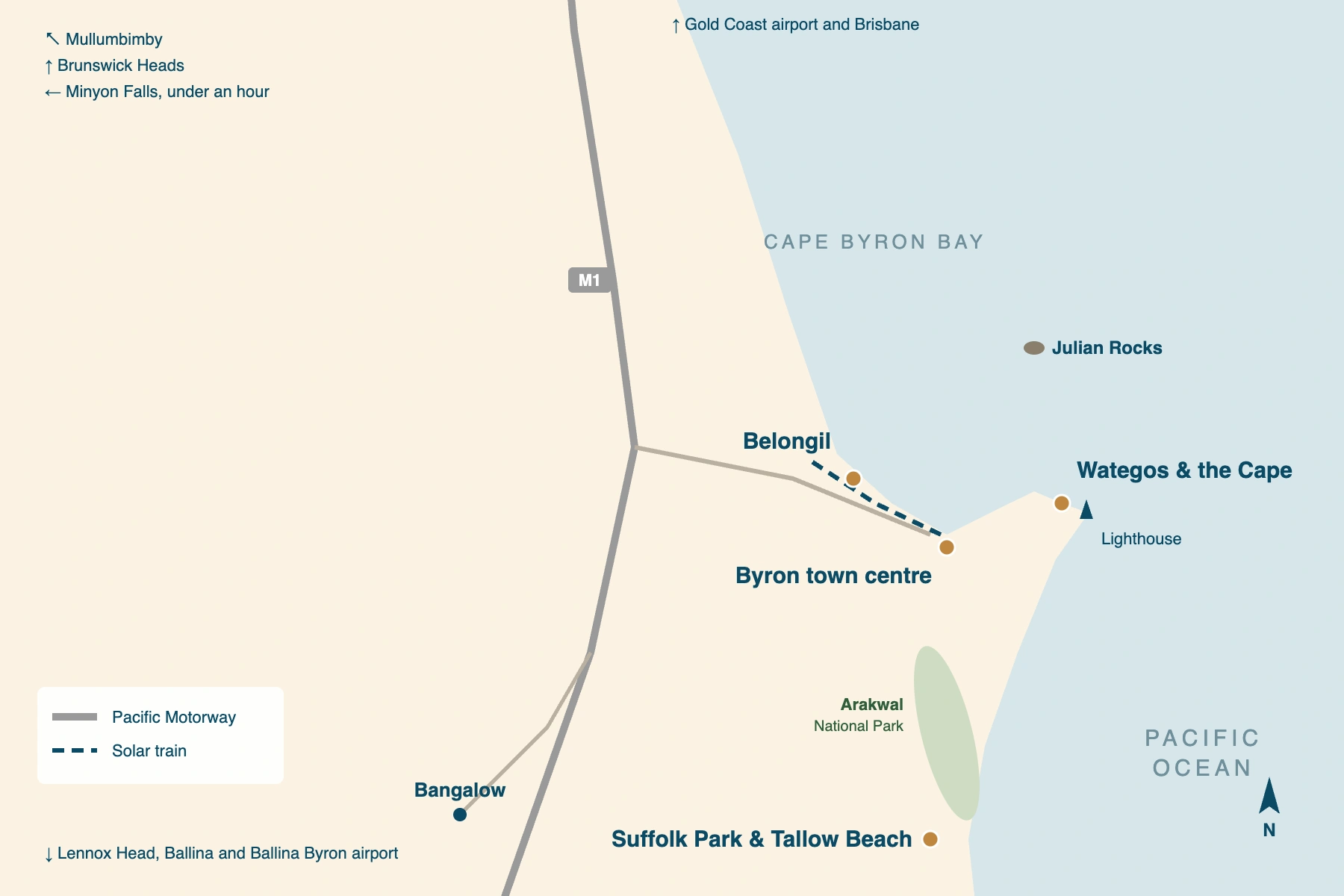
The bay faces north, and the town sits at its eastern end. Main Beach is directly in front of the town centre, and the sand runs west from there past Belongil for kilometres. To the east it runs round under the headland to The Pass, Wategos and the Cape. On the far side of the Cape, Tallow Beach faces the open ocean and runs south past Suffolk Park.
For a visitor, that gives four areas. The town centre is the only one where you can walk to everything, and the only one where holiday lets can be rented all year.
Across most of the rest of the shire, unhosted holiday lets have been limited to 60 nights a year since September 2024. So beds are thinner away from the centre than the size of the town suggests. The four panels below use the same names as the rest of our Byron coverage.
Byron town centre
the walkable townJonson and Lawson Streets hold most of the shops, cafés and restaurants, and Main Beach is at the end of them. It is the busiest part of Byron and the liveliest in the evening. It is also the easiest one-night stop on the coast, because you park once and walk to everything.
Wategos & the Cape
a cove under the lighthouseThe road ends at Wategos, a small cove under the headland, with The Pass and its surf break just to the west. The Walgun Cape Byron walking track passes through both. Staying here puts the lighthouse walk at your door, but there is little else here, and parking near the Cape is paid and short-stay.
Belongil
the long beach westBelongil runs west from the town along the bay, with the beach on one side and Belongil Creek behind. The solar train runs 3 km from the town centre to North Beach station on Bayshore Drive, every day except Christmas Day. It is quieter than the centre and still near enough to walk in for dinner.
Suffolk Park & Tallow Beach
the quieter south sideSuffolk Park is a residential suburb south of the Cape, behind Tallow Beach and Arakwal National Park. It suits a longer stay in a rented house. Holiday lets here are held to 60 nights a year, so book well ahead. You will want a car, or the local bus, to reach the town centre.
Places you don't want to miss
Four of these six are the headland and the beaches around the town, and you can walk to all of them. Julian Rocks needs a morning booked with a dive or snorkel operator, and Bangalow is fifteen minutes inland by car. The headland and its beaches take half a day on their own.
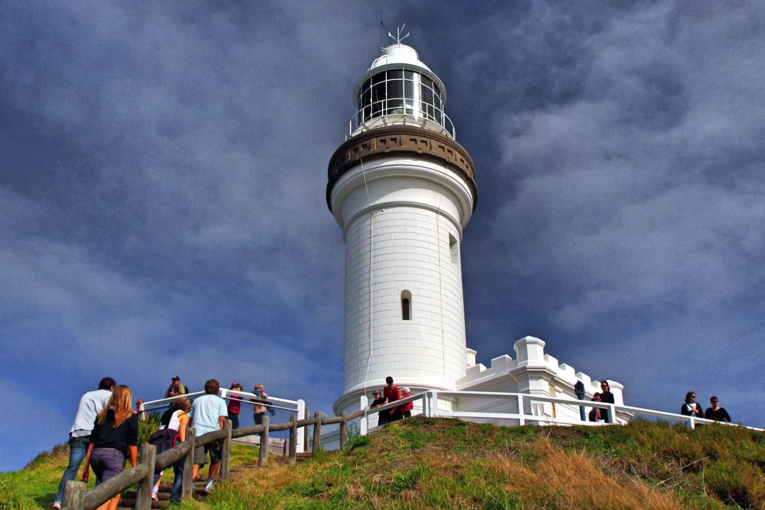
Cape Byron lighthouse and the Walgun walk
A 3.7 km loop over the most easterly point of the mainland, past the 1901 lighthouse. One to three hours.
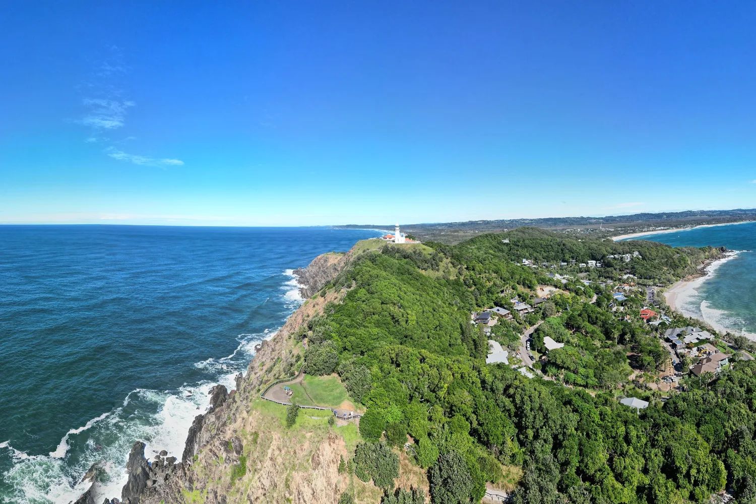
Wategos and The Pass
Wategos Beach and The Pass sit under the headland, facing north across the bay. The Pass is one of Byron's surf breaks.
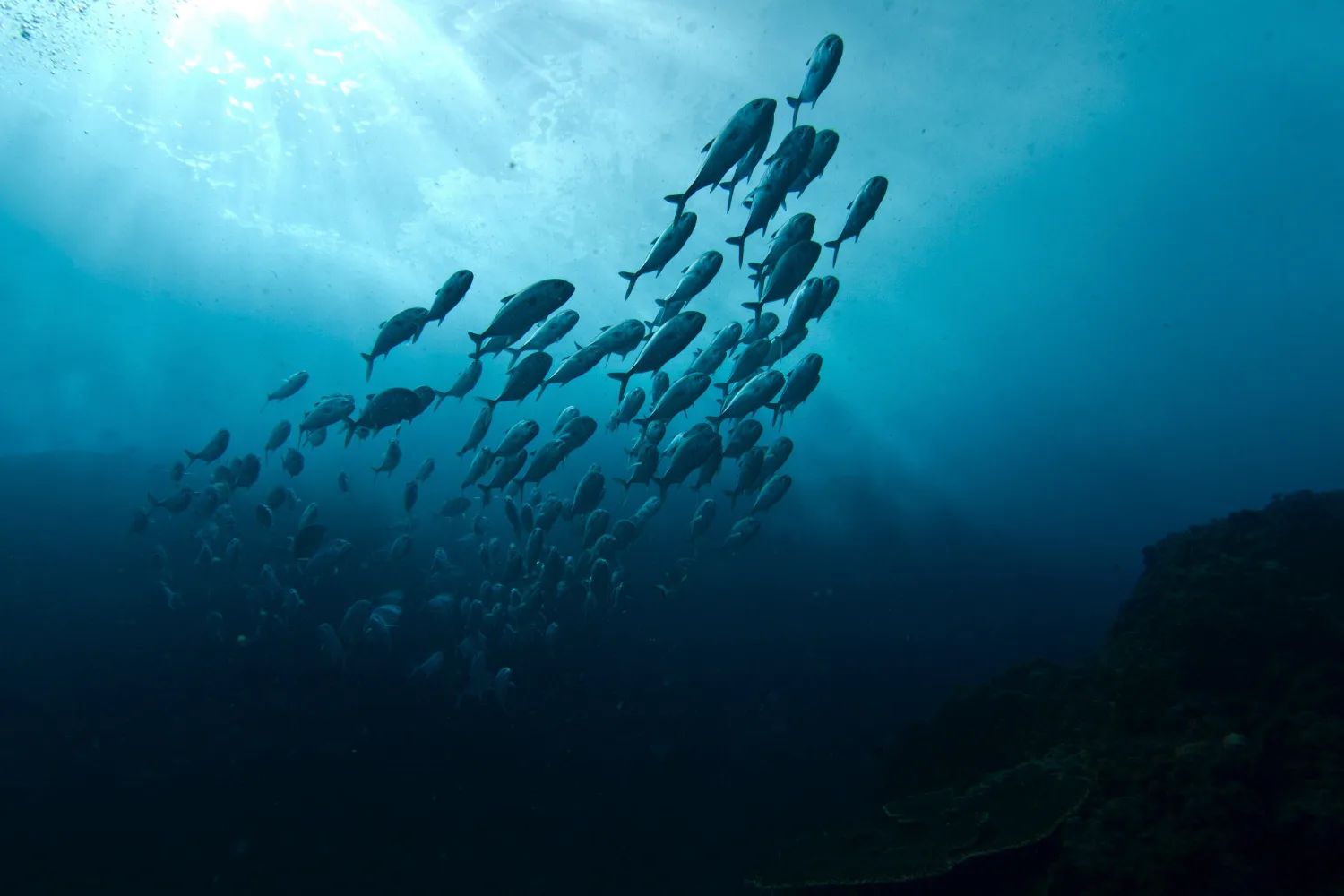
Julian Rocks
Nguthungulli Nature Reserve, 2.5 km offshore inside the marine park. Grey nurse sharks in winter, leopard sharks in summer.
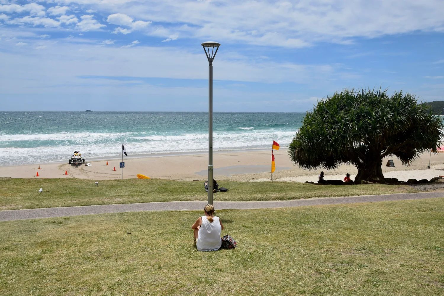
Main and Clarkes beaches
The town's own beaches, facing north across the bay at the end of the main street. Main Beach is the one patrolled all year.
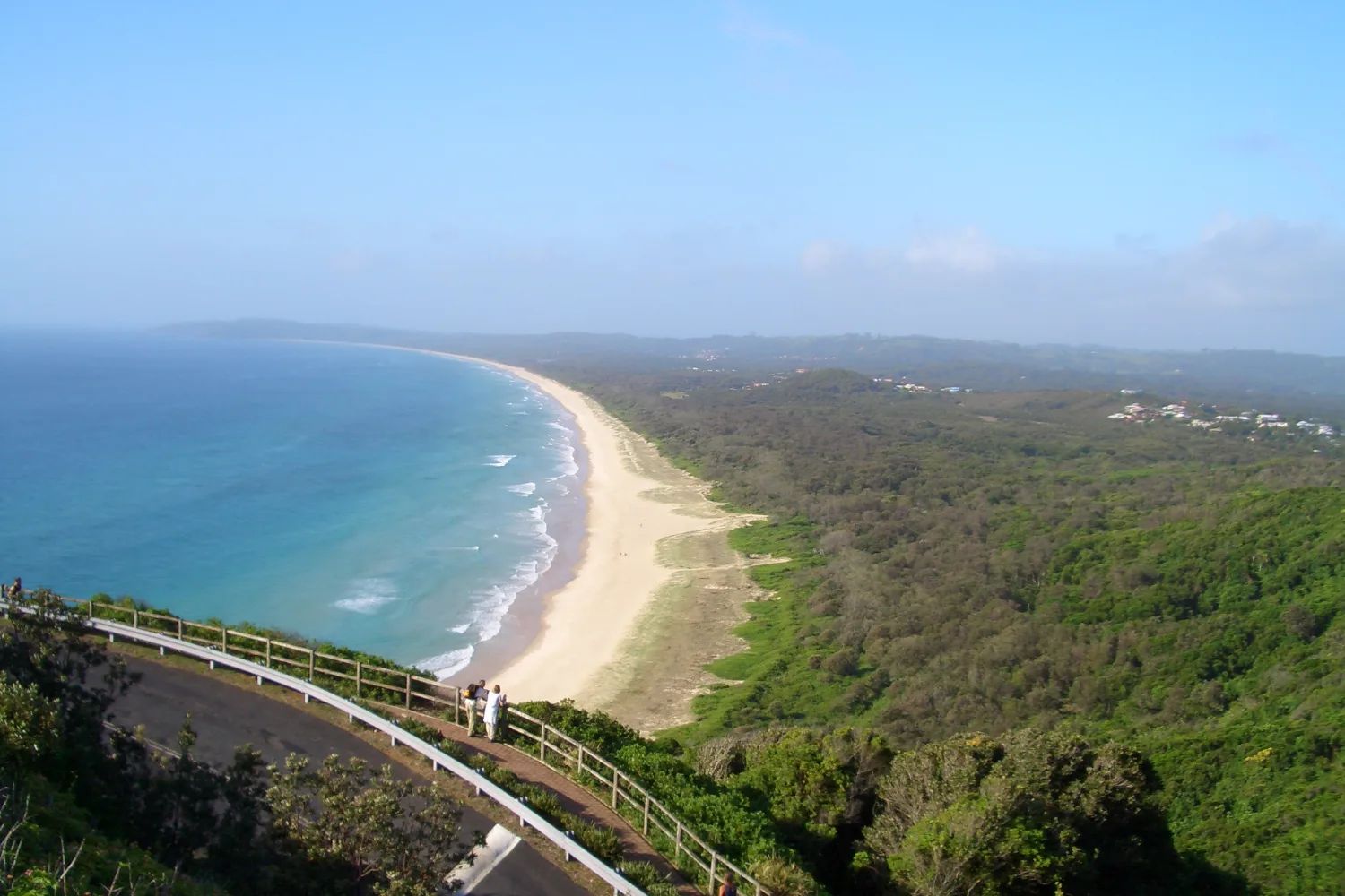
Tallow Beach and Arakwal National Park
A long open-ocean beach running south from the Cape, backed by a national park the Arakwal people manage with NSW Parks.
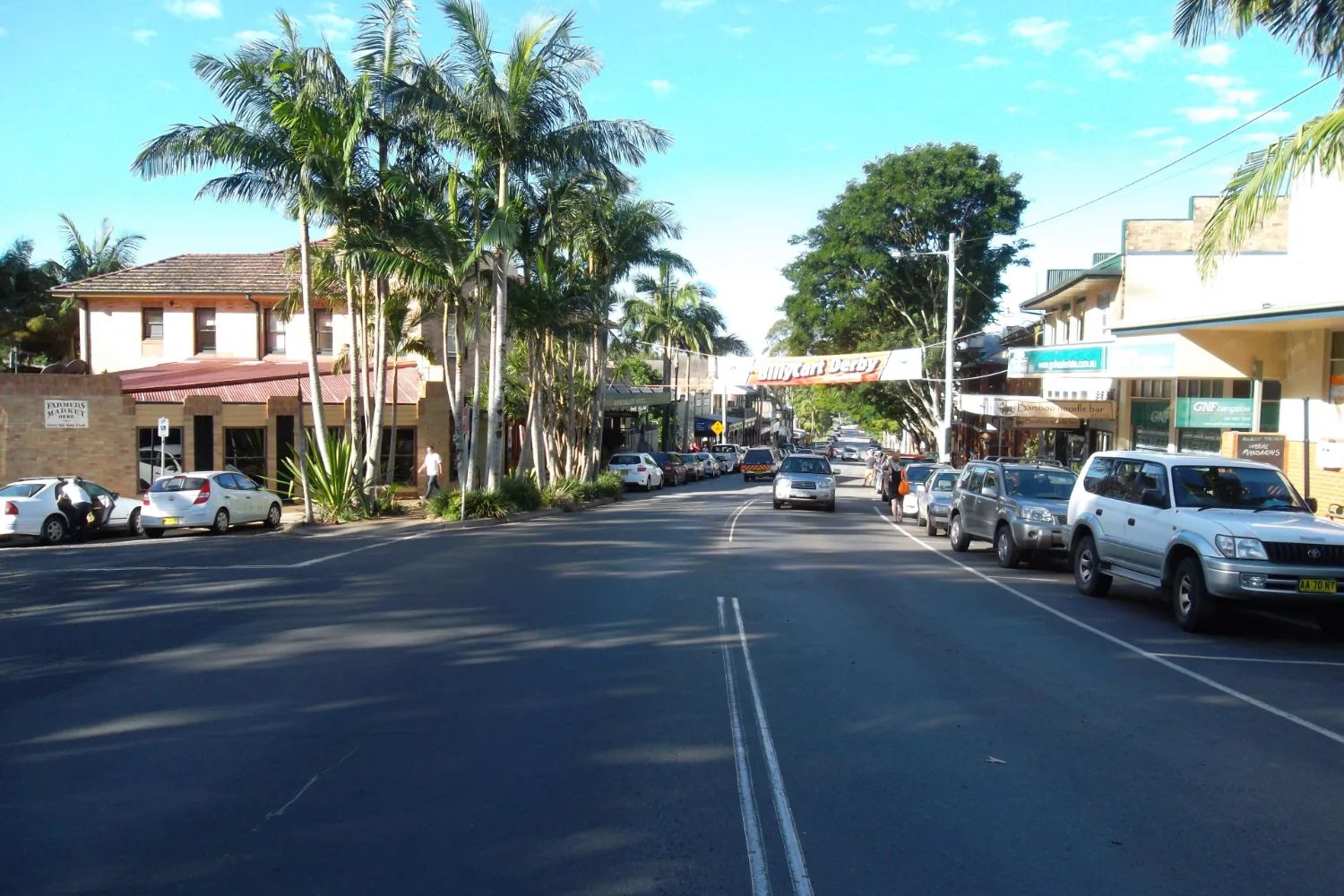
Bangalow
A hinterland village fifteen minutes inland, its main street lined with Federation-era shopfronts. The market is on the fourth Sunday.
We have not yet written these places up individually. Their cards carry no link, rather than a link to nothing.
Humpback whales pass the Cape twice a year, and from August to November, on the way south, they come closest to the shore. Stop at the rail below the lighthouse and give it ten minutes. Watch the water, not the horizon, for a burst of spray that hangs for a second and drifts on the wind. Feel the wind on the rail, and listen as well as look. Then look down, and notice how the swell wraps round the headland to reach the bay behind you.
Getting there and around
No mainline train reaches Byron Bay: the line closed in 2004, and only the short solar train runs on part of it. Most people arrive by road, on the coast drive between Sydney and Brisbane, or fly into Ballina or the Gold Coast.
Ballina Byron Gateway takes domestic flights only, from Sydney and Melbourne. The Gold Coast airport has more routes, including international ones, and is under an hour away by car or shuttle. Shuttles run to a timetable, so book them ahead, especially for the return journey.
| Arriving from | How far | Best for | The catch |
|---|---|---|---|
| Ballina Byron airport | About half an hour | Flights from Sydney, Melbourne | Domestic flights only |
| Gold Coast airport | Under an hour | More flights, some international | Shuttles run to a timetable |
| Brisbane by road | 180 km, motorway | A car for the hinterland | Paid parking in town |
| Sydney | About nine hours by car | The coast drive | Coach and rail take longer |
In the town centre, walk. Everything in the centre is within a few streets, and the beaches are at the end of them. The solar train runs along the bay to North Beach, the local buses run out to Suffolk Park and the other towns, and bikes are easy to hire.
Parking in the centre is paid, and so is the lighthouse car park, where you can stay for only an hour. If you are driving the coast, leave the car where you sleep.
When to go, and what the beaches allow
Byron is mild all year and busy most of it. Summer days reach about 28°C, winter days about 19°C, and February and March are the wettest months. Autumn and spring are the best balance: fewer people than summer, and the whales passing in spring.
The pressure on beds comes from the school holidays, and above all from Christmas and January, when the New South Wales and Queensland holidays both fill the town. We have not found an official calendar that sets the two states' dates side by side, so check both before you book.
Byron's big music festivals are less reliable than their reputation. Bluesfest was cancelled weeks before its 2026 dates, and Splendour in the Grass did not run in 2024 or 2025. The Byron Writers Festival runs in August. Whatever is listed for your dates, check the event's own site before you plan around it.
The beaches are why many people come, but most are patrolled only in the summer holidays. Main Beach is the one patrolled all year, five days a week. At The Pass, Wategos, Clarkes and Tallow, lifeguards are on duty only from late December to late January and over the April holidays. Out of season, swim at Main Beach, between the flags.
Where to stay and eat
Book the bed before anything else. Byron is the stop on the coast least likely to have a room left on the day. Our guide to where to stay in Byron Bay compares six places to sleep, from the town centre to Brunswick Heads and Lennox Head, with prices, places we would look at, and what to do if Byron is full.
Where to eat
Byron’s food is the region’s: macadamias, Ballina prawns, local beer and a Thursday farmers market. Our guide to where to eat in Byron Bay covers six food areas from the town centre to Brunswick Heads, what things cost, and a day built around the food.
Nearby, and further afield
The hinterland is where Byron changes character. Bangalow is fifteen minutes inland, and its market fills the showground on the fourth Sunday of each month. Mullumbimby, further north and inland, is the shire's other town. Minyon Falls, in Nightcap National Park, drops about 100 metres over a cliff of rhyolite, and is under an hour's drive away.
Along the coast, Brunswick Heads to the north is a quiet river town. Lennox Head, to the south, is a smaller surf town.
Wollumbin, the old Mount Warning summit track, has been closed since June 2023, and no reopening date has been given. The mountain is sacred to the Bundjalung. Do not plan a day around the climb. North over the border, the Gold Coast and Brisbane are up the motorway. Our Sydney to Brisbane road trip puts Byron on the sixth night.
A final word on Byron Bay
Most visitors give Byron one night on the way to somewhere else, and one night means choosing. Walk the Cape track from the town in the early morning, and keep the beach for the afternoon. A second night means you do not have to choose. Either way, book the bed first and leave the car where you sleep.
Andrew + Margaret
- Visiting Australia Overview
- Where to stay in Byron Bay Decide
- Where to eat in Byron Bay Practical
- Sydney to Brisbane road trip Journeys
- The Gold Coast Overview
- Brisbane Overview