The Mackenzie
Lake Tekapo, Twizel and Aoraki / Mount Cook Village: the high country of turquoise lakes, the country’s highest mountain and a sky full of stars
Travellers come to the Mackenzie for colour and scale. Lakes of an unreal turquoise lie in a wide golden basin, and at the head of Lake Pūkaki stands Aoraki / Mount Cook, the highest mountain in New Zealand. At night the basin lies inside an international dark sky reserve, and visitors come as much for the stars as for the mountain. The basin holds three places to stay: Lake Tekapo for the sky, Twizel in the middle, and Mount Cook Village at the foot of the mountain. Give it two nights, one at the lake and one by the mountain, and let the weather decide which day you walk.
How this page was madeWe last travelled in the South Island before 2011, too long ago to describe the Mackenzie from memory. So this page is researched from the Department of Conservation, NZ History, the Mackenzie region’s official tourism site, the operators’ own pages and the sources named at the end, checked on 11 October 2026. When we go back, we will say so here.
Last updated 11 October 2026
A little background
The basin’s Māori name is Te Manahuna. For Ngāi Tahu, Aoraki is an ancestor, the most sacred of all, and whānau from the coast came inland each season for eels and weka. When Ngāi Tahu’s Treaty claim was settled in 1998, the mountain’s name became Aoraki / Mount Cook. Its title was returned to the iwi, who gifted it back to the nation.
The European name comes from a sheep thief. On 4 March 1855 James Mackenzie was caught in the upper Waitaki with about 1,000 stolen sheep, and the basin he had found on his way became known as his. Within a few years it was divided into great sheep stations, and wool built the high country. A bronze sheepdog stands by the church at Tekapo in honour of the dogs that made the work possible.
The twentieth century added water and light. The Upper Waitaki hydro scheme laid canals across the basin and raised new lakes, and Twizel was founded in 1968 to house its workers. In June 2012 a 4,367 square kilometre area around Tekapo and Aoraki was made the Aoraki Mackenzie International Dark Sky Reserve, and the region’s night sky became one of its great attractions.
How the place fits together
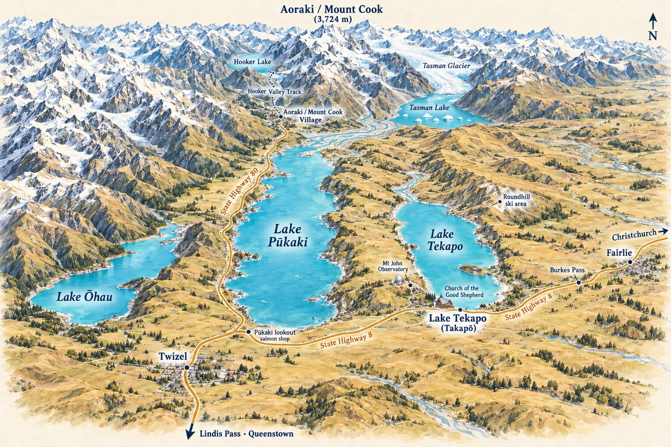
The Mackenzie is a wide, high basin with three long lakes running down from the Southern Alps. State Highway 8 crosses it from Fairlie and Burkes Pass in the north-east to Twizel and on over the Lindis Pass to Queenstown. Lake Tekapo is the first lake you reach. Lake Pūkaki is next, with Aoraki at its head, and State Highway 80 runs up its shore to Mount Cook Village, a dead end inside the national park. Twizel lies on the plain beyond, close to Lake Ōhau.
Distances look short on the map but take time on the road, and the weather can close the high passes in winter. Most visitors use two bases: Tekapo, which they reach first from Christchurch, and Mount Cook Village or Twizel for the mountain. Twizel is the practical choice for a longer stay, with a supermarket, more beds and the lakes on either side. Mount Cook Village is the memorable one, with the mountain filling the end of the valley and the tracks starting from the door.
Lake Tekapo (Takapō)
the skyVisitors come here for the colour of the water by day and the stars by night. The village sits on the south shore, with the Church of the Good Shepherd at the water’s edge, Mt John above, and the stargazing tours leaving from the main street.
Twizel
the middleThe basin’s practical centre, and its largest town: a supermarket, a good spread of places to stay, and Lake Pūkaki and Lake Ōhau within easy reach. Twizel sits between Tekapo and the mountain, which makes it a sensible base for two or three nights.
Aoraki / Mount Cook Village
the mountainThe place to wake up beneath the mountain. It is a small cluster at the head of the Hooker and Tasman valleys, with the Hermitage hotel, a few lodges and the Department of Conservation visitor centre. There is no supermarket, so shop in Twizel. Waking up here puts the tracks and the light of early morning at your door.
Places you don’t want to miss
The Mackenzie rewards anyone who stops for long enough to walk, look up and wait for the weather. We plan full guides to Aoraki / Mount Cook National Park, Lake Tekapo and Lake Pūkaki, and stargazing in the Mackenzie; until they are written, those cards carry no link. The Alps 2 Ocean already has a guide of its own.
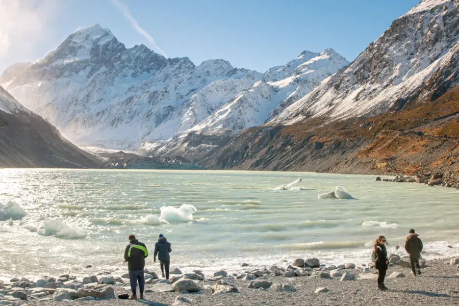
Aoraki / Mount Cook and the Hooker Valley
The walk most visitors come for: some 500,000 a year, says DOC. The track crosses three swing bridges to a glacier lake with icebergs, 10 km and three hours there and back, below the 3,724-metre summit of New Zealand’s highest mountain.
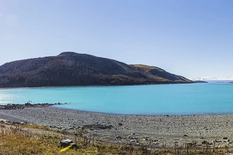
Lake Tekapo and the Church of the Good Shepherd
The colour stops people on the road: glacial silt holds the light in the water and turns it turquoise. On the shore stands the stone Church of the Good Shepherd, built in 1935, still a working church and one of the most photographed buildings in the country.
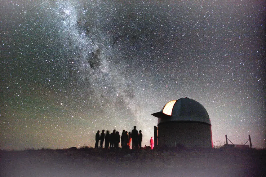
Stargazing at Mt John
For many visitors the night sky is the highlight. The university observatory on Mt John above Tekapo opens to tours after dark, and the Dark Sky Project refunds you if cloud stops the tour.
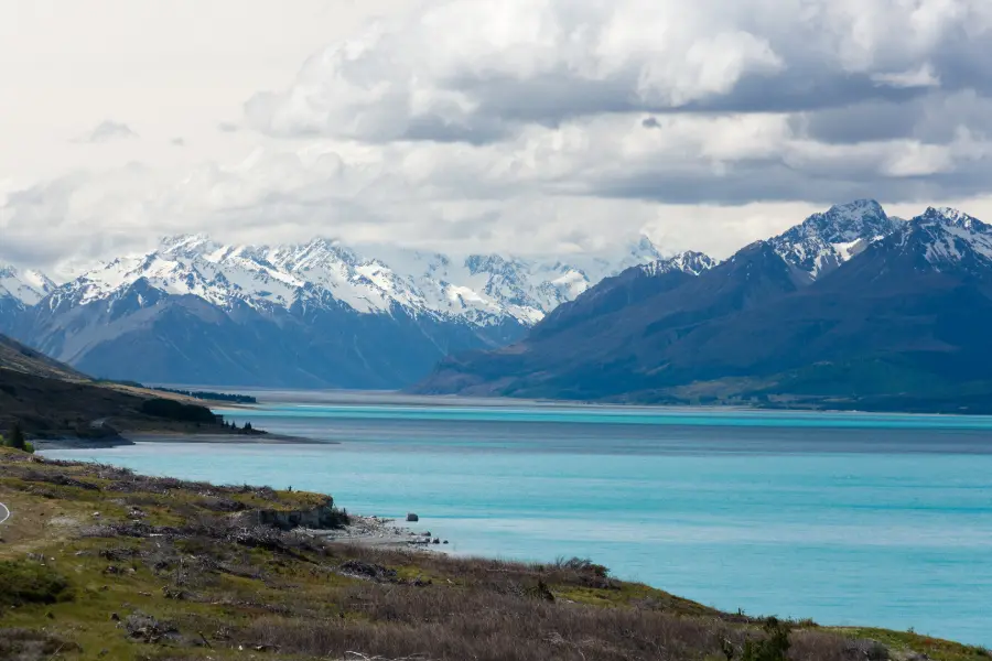
Lake Pūkaki and the road to the mountain
The view most people remember: the long blue lake with Aoraki at its head. The road to Mount Cook Village runs up its western shore, and at the visitor centre on State Highway 8 you can buy canal-farmed salmon to eat by the water.
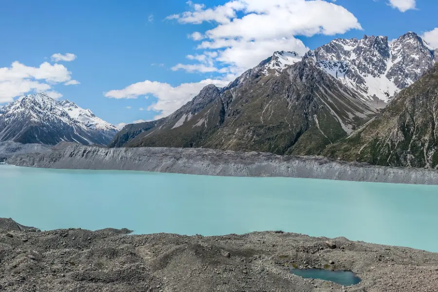
Tasman Glacier and the Blue Lakes
Icebergs drifting in a grey glacial lake are the draw. A short, steep walk climbs past the Blue Lakes to a view over the lake where the Tasman Glacier ends; from late August, small boats go out among the ice.
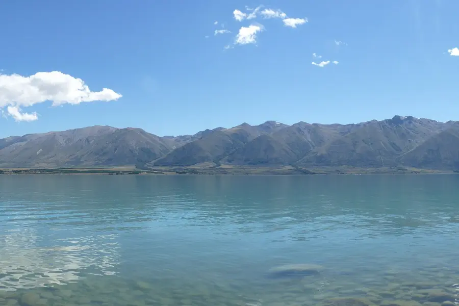
The Alps 2 Ocean and Lake Ōhau
Riders come for the lakeshores and the long, quiet trail. The Alps 2 Ocean starts at Aoraki / Mount Cook or Takapō and runs past Lake Pūkaki and Lake Ōhau towards the sea. Ride a day of it from Twizel, or the whole trail over five to seven days. Read the guide →
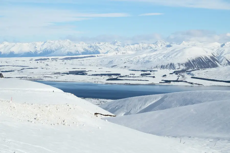
Winter on the ski fields
Snow brings a second season. Three small ski areas open from about July to September: Roundhill above Lake Tekapo, Mt Dobson near Fairlie and Ōhau near Twizel. Tekapo Springs adds hot pools and winter skating.
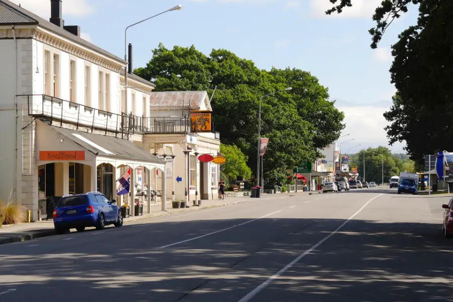
Fairlie, the way in
Travellers stop here for a stretch and a bakery pie, which has a following of its own. It is the last town on the road from Christchurch before Burkes Pass lifts you into the basin.
On a clear night at Tekapo, walk away from the village lights to the lakeshore and switch off your torch. Give your eyes time: they need many minutes to adjust to the dark. Notice how the air cools once the sun has gone, and how quiet the basin becomes. Then look up. Depending on the season and the moon, look for the band of the Milky Way and the two Magellanic Clouds, small galaxies seen only from the southern sky. The reserve exists to keep this sky dark. Leave the torch off and let it work.
Getting there and around
By car, the Mackenzie lies on State Highway 8, the inland road between Christchurch and Queenstown. On our New Zealand in two weeks route it is one night at Lake Tekapo; our South Island itinerary adds a night at Mount Cook Village. Many travellers remember the drive in over Burkes Pass, when the basin opens out below them.
| From and to | Distance | What to expect |
|---|---|---|
| Christchurch to Lake Tekapo | 227 km | About 3 hours, through Fairlie and over Burkes Pass |
| Lake Tekapo to Twizel | About 60 km | 35 to 45 minutes, past Lake Pūkaki |
| Twizel to Mount Cook Village | About 65 km | 45 minutes to an hour up State Highway 80, a dead end |
| Lake Tekapo to Mount Cook Village | 104 km | 1¼ to 1½ hours |
| Mount Cook Village to Queenstown | 271 km | 3 to 3½ hours, over the Lindis Pass |
Planning estimates in normal conditions, checked on 11 October 2026. Where sources differ we give the longer time. In winter, snow and ice can close Burkes Pass, the Lindis Pass and the road to Mount Cook Village; check the NZ Transport Agency before you set off.
By coach, long-distance services between Christchurch and Queenstown stop at Tekapo and Twizel, and seasonal shuttles run up to Mount Cook Village. We could not confirm this season’s timetables, so check with the operators before you plan around them. A car gives you far more of the basin. Mount Cook Village has no supermarket, so buy food in Twizel or Tekapo. Sources disagree on the fuel available in the village, so fill up before you drive up the valley.
When to go and practical notes
Every season has its own Mackenzie. From November to April the tracks are usually clear of snow, the days are long and the lakes are at their bluest. In late November and December the roadsides and riverbeds fill with lupins, purple, pink and blue. They are a much-photographed sight, but also an introduced weed that crowds the braided rivers, so admire them from the paths and leave them unpicked. Winter, from June to September, brings snow to the ranges, ski days on the three small fields and the longest, darkest nights for stargazing.
The stars are here all year, but cloud decides every night, so book a tour for your first evening and keep the second spare. The Church of the Good Shepherd is a working church. It opens for limited hours around the middle of the day and for Sunday services, and at other times you see it from the shore.
The Hooker Valley is an easy walk to a world-class view, and well worth an early start. But weather changes fast in the park: the Department of Conservation warns that avalanches can occur in any season, and from June to September snow can limit access to Mount Cook Village. Check the DOC visitor centre and the forecast on the day, and keep off the ice of the glacier lakes, whose water is close to freezing.
For the people and the place, see our guide to understanding Māori New Zealand. With children, the Hooker Valley is a long but gentle walk on a wide gravel track; the Dark Sky Project’s summit tour at Mt John takes children from age 10.
Where to stay and eat
Choose Lake Tekapo for the night sky and the lake: the stargazing tours leave from the village, and it is the natural first night from Christchurch. Choose Twizel for the widest choice of beds and the basin’s largest supermarket, at lower prices than Tekapo in our sample; it suits two or three nights and families. Choose Mount Cook Village to wake up beneath the mountain, with the tracks at your door. Beds there are few and the dearest in the basin, so book early.
Our guide to where to stay in the Mackenzie settles the choice. It compares the three on a first visit, mountain access, the night sky and families, gives each a price band from our own sample of rates, and names two places to look in each.
Where to eat
Food here is mostly hearty and local: lamb from the stations, and king salmon from the hydro canals, which appears on menus all over the basin. We researched one place in each settlement on 11 October 2026; confirm opening hours before you go.
Kohan, on the main road at Lake Tekapo, is a Japanese restaurant known for its sushi and sashimi made with local salmon.
Poppies Café & Restaurant, 1 Benmore Place, Twizel, is a licensed, family-friendly restaurant with outdoor tables and views of the Southern Alps.
The Old Mountaineers’ Café, in Mount Cook Village, is a café, bar and restaurant hung with climbing photographs. Its listing says it is the only business in the village opened by Sir Edmund Hillary. Hours change with the season, so check before you rely on it for dinner.
A final word on the Mackenzie
The Mackenzie is big country, and it repays slowness. Drive in over Burkes Pass and let the basin open up below you. Walk to Hooker Lake early, before the crowds and the cloud, and give the stars a second night if the first is grey. Two nights here can carry more of New Zealand’s scale and silence than a week of driving past it.
Andrew + Margaret
- Visiting New Zealand Overview
- New Zealand in two weeks Journeys
- The South Island itinerary Journeys
- The Alps 2 Ocean cycle trail Journeys
- Christchurch Overview
- Queenstown Overview
- Getting around New Zealand Practical
- Best time to visit New Zealand Practical
- Mackenzie Region, official tourism site Official
- Department of Conservation — Aoraki / Mount Cook National Park Safety
- Department of Conservation — Hooker Valley Track Safety
- Dark Sky Project, Lake Tekapo Booking
- NZ Transport Agency — journey planner Safety
- NZ History — James Mackenzie is caught, 1855 Culture
- Charles Decimus Barraud, Mt. Cook from Tasman Valley (1891), Te Papa Reading
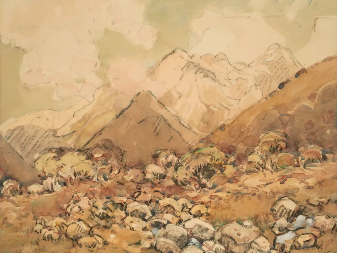
- Margaret Stoddart, In the Mackenzie Country (about 1930), Christchurch Art Gallery Reading
Should I stay at Lake Tekapo, Twizel or Mount Cook Village?
With one night, Tekapo for the stars or Mount Cook Village for the walks. With two, one of each. Twizel suits longer stays and families, with a supermarket and more choice, and it sits between the two. Our where-to-stay guide compares all three.
Can I see Aoraki / Mount Cook as a day trip from Tekapo?
Yes: it is about an hour and a half each way, and the Hooker Valley takes three hours. It makes a long but rewarding day. Staying a night in the village lets you walk in the calm and the light of early morning.
What if it is cloudy?
Stargazing tours are cancelled with a refund when cloud hides the sky, and the mountain can hide for days. Keep a spare night if you can. On grey days the lower walks, the Hillary Alpine Centre and the hot pools at Tekapo are good alternatives.