Sha Tin to Tai Mei Tuk by Bike
This is the best bike ride in Hong Kong for a visitor: a cycle track that leaves the MTR at Tai Wai, follows the Shing Mun River through Sha Tin to the sea, and runs along the shore of Tolo Harbour to the village of Tai Mei Tuk, with the hills of Ma On Shan and Pat Sin Leng across the water. It is mostly flat and mostly away from traffic. Its demands are the heat, the weekend crowds and, near the end, a short stretch of road and one real climb.
How this page was madeWe rode the first half, from Tai Wai along the river to the Chinese University and Hong Kong Science Park and back, on a weekday in April 2026. The rest of the route, from Science Park to Tai Mei Tuk, is researched, and we say so at each stage. It is about 22 km one way, and most riders take two to three hours; it suits anyone who can ride a bike for a morning. It is one of the rides on our cycling in Hong Kong page.
Last updated 14 October 2026
At a glance
The route
The ride follows water all the way. From Tai Wai it runs beside the Shing Mun River, a broad, straightened river through the middle of Sha Tin new town, with tower blocks, parks and the racecourse on either side. At Ma Liu Shui, below the Chinese University, the river meets Tolo Harbour, and the track turns north along the shore past Science Park and round the head of the harbour to Tai Po.
From Tai Po it runs east along the north shore, through villages, to Tai Mei Tuk at the foot of Plover Cove.
Ride it in this direction: the river gives an easy start, the harbour opens out as you go, and Tai Mei Tuk is a good place to stop, eat and look at the water. The way back is by the same track, by bus or minibus to Tai Po Market MTR station, or by handing the bike back in Tai Mei Tuk if the shop allows it.
What the riding is like
On the river it is easy riding: a wide, flat track beside the water, with walkers on their own path alongside, joggers, families and the odd fast group. We rode out on a weekday morning and it was calm.
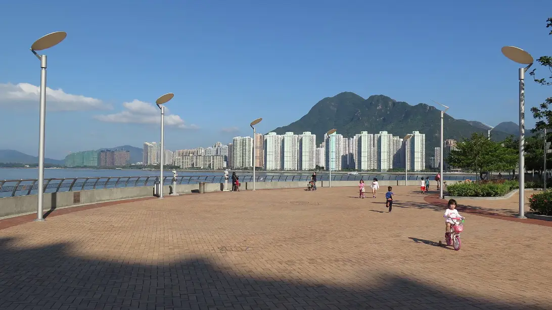
At the Chinese University we stopped for coffee, and at Science Park, where the track runs along the Pak Shek Kok promenade on its own lane beside the walkers’ path, we stopped for lunch before riding back. Out and back with the stops took us half a day.
What changes as you go is the view. Past Sha Tin the river widens into Tolo Harbour, and the track runs along the shore with Ma On Shan across the water. There is little shade on the harbour stretch, so the sun is the thing to plan for. Beyond Tai Po, by riders’ accounts, the character changes: the track threads through villages, crosses roads, and briefly joins one.
The stages
Five stages, each a natural place to pause. We rode stages 1 to 3 and back; stages 4 and 5 are from Discover Hong Kong and riders’ guides. No source gives official distances for each stage, so we give them only where a source does.
| Stage | From → to | Distance / time | Character and effort | Services / overnight | Main constraint |
|---|---|---|---|---|---|
| 1 Shing Mun River | Tai Wai MTR (Exit A) → Sha Tin town centre | A few kilometres; flat | Riverside track beside a separate footpath; easy | Shops and food in Sha Tin town centre | Busy at weekends and on holidays |
| 2 To the harbour | Sha Tin → Chinese University (Ma Liu Shui) | Short; flat | Under a flyover and onto the Ma Liu Shui promenade | Cafés at the Chinese University | Signs and junctions near the flyover |
| 3 Pak Shek Kok | Chinese University → Science Park | About 2 km of promenade | Through two short tunnels; a cycle lane beside the walkers’ path | Food and toilets at Science Park | Little shade; walkers crossing |
| 4 Round to Tai Po | Science Park → Tai Po | A few kilometres; flat (researched) | Track round the head of the harbour; tunnels and turnings in Tai Po | Kiosk at Tai Po Waterfront Park (a side turn) | Easy to take a wrong turn in Tai Po |
| 5 The north shore | Tai Po → Tai Mei Tuk | About 8 km from the Waterfront Park (researched) | Villages, a dismount crossing, a short road stretch and one steep climb | Kiosk at Ting Kok; shops and cafés at Tai Mei Tuk | The only traffic and the only real hill |
Stages 1 to 3: the river and the harbour (ridden)
From Exit A of Tai Wai station, the hire shops are across the road and the track is a few minutes away, signed towards the Hong Kong Heritage Museum and the river.
For flood-wall works, the Transport Department has closed the track on the western bank of the river between the Sha Tin Jockey Club Swimming Pool and Sha Tin Sports Ground, near Fo Tan Road, until 6 pm on 22 January 2027. Use the track on the eastern bank between Sha Tin Rural Committee Road and Fo Tan Road instead. Works like these are often extended, so check the department’s cycling notices before you go. After the Chinese University the track passes through two short tunnels and comes out on the Pak Shek Kok promenade, where riders have their own lane beside the walkers.
Stage 4: round to Tai Po (researched)
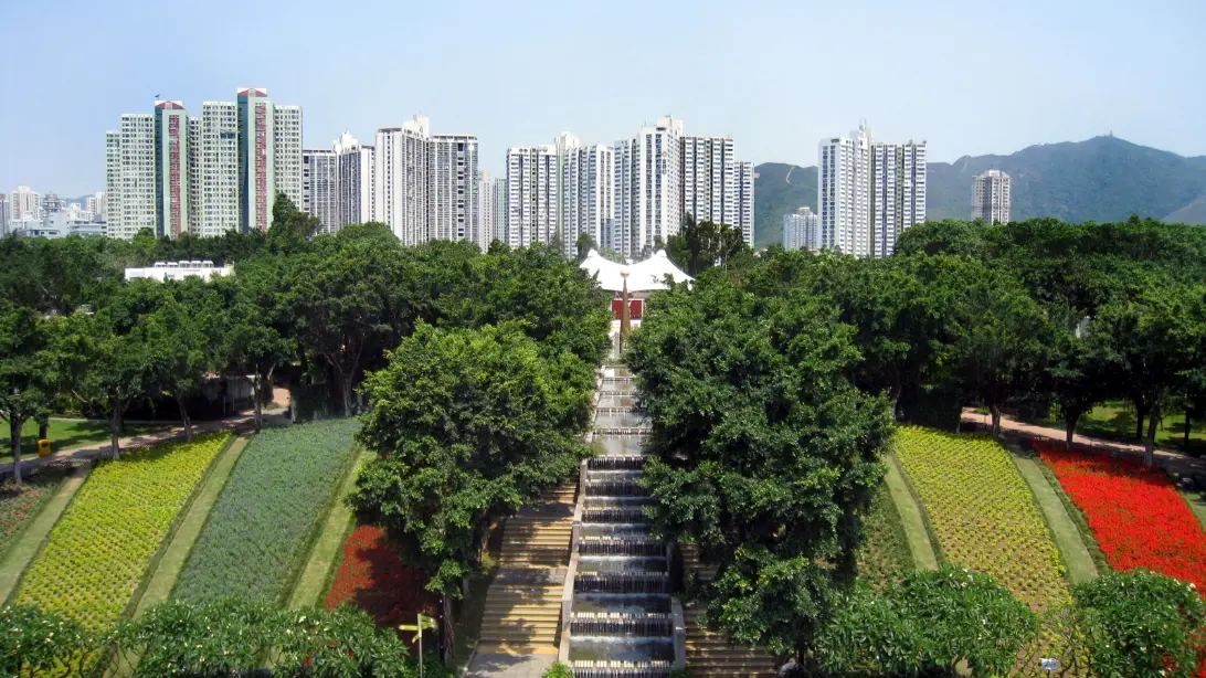
Beyond Science Park the track keeps to the shore round the head of Tolo Harbour into Tai Po. Riders’ guides describe a maze of tunnels and turnings in Tai Po itself, so watch the signs for Tai Mei Tuk. Tai Po Waterfront Park, 22 hectares with a 32-metre spiral lookout tower over the harbour, is a short turn off the track and a good place for a break. Our Tai Po District page describes the town.
Stage 5: the north shore to Tai Mei Tuk (researched)
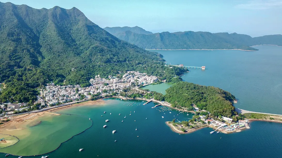
This is the stage that asks most. By riders’ accounts the track passes through villages, crosses a road where riders must get off and walk, runs briefly on the main road, and then climbs steeply past a fire station before dropping to Ting Kok and the last stretch along the water. Discover Hong Kong puts it at about 8 km from the Waterfront Park.
Tai Mei Tuk is a small village of cafés, barbecue sites and bike-hire shops at the foot of the Plover Cove main dam, which you can ride out along for the view.
Planning the ride
Hiring a bike
Most riders hire at Tai Wai, from the shops opposite Exit A. A guide dated January 2026 puts a day’s hire at about HK$60 to 80 on weekdays and HK$90 to 120 at weekends, with a helmet extra. Prices change, so ask. We hired from INVIS Cycling (形動單車), a cycling school that also rents bikes, and returned them there.
If you want to ride one way, ask before you set off: some shops will take the bike back in Tai Mei Tuk, by riders’ reports for a small extra charge, and there are hire shops in Tai Mei Tuk itself.
Getting there and back
Take the MTR to Tai Wai, on the East Rail and Tuen Ma lines. Our getting around guide covers the MTR and the Octopus card.
Bus 75K and minibus 20C run from Tai Mei Tuk to Tai Po Market MTR station, and bus 275R on Sundays and public holidays. We could not confirm whether these buses carry bikes, so either ride back the way you came or arrange before you set off to return the bike in Tai Mei Tuk.
At weekends and on public holidays the track fills with families, learners, groups and fast riders, and Tai Mei Tuk is crowded. From May to September the heat makes even a flat ride hard; start by nine, carry water, and see our best time to visit guide.
Hire at Tai Wai on a weekday morning and ride the river and the harbour to Science Park, with coffee at the Chinese University and lunch at Science Park, as we did. If you want the whole ride, agree a one-way return with the shop first, and leave Tai Po by late morning so the climb and the road stretch come before the worst of the heat.
— Andrew + MargaretIf the ride breaks down
The route is never far from help. Along the river and the harbour, MTR stations are close by: Tai Wai, Sha Tin, Fo Tan, University and Tai Po Market. If you are hot, tired or the weather turns, stop there; remember that the MTR takes a bike only folded, or with its front wheel off, and only if it then fits the luggage limit of 170 cm for length, width and height added together. A full-size bike rarely does, so it is usually simpler to ride back the way you came or call the hire shop.
The last decision point is Tai Po. Beyond it, stage 5 is the most demanding part and the furthest from a station; if you are flagging, turn back there, or finish at Tai Po Waterfront Park. Do not ride under a typhoon signal or a rainstorm warning. In an emergency, call 999.
A final word on Sha Tin to Tai Mei Tuk
For a visitor who wants to ride a bike in Hong Kong, this is the ride. It asks little of you but a morning, it shows you the new towns and the harbour that most visitors never see, and it ends by the sea at the foot of the hills. We have ridden the first half, and we have told you plainly where our own miles end.
Andrew + Margaret
- Can I cycle in Hong Kong? Overview
- Sha Tin District Overview
- Tai Po District Overview
- Hong Kong in a week Journeys
- Getting around Hong Kong Practical
How long does it take to cycle from Sha Tin to Tai Mei Tuk?
Two to three hours one way at an easy pace, for about 22 km. Allow a full morning with stops, and the same again to ride back.
Can I return a hired bike at Tai Mei Tuk?
Some Tai Wai shops allow it, by riders’ reports for a small extra fee. Ask when you hire.
Is the ride suitable for children?
The river and harbour stretches are flat and separated from traffic, and families ride them every weekend. Stage 5, with its road crossing and climb, is harder; children under 11 must have an adult with them on any road.