Hiking Hong Kong: Three Days on the Trails from One Hotel
Three day walks and a fourth to the wild east, all from one hotel
Most visitors never learn that about 40 per cent of Hong Kong's land is country park or special area, or that its trails start a bus ride from the towers. This itinerary gives walkers three days on them from a single hotel: a ridge between two seas, the long quiet back of Hong Kong Island, and the pilgrims' climb to the Big Buddha. A fourth, optional day goes out to the beaches of the far east.
It suits fit walkers who want the city in the evenings and the hills by day, without carrying a pack or camping. Each day is a return trip from the hotel by public transport, with a taxi for part of Day 4 on weekdays. If you would rather see the sights, take our three-day itinerary or a week in Hong Kong instead.
3 days + 1 optional · 4 nights · one base, Admiralty, Central or Wan Chai · on foot, with MTR, bus and cable car · Admiralty and back each day
How this page was madeWe have walked parts of this ourselves: the Peak circuit and the middle of Day 2, the first half of Day 4 from the East Dam to Sai Wan Shan, and Sharp Island, one of the alternatives. Days 1 and 3 follow walks that friends from Hong Kong, now living in California, planned and tested for their hiking club in 2025; the rest is researched from the government's trail pages.
Last updated 14 October 2026
The itinerary, day by day
Open one day, or all four.
Day 1Dragon's Back — a ridge between two seas8.5 km, about 2¾ hours walkingTo Tei Wan → Dragon's Back → Big Wave Bay
Begin with the walk everyone has heard of. It is short enough for a body still on another clock, and high enough to show you that Hong Kong is mostly hills and sea.
- MorningOut to To Tei Wan
Take the MTR to Shau Kei Wan, then Citybus 9 towards Shek O, and get off at To Tei Wan, where the path leaves the road. There are toilets at the start and none on the ridge, so carry all your water.
- Late morningAlong the Dragon's BackSeethe ridge·Shek O Peak·Tai Tam Bay
People come for the feeling of walking a spine of grass with the sea on both sides: Shek O's headland and the open water to the east, Tai Tam's bays to the west, the city out of sight. Most of the climb comes in the first half, to a top of 284 metres, and the ridge has little shade.
This is Section 8 of the Hong Kong Trail: AFCD, which runs the country parks, gives 8.5 km and about 2¾ hours, and rates it strenuous. Our Southern District profile sets the scene.
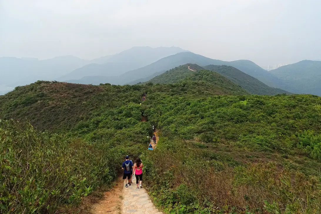
- Early afternoonBig Wave BaySeethe surf beach·Shek O village
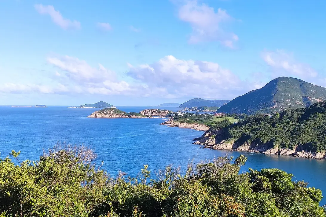
What the walk ends in is the sea: a surf beach where you may swim in season, watch the surfers when the swell is up, or sit on the sand with a cold drink. The descent to it through the woods is rough underfoot.
Sleeping here · Admiralty, Central or Wan Chai, nights 1 to 4. Stay within a short walk of Admiralty MTR, where four lines meet and the buses to the Peak leave from Queensway: every walk on this page starts one ride from your door. A mid-range hotel suits; you are out all day and need a good shower more than a view. Rooms here are small for the price. Our where to stay guide compares the areas.
- Travel
- MTR to Shau Kei Wan, Citybus 9 out; Citybus 9 or the red minibus back
- Stay
- Admiralty, Central or Wan Chai — nights 1 to 4
- Eat
- Lunch at Big Wave Bay or Shek O; dinner in Wan Chai
- Check
- No water on the ridge. Avoid summer afternoons and the day after heavy rain
Day 2The Peak to Wan Chai Gap — the island's quiet back18 km, about 5¾ hours walkingThe Peak → Pok Fu Lam → Above Aberdeen → Reservoirs → Wan Chai Gap
Day 2 is the long one, and it changes how you see the city: the first three sections of the Hong Kong Trail, round the island's quiet back through woods and reservoirs, the towers always somewhere below. You can leave at two points.
- EarlyThe Peak and Lugard RoadSeeLugard Road·the harbour from above
The trail begins with the most famous view in Hong Kong: Lugard Road, a ledge cut into the hillside with the whole harbour beneath it, which at nine in the morning you share with joggers rather than coach parties. Citybus 15 climbs to the Peak from the Admiralty stop on Queensway. Mind the drop: AFCD warns of cliff edges. Our Victoria Peak guide has more.
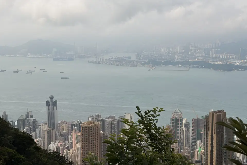
- Late morningDown to Pok Fu Lam ReservoirSeePok Fu Lam Country Park·the reservoir
Section 1 leaves the view for the island's quiet western flank, winding down through woodland to Pok Fu Lam Reservoir, Hong Kong's first, completed in 1863. It is 7 km from the Peak, about 2¼ hours. If one section is enough, walk out along Pok Fu Lam Reservoir Road to the buses.
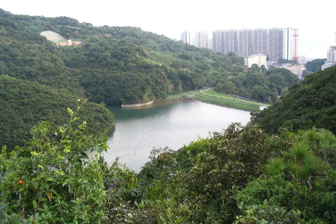
- MiddaySection 2, above AberdeenSeethe contour path·views to Lamma
This is the stretch we know: a contour path through the trees, with glimpses south over Aberdeen and Ap Lei Chau to Lamma, so quiet on a weekday that the city seems a rumour. It runs 4.5 km, about 1½ hours, to Peel Rise. That is the second way out: 1.6 km down to Aberdeen's bus terminus.
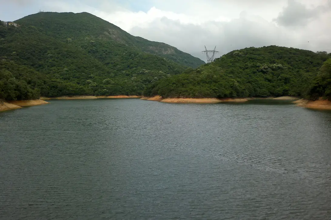
- AfternoonThe Aberdeen reservoirsSeeAberdeen Country Park·the upper reservoir
Section 3 passes the Aberdeen reservoirs, still water in a fold of the hills, then pulls steadily up to Wan Chai Gap: 6.5 km, about 2 hours, and the hardest-feeling part only because it comes last.
- Late afternoonWan Chai GapSeeWan Chai Gap Park
The end of the walk is the moment the city comes back: a small park on the saddle above Wan Chai, with traffic noise rising from below after a day of birdsong. Walk about 700 metres up Aberdeen Reservoir Road to the Wan Chai Gap Road stop, and Citybus 15 takes you down. Our Wan Chai District profile has the evening.
- Travel
- Citybus 15 up to the Peak and back down from Wan Chai Gap
- Stay
- Admiralty, Central or Wan Chai — night 2
- Eat
- Carry lunch and all your water; Wan Chai for dinner
- Check
- We found no shops or water points on AFCD's pages for these sections
Day 3Lantau — on foot to the Big Buddhaabout 5 km, all uphillShek Mun Kap → Po Lam Monastery → Big Buddha → Ngong Ping 360
Day 3 crosses to Lantau and climbs to the Big Buddha the old way, on foot: up a green valley past small monasteries, reaching the statue from below. Go on a weekday; Ngong Ping is crowded at weekends.
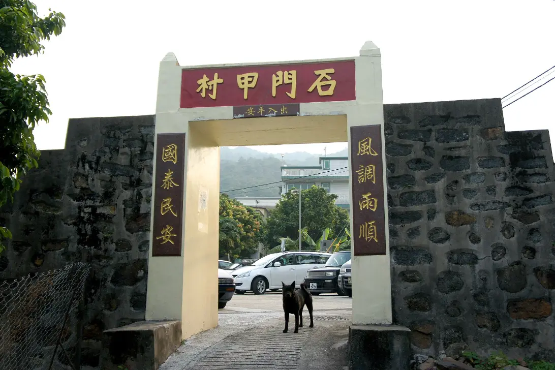
- MorningShek Mun KapSeethe village·the valley path
Shek Mun Kap is where the city falls away: a small village at the foot of the climb, with a toilet by the village office. Take the MTR to Tung Chung and New Lantao Bus 34. The bus is infrequent, about hourly by the one timetable we found, so check New Lantao Bus before you leave the hotel.
- Late morningUp the Tei Tong Tsai trailSeePo Lam Monastery·the valley
The climb is the point: a stepped path up a quiet valley, a stream for company, and monasteries and retreats along the way where nuns and monks still live, so keep voices low. The government guide gives about 5 km, all uphill, and allows about 4 hours. The hiking club whose route this is took about 2 hours on the move.
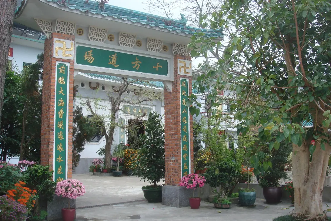
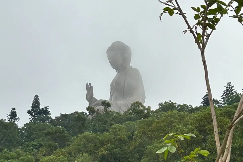
- MiddayThe Big Buddha and Po LinSeeTian Tan Buddha·Po Lin Monastery
Arriving on foot may change how the Buddha feels: you come up out of the trees to bronze and sky, and the 268 steps can feel like the last stage of a pilgrimage rather than a tourist climb. Then a vegetarian lunch at Po Lin Monastery. See our Tian Tan Buddha guide.
The Wisdom Path, its wooden steles on the hill nearby, closed for refurbishment in June 2025, with a staged reopening due by late 2026. We could not confirm whether it is open.
- AfternoonDown by cable car
Ride the cable car down over the hills and the bay: a one-way adult ticket is HK$205 in a standard cabin. If it is stopped for weather or maintenance, New Lantao Bus 23 runs down to Tung Chung.
- Travel
- MTR to Tung Chung, New Lantao Bus 34; Ngong Ping 360 or bus 23 down
- Stay
- Admiralty, Central or Wan Chai — night 3
- Eat
- Vegetarian lunch at Po Lin
- Check
- Bus 34 is infrequent. The cable car stops in storms. The Wisdom Path may still be closed
Day 4Optional — the East Dam to Tai Long Wana full day on foot, out by boat or busSai Kung → East Dam → Long Ke Wan → Sai Wan Shan → Ham Tin
The fourth day is for walkers who want Hong Kong at its wildest: volcanic columns, empty beaches and the open sea, on the MacLehose Trail in the far east of the Sai Kung peninsula. It is the most committing day on this page, though Day 2 is longer, and it is the one we remember best. We walked it on 31 January 2017, from the East Dam over to Long Ke and up Sai Wan Shan; the beaches beyond are researched. For the full walk from Pak Tam Chung, with the campsites and the way out at Sai Wan, see the MacLehose Trail, Sections 1 and 2.
- EarlyOut to Sai Kung
Take the MTR to Diamond Hill and bus 92 to Sai Kung. On weekdays, take a taxi from Sai Kung to the East Dam. At weekends and on public holidays, bus 94 runs along the peninsula to Pak Tam Chung, where green minibus 9A goes on to the dam.
- MorningThe East DamSeethe hexagonal columns·the open sea
Walkers come for rock that looks made rather than formed: ranks of hexagonal volcanic columns beside the High Island Reservoir dam, part of the UNESCO Global Geopark, with the open sea breaking beyond. There is nothing to buy here, or anywhere until the beaches.
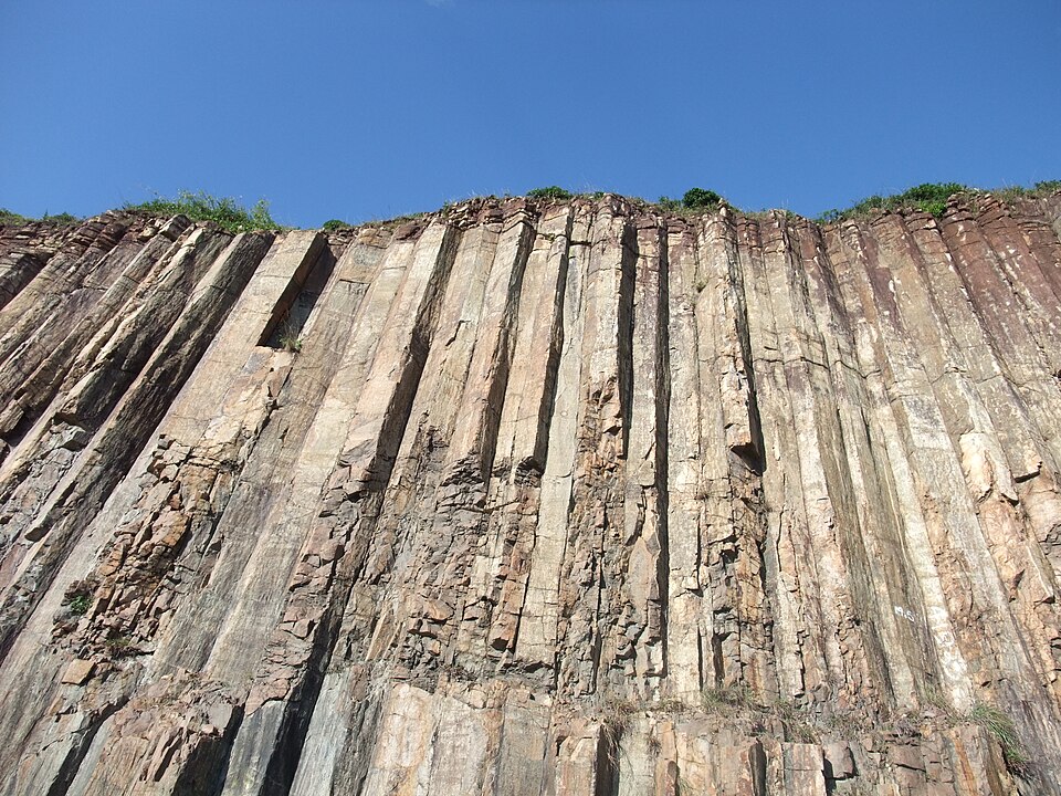
- Late morningOver to Long Ke WanSeeLong Ke Wan·the headland path
From the dam the MacLehose Trail climbs over a headland and drops to Long Ke Wan, a curve of white sand with only hills behind it. We first saw it from the path above at about ten in the morning, the surf pale against green water, and it is still the Hong Kong we carry home.
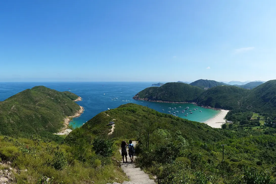
- MiddayUp Sai Wan ShanSeethe Tai Long Wan Panorama
The climb out of Long Ke is steep, as AFCD's page for the stage warns, and we found it hard going. Near the top, a wooden sign marks the Tai Long Wan Panorama: the bays of the far shore laid out below, white sand and surf, often softened by haze. We reached it a little after noon.
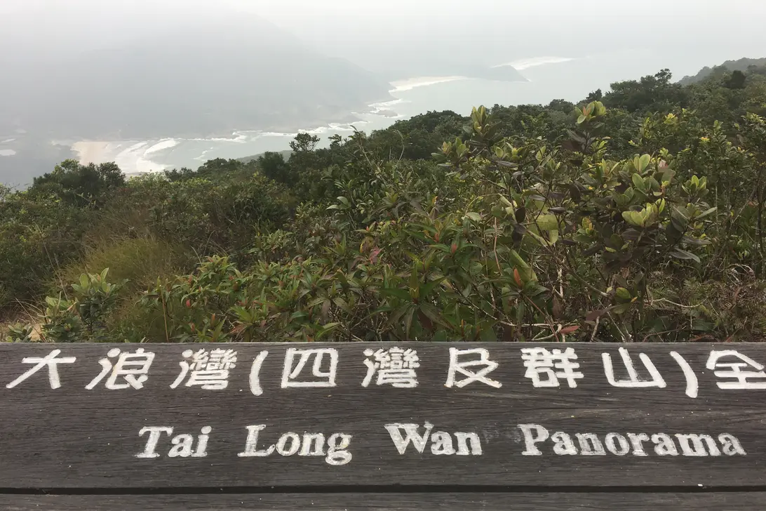
- AfternoonSai Wan and Ham TinSeeSai Wan beach·Ham Tin beach·Sharp Peak
These are the beaches people cross Hong Kong for: broad sand facing the open sea, with a village behind. Sai Wan has beach restaurants and Ham Tin has stores, but we found no published opening days, so carry enough for the whole day. This is open coast: look at the sea before you swim.
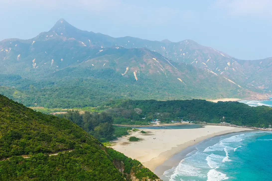
- Late afternoonOut by boat or on foot
The usual way back is by sea: private operators run shared speedboats from Sai Wan and Ham Tin to Sai Kung's waterfront; they take bookings by message and publish no fares or timetables, so we cannot vouch for them. Arrange the return before you set out.
The alternative is the rest of Stage 2, via Chek Keng to Pak Tam Au: several more hours on foot, since the whole stage is 13.5 km and about 5¼ hours from Long Ke. Start it only with time to finish in daylight. KMB 94 runs from Pak Tam Au to Sai Kung, and bus 92 back to Diamond Hill.
- Travel
- MTR and bus 92 to Sai Kung; taxi, or bus 94 and minibus 9A at weekends; speedboat or bus back
- Stay
- Admiralty, Central or Wan Chai — night 4
- Eat
- Carry food and water from Sai Kung; beach restaurants at Sai Wan if open
- Check
- Little shade; walkers report patchy phone signal. The boats are unofficial
At the panorama sign, stop and let your breathing settle after the climb. The wind comes straight off the sea here, cool on a sweating back. Below, the bays lie one beyond another, each a pale crescent of sand edged with surf you can see but cannot quite hear. Nothing is moving except the water. Somewhere behind the hills are seven million people, and from here there is no sign of any of them.
The shape of the route
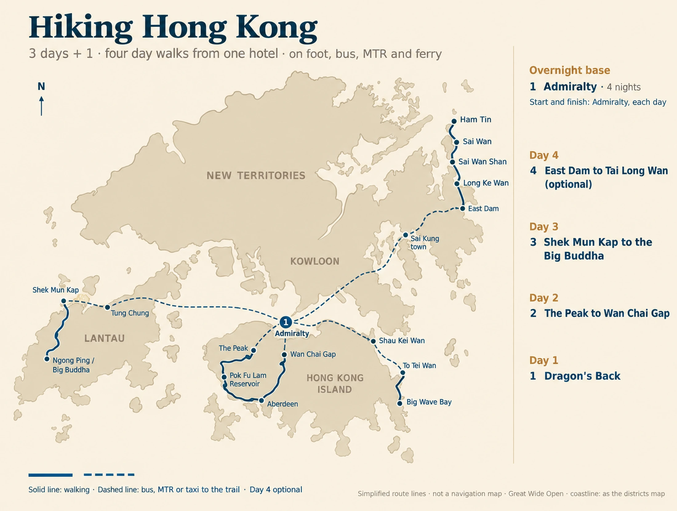
Everything starts and ends at one hotel near Admiralty, for four nights. Each day goes out in a different direction: east along the island to the Dragon's Back, up and round the island's own hills on Day 2, west across the water to Lantau, and on the optional fourth day north-east to the Sai Kung peninsula.
The walks are 8.5 km, 18 km and about 5 km, and Day 4 is a full day. The solid lines on the figure are walking; the dashed lines are the bus, MTR or taxi to the trail.
Before you commit
The longest day is Day 2, nearly six hours on the move, with nothing to buy on the way. The most committing is Day 4: far from help, with patchy phone signal by walkers' accounts, and a return you must arrange in advance. Nothing else needs booking. It leaves out harder hikes such as Lion Rock, Ma On Shan and Sharp Peak; our trails guide covers some.
Walk between October and April. From May to September the heat and humidity make long, exposed walks hard going and a risk of heat illness; AFCD advises shaded routes and short hikes in hot weather, and typhoon and rainstorm warnings can stop the transport. Hong Kong's hills are steeper than they look, the paths are often concrete steps, and the published times are walking times, without stops. Start by nine, and finish in daylight.
Download AFCD's Enjoy Hiking app, which can track your walk, and the police HKSOS app. Note the number on the nearest distance post as you go; in an emergency call 999 or 112 and give it. Fire Services answered 588 mountain-rescue calls in 2024; 15 people died.
With children · No walk here takes a pushchair, though Lugard Road is level and paved, and every MTR station has a step-free entrance. Dragon's Back, with its climb done early and a beach at the end, suits older children used to hills; Days 2 and 4 are too much for most. The cable car both ways gives the Buddha without the climb: free under three, a child fare to eleven. Our Hong Kong with children guide has easier days, and Ocean Park can replace one.
Make it yours
For the same coast on an easier day, take a kaito, the small village ferry, from Sai Kung pier to Sharp Island. We have walked it: at low tide a sand bar joins it to tiny Kiu Tau, among weathered rocks that AFCD likens to pineapple buns. Check the Observatory's tide times first. You lose the long ridge and the wild beaches.
Strong walkers on a clear, still day can climb Lantau Peak instead: New Lantao Bus 3M, 11 or 23 from Tung Chung to Pak Kung Au, then Lantau Trail Section 3 over the 934-metre summit to Ngong Ping. AFCD gives 4.5 km and about 2½ hours, rates it difficult, and warns of steep stone steps and little shade. You lose the monasteries.
Walk Section 1 only and leave at Pok Fu Lam, or go on through Section 2 and walk down Peel Rise to Aberdeen. You keep the Peak and the woods; you lose Wan Chai Gap.
If the route slips
Weather is the usual reason a walking day fails. Under a Typhoon Signal No. 8 or a Black Rainstorm warning, do not walk; expect ferries, the cable car and many buses to stop. In heat, start earlier and shorten the day. On a hot or wet day, Bowen Road above Wan Chai is a mostly level, shaded walk, about an hour at a leisurely pace by the Tourism Board's reckoning, a short climb from Admiralty.
Nothing on the route is fixed except the Day 4 boat, if you book one. Recover in this order. Keep Day 4 for a cool, clear, settled day, or drop it first. Swap Days 1 and 3 freely; both are half-days on the move. If Day 2 runs late, leave at Pok Fu Lam or Peel Rise.
On Day 4, if the boat does not come and the light is going, do not set out on the hours of trail to Pak Tam Au: stay at the beach and call 999 if you need help. Check the Observatory before each start.
A final word on hiking Hong Kong
Most visitors leave Hong Kong with a picture of towers and neon. Walk for three days and you take home another: a ridge in the wind above Shek O, a reservoir in the woods behind the Peak, a white beach with no road to it. That second Hong Kong is a bus ride from the first.
Andrew + Margaret
- Visiting Hong Kong Overview
- Walking and hiking trails in Hong Kong Highlight
- Hong Kong itinerary: 1 to 3 days Journeys
- Hong Kong in a week Journeys
- Where to stay in Hong Kong Decide
- Getting around Hong Kong Practical
- Best time to visit Hong Kong Practical
- Sai Kung District Overview
- AFCD Enjoy Hiking: trails and the app Official
- AFCD: country parks, about 40% of the land Overview
- Hong Kong Observatory: warnings and tides Safety
- Ngong Ping 360: fares and closures Booking
- New Lantao Bus: routes 34 and 23 Practical
- Hong Kong UNESCO Global Geopark Official