National Park Village (Waimarino)
A railway village at the foot of three volcanoes: the base for the Tongariro Crossing, the Ruapehu ski fields and the oldest national park in the country
Few places in New Zealand put you this close to something this big. Step out of your door in National Park Village and the eastern sky belongs to three volcanoes: broad, snow-capped Ruapehu; Ngāuruhoe, a near-perfect cone; and the long massif of Tongariro. They are sacred to the iwi who live beneath them, and the heart of the country’s first national park, twice recognised by UNESCO. From here you can walk the Tongariro Alpine Crossing, ski Ruapehu, ride through forest on a mountain bike, or watch the light move across the snow. Give it two nights: the mountains make their own weather, and the second night turns a hope into a walk.
What is ours, and what is researched. We have not stayed in the village. On our own North Island trip in March 2026 we drove State Highway 41 past the northern edge of the park, between Taupō and Taumarunui, but did not stop; and the Crossing is marked as researched on our North Island in two weeks route. So everything on this page comes from the Department of Conservation, UNESCO, the iwi and government sources named below, the ski operators and the businesses’ own pages, checked on 29 September 2026. We will say so, and update the page, when we go.
A note on the name. in December 2024 the village’s official name became Waimarino, its original name, for the calm waters pooling on the plains below the mountain. The railway station is still called National Park, and so are most signs, timetables and bookings, so we use both.
Last updated 29 September 2026
The mountains that were entrusted
To the iwi of this place the mountains are ancestors, not scenery. Ngāti Tūwharetoa tell of Ngātoroirangi, the tohunga who came with the Te Arawa canoe and climbed Tongariro to claim the land. On the summit a bitter southerly nearly killed him, and he called to his sisters in Hawaiki to send fire. It came underground, surfacing at Whakaari, Rotorua and Taupō, and burst out on the mountain to save him. The name Tongariro remembers that moment: seized by the cold south wind. Ngāti Rangi, whose home is the southern flank of Ruapehu, Ngāti Hikairo ki Tongariro and the iwi of the Waimarino plains to the west all hold these peaks as their own.
By the 1880s the land around the mountains was passing through the Native Land Court, and the summits were at risk of being cut up and sold. On 23 September 1887 the paramount chief of Ngāti Tūwharetoa, Horonuku Te Heuheu Tūkino IV, signed the peaks of Tongariro, Ngāuruhoe and Ruapehu, about 2,640 hectares, over to the Crown, so that they could never be divided. Ngāti Tūwharetoa understood it as a shared guardianship, not a gift outright. That land became the nucleus of Tongariro National Park, the first in New Zealand and among the first in the world.
A century later the park made history again. UNESCO listed it as a World Heritage Site in 1990 for its volcanoes. In 1993 it became the first place anywhere in the world to be listed as a cultural landscape, recognising that the mountains’ meaning to Māori is as much a part of their value as their geology. The iwi and the Crown are still negotiating how the park should be governed together.
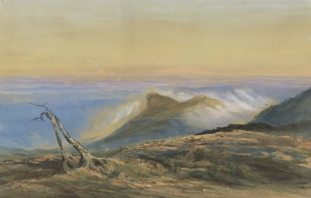
The village has a younger story. It grew up around Waimarino station after the Main Trunk railway was completed in 1908, when some thirty sawmills worked the forest nearby. The station was renamed National Park in 1926, and the village took the name with it until 2024.
To walk here is to walk through a living ancestral landscape, and the iwi ask only three things of every visitor. Do not touch or enter the lakes and streams, the Emerald Lakes included. Do not climb to the summits, which are tapu. And call Ngāuruhoe by its own name: the iwi have asked tourism operators to stop marketing it as “Mount Doom”. Since the November 2025 fire burned about 2,935 hectares on the Whakapapa side, a ten-year restorative rāhui has covered the burnt ground: stay on the open tracks. See our guide to Māori etiquette.
How the place fits together
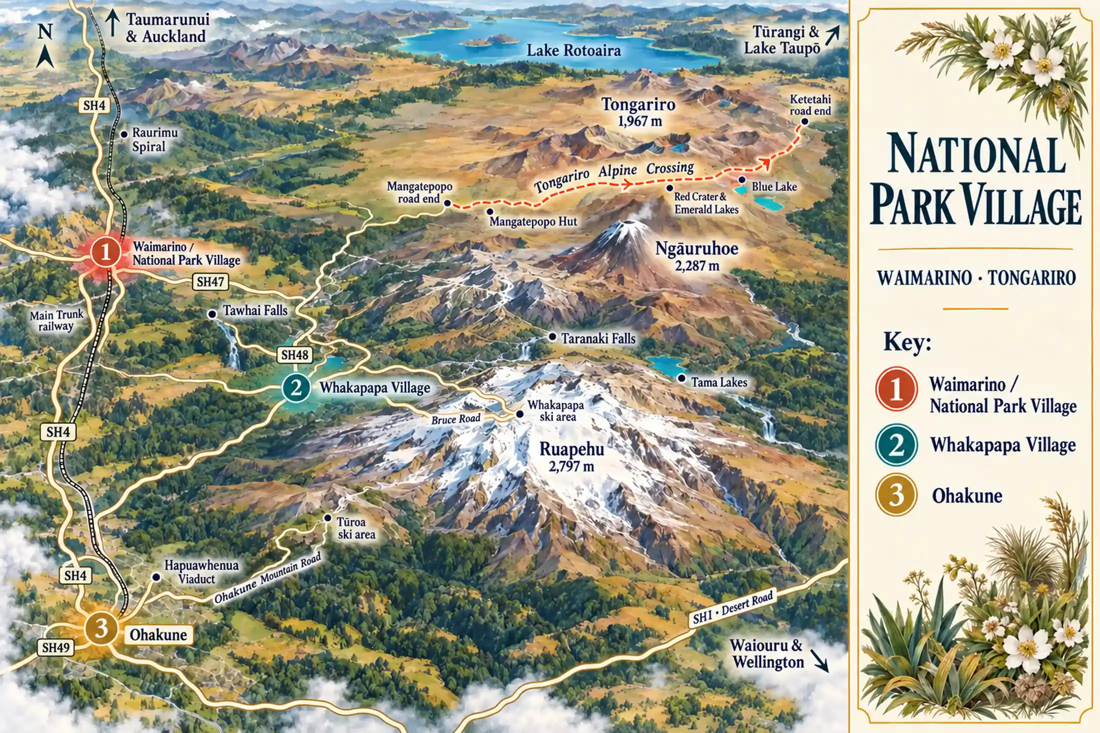
The village sits on the park’s western edge; the mountains, the walks and the ski field all lie to the east. State Highway 47 runs past the Mangatepopo road end, where the Crossing starts, to Tūrangi. State Highway 48 climbs to Whakapapa Village, and the Bruce Road goes on up to the ski area. South on State Highway 4 is Ohakune, the gateway to Tūroa.
That gives three places to base yourself, and each suits a different trip. Tūrangi, forty minutes north-east at the southern tip of Lake Taupō, is a fourth for anyone who also wants the trout rivers and the lake.
Waimarino / National Park Village
the baseLodges, motels and chalets around the railway station, with the volcanoes filling the eastern sky. The shuttles start here, the store sells your lunch, and dinner is a walk away. A working base rather than a pretty one.
Whakapapa Village
inside the parkA small cluster inside the park where the Bruce Road starts its climb to the ski area. The DOC visitor centre and the walks to Taranaki Falls and Silica Rapids start at the door. Skotel is the hotel; the grand Chateau has been closed since 2023.
Ohakune
the south sideThe larger town, and the base for Tūroa on Ruapehu’s southern slopes. In winter it hums with skiers; in summer it starts the Old Coach Road, and it is a sound alternative if the village is full.
Places you don’t want to miss
This is a place for people who like to use their legs. The Crossing is the famous day, but the park rewards anyone who stays long enough to walk the quieter tracks, and in winter the same slopes become the North Island’s playground. Only the Crossing has a guide of its own on our site so far; the other cards here carry no link until we write them up.
The Tongariro Alpine Crossing
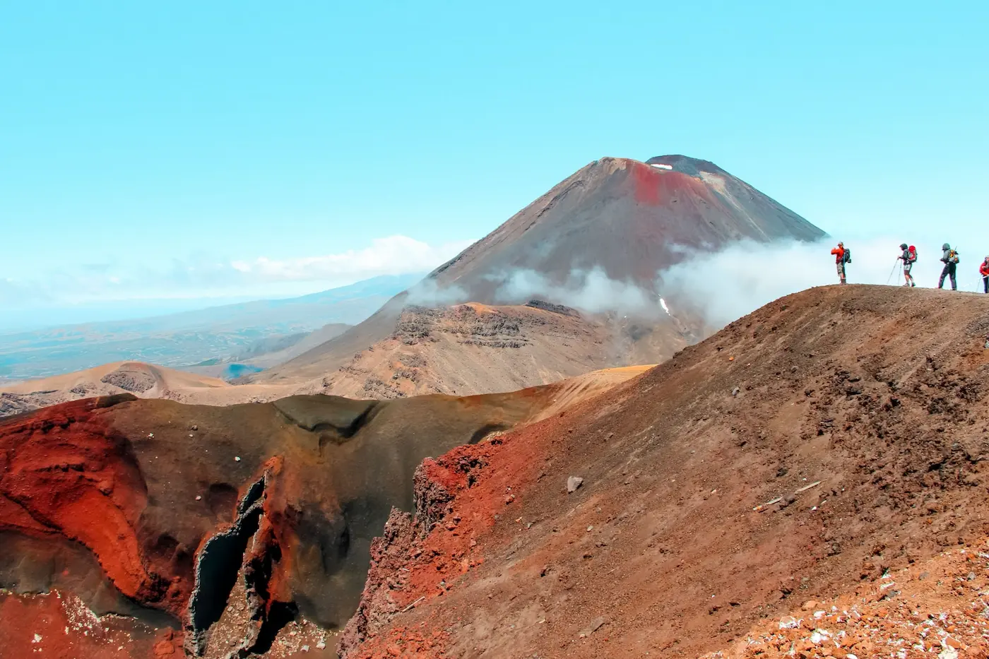
The walk that brings most people here: a one-way day across an active volcanic massif, past the Red Crater and the Emerald Lakes, with Ngāuruhoe’s cone beside you. It is why you need the second night. Read the guide →
Taranaki Falls and the Tama Lakes
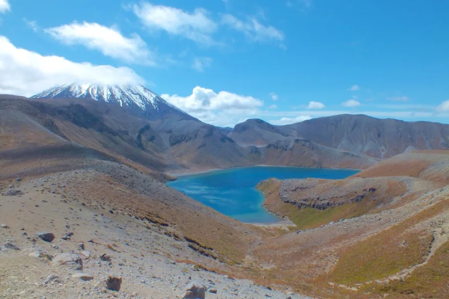
A two-hour loop from Whakapapa Village reaches Taranaki Falls, a 20-metre curtain of water over an old lava flow. Carry on across the tussock to the Tama Lakes, two explosion craters on the saddle below Ngāuruhoe. Some walkers find it the better day.
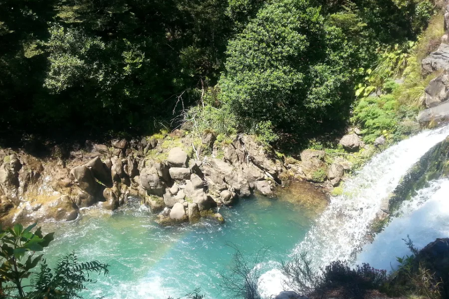
Short walks: Tawhai Falls and Silica Rapids
Some of the park’s loveliest corners take less than an afternoon. Tawhai Falls drops into a clear green pool a few minutes from the road; Silica Rapids follows a beech-forest stream to cream-coloured mineral terraces. Perfect when the tops are in cloud.
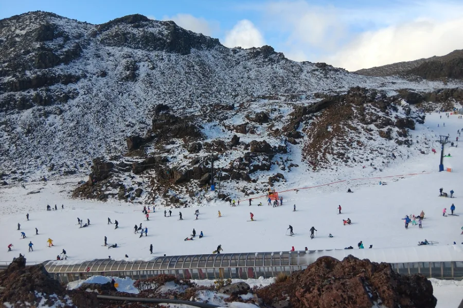
Whakapapa ski area and the Sky Waka
One of the country’s biggest ski areas, about 550 hectares on Ruapehu’s northern slopes, with Happy Valley below it for learners. The Sky Waka gondola rises 1.8 km to Knoll Ridge Chalet at 2,020 metres, and runs for sightseers in summer too.
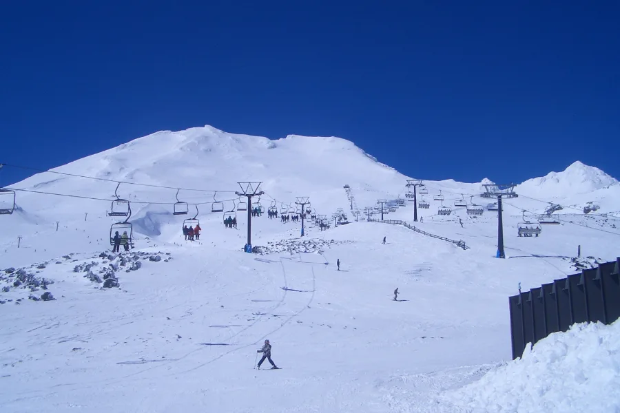
Tūroa, from Ohakune
Ruapehu’s southern ski area has the longest vertical in New Zealand, 722 metres, on wide open slopes that hold the spring snow. It is reached from Ohakune, half an hour away; on a clear day you look west to Taranaki.
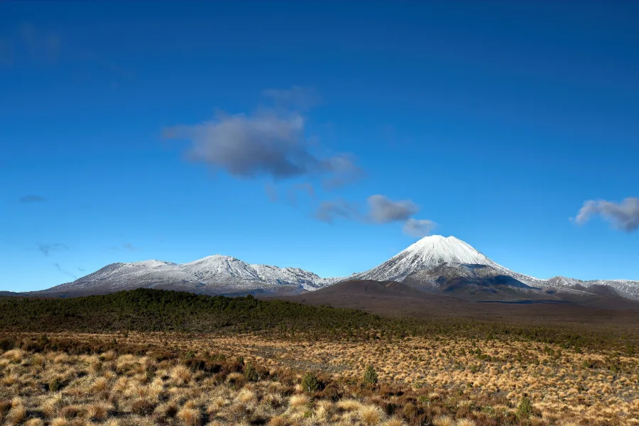
The Tongariro Northern Circuit
The Crossing is one day of a Great Walk. The full circuit takes three or four days around Ngāuruhoe, through lava fields and tussock, with nights in DOC huts under a sky without a light in it. Book the huts for the season, 23 October to 30 April. For 2026/27 the circuit starts at Mangatepopo, because the section from Whakapapa Village is closed after the 2025 fire.
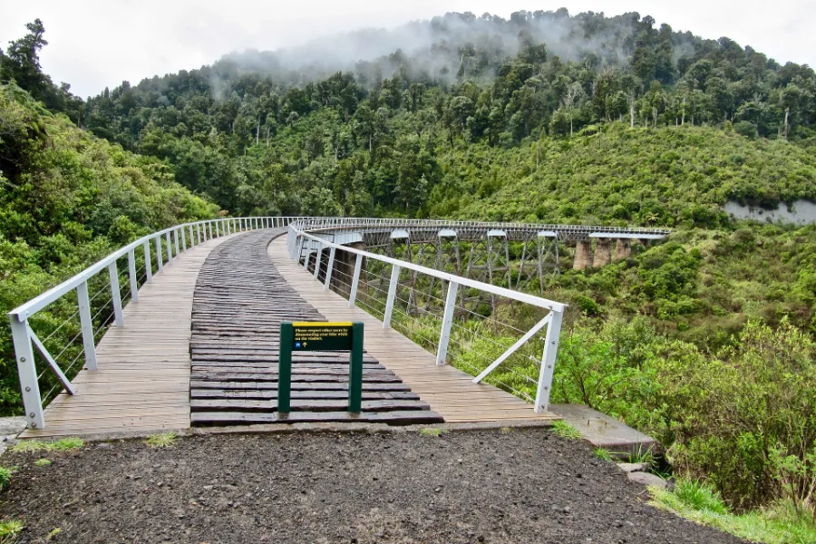
On two wheels: Old Coach Road, Fishers Track and the 42 Traverse
Cyclists are spoiled here. The Old Coach Road runs 15 km through forest from Ohakune, over the restored Hapuawhenua Viaduct of 1908. The Fishers Track is a long, easy descent from the village; the 42 Traverse is a classic backcountry ride.
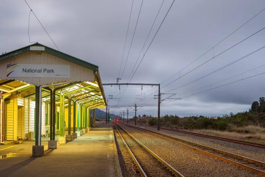
The Raurimu Spiral and the Northern Explorer
The village owes its existence to the railway. Just north, the Main Trunk climbs onto the plateau by the Raurimu Spiral, an engineering marvel of 1908. Ride it on the Northern Explorer, which stops at National Park station, and arrive as the first visitors did.
If you walk the Crossing, stop on the rim of the Red Crater, the highest point of the day. The wind up here is often cold enough to hurt, even in summer. Listen for it rattling the loose scoria. Notice the sulphur, sharp in the back of your throat, and the warmth rising through your boots where the ground still steams. Below you, the Emerald Lakes show a green no photograph quite matches. You have climbed nearly 800 metres to be here, and your legs will tell you so. Stand still for a minute before you start the steep, sliding descent: this is the living volcano that Ngātoroirangi climbed.
Getting there and around
By car, the village sits on State Highway 4, the old road between Auckland and Wellington through the heart of the island. From Taupō it is about 100 km round the southern end of the lake. Our itineraries give the village two nights for one reason: the Crossing needs a day, a shuttle, and a spare day for weather.
| To or from | Distance | What to expect |
|---|---|---|
| Whakapapa Village | 16 km | About 20 minutes up State Highway 48 |
| Mangatepopo (Crossing start) | 20 km | About 25 minutes; the last stretch is gravel, and in summer there is no Crossing parking |
| Ohakune | 36 km | About 30 minutes south |
| Taupō | About 100 km | 1¼ to 1½ hours round the south of the lake |
| Auckland | About 325 km | About 4 hours |
| Wellington | 314 km on our itinerary | About 4 hours |
Planning estimates in normal conditions, checked on 29 September 2026. In winter, snow and ice can close the Desert Road and the Bruce Road; check the NZ Transport Agency and the ski area’s road report before you set off.
By train, the Northern Explorer stops at National Park on its way between Auckland and Wellington: southbound on Mondays, Thursdays and Saturdays, northbound on Wednesdays, Fridays and Sundays. Some lodges will meet the train. It is a fine way to arrive, over the Raurimu Spiral with the mountains rising beside the line.
For the Crossing, you will need a shuttle in summer. DOC restricts parking at the Mangatepopo road end in the busy season, so walkers are dropped at the start and collected at Ketetahi, most leaving between about 6 and 8am. Several lodges in the village run their own. The official sources disagree on whether you must book the walk itself: DOC says booking is recommended and free, and required if you use a shuttle or a guide, while the Crossing’s own information site says it is mandatory. Book it either way; it costs nothing.
When to go and practical notes
This is a village with two seasons, and both are good. From November to April the tracks are clear of snow, the days are long, and the Crossing and the Northern Circuit are at their best, with alpine flowers in the tussock in early summer. From about June to October the mountains turn white, the ski areas open, and the village fills with skiers. Whakapapa’s learners’ area opens first; the upper mountains open as the snow allows. Spring and autumn are the quiet months, with fewer people and changeable weather.
In any season, the forecast decides the day, not the calendar. The village store and fuel station can stock you up for the walk; carry at least two litres of water each, because there is none on the Crossing.
These are real mountains, and the reward matches the effort. But conditions change fast: winds of 60 km/h or more make the Crossing unwise, and from May to October it is a winter alpine route that needs crampons, an ice axe and the skill to use them, or a guide. Before you go, check the mountain forecast and the GeoNet volcanic alert level, and plan the spare day. If the shuttles are not running, that is your answer; walk to Taranaki Falls instead.
Where to stay and eat
Stay in the village for the widest choice of beds, the shuttles at the door and a walk to dinner. Choose Whakapapa Village to wake up inside the park, with the walks starting outside. Choose Ohakune if Tūroa is your ski area. There are no separate stay and eat pages for this base, so our choices are here, researched on 29 September 2026. Please confirm hours and availability yourself before you rely on them.
The Park Hotel Ruapehu, 2 Millar Street, is a full-service hotel, with a spa pool, its own Crossing shuttle and the Spiral restaurant on site. Its current packages run into 2027.
Tongariro Crossing Lodge, 27 Carroll Street, is a family-run lodge with new garden suites, packed lunches for the walk and transport to the tracks.
Skotel Alpine Resort, 1 Ngauruhoe Place in Whakapapa Village, has rooms from budget to premium, a spa pool, and the tracks starting at its door. We found it listed and taking bookings, but no dated notice for this season, so confirm directly.
We did not name the grand Chateau Tongariro. It has been closed since February 2023; its owners sought restoration proposals in 2026, but there is no reopening date, whatever older listings say.
Where to eat
Eating here is hearty and simple: food to recover by after a day on the mountain. The village has a store for picnic supplies and a handful of places to eat, several of them in the lodges.
Spiral Restaurant & Bar, at the Park Hotel, 2 Millar Street, serves dinner by the fire. We could not confirm this season’s hours.
Schnapps Bar, 2 Findlay Street, is the village’s bar, with mountain views, an open fire and a volcano-themed mini golf course outside. Its listing gives no days, so check before you go.
Knoll Ridge Chalet, at the top of the Sky Waka, is the highest place to eat in New Zealand, at 2,020 metres, and open daily through the ski season. Lunch above the clouds is the point; check its summer dates on Whakapapa’s site.
Further afield: if you have more days
The village sits on the crest of the North Island, and some of its greatest journeys begin close by. Lake Taupō and the Desert Road make easy half-days from here. The Whanganui River and the Timber Trail are journeys of several days in their own right, best planned as the next leg of your trip rather than as outings from the village.
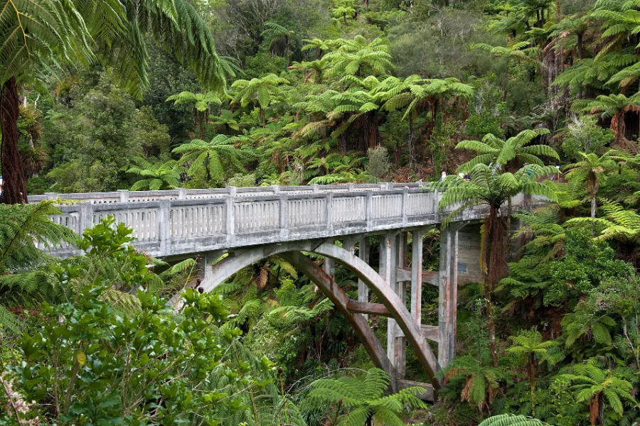
The Whanganui River and the Bridge to Nowhere
West of the village the Whanganui River winds through deep bush to the sea: a Great Walk you paddle, over three to five days. Since 2017 it has been a legal person, Te Awa Tupua. From Pipiriki a jet boat reaches the Bridge to Nowhere, built in 1936 for a farm settlement the bush took back.
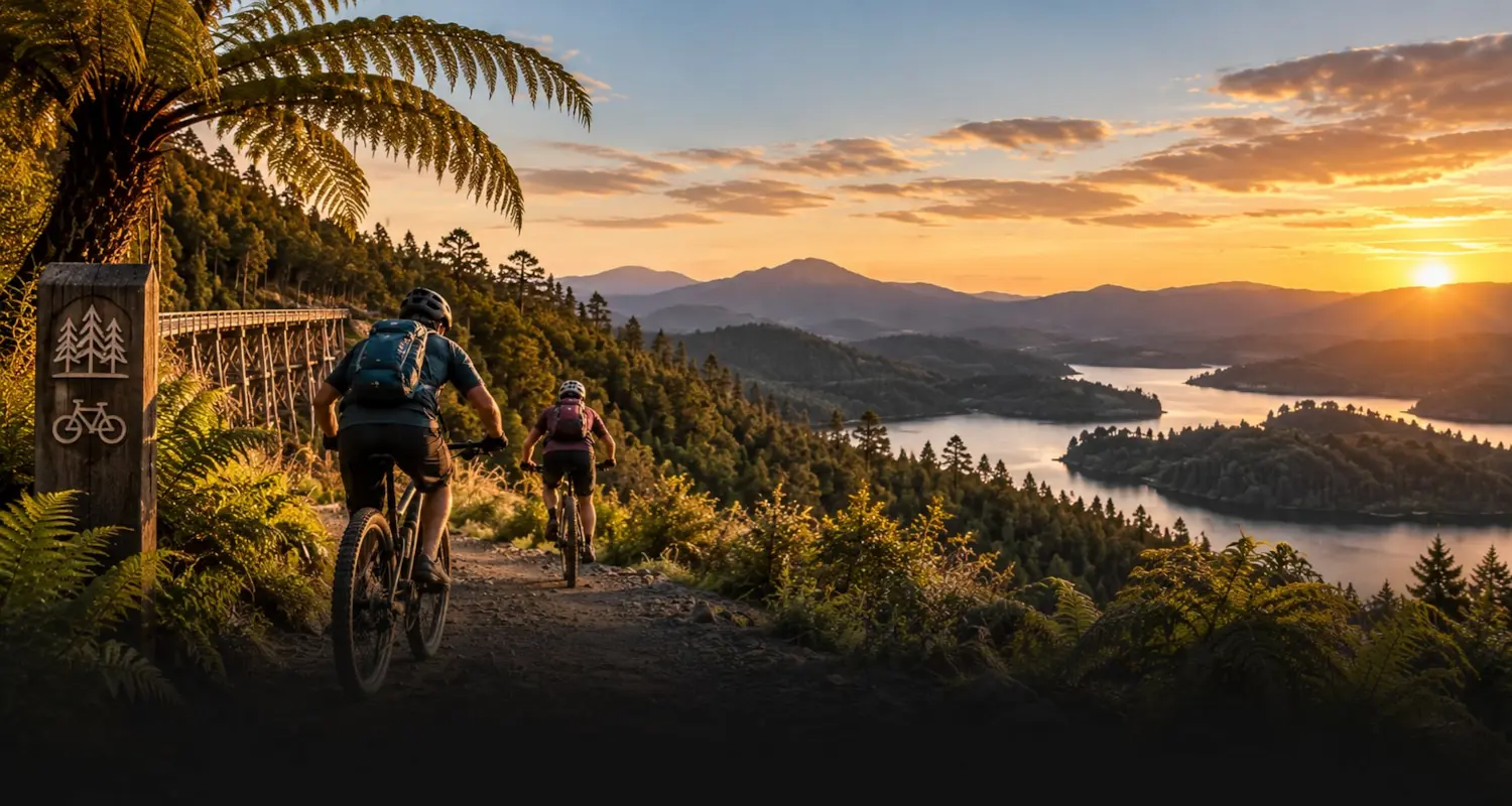
The Timber Trail
North beyond Taumarunui lies one of New Zealand’s finest Great Rides: 85 km of old logging tramways and suspension bridges through the Pureora Forest, over two days on a bike. Read the guide →
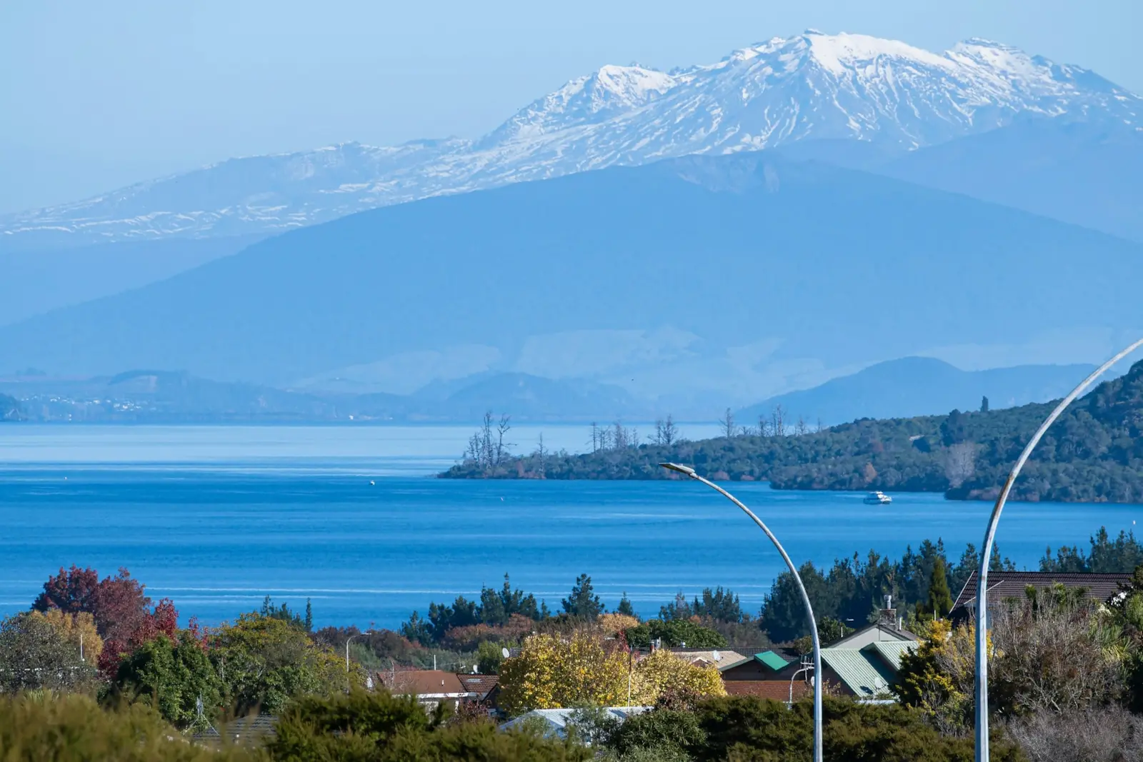
Lake Taupō
Forty minutes north-east, at Tūrangi, you reach the southern shore of the country’s largest lake. It fills the caldera of a colossal eruption some 25,000 years ago, reshaped by another about 1,800 years ago. Look back from its northern shore on a clear day and the three volcanoes stand at the far end. Read the guide →
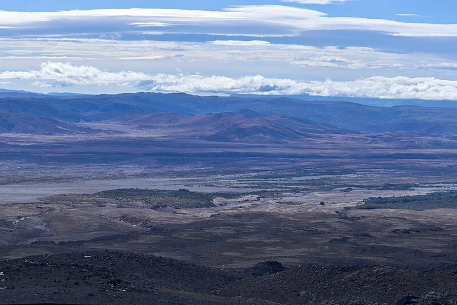
The Desert Road and Tangiwai
The drive south on State Highway 1 crosses the Rangipo Desert, a high, bare plain of ash and tussock. At Tangiwai a memorial marks 24 December 1953, when a lahar from Ruapehu’s crater lake swept away the rail bridge and 151 people died.
Drive times are our planning estimates in normal conditions, checked on 29 September 2026. If you are driving from Rotorua towards Taranaki, our North Island road trip suggests breaking the journey near here.
A final word on National Park Village
Come for the Crossing, by all means. But stay long enough to let the mountains show you more than one face: the walk to the falls when the tops are in cloud, the Tama Lakes on a clear, still morning, the snow in winter, the stars over the plateau at night. Remember whose mountains they are, walk lightly, and give yourself the second night. It is the best insurance you can buy here, and it costs nothing like the day it saves.
Andrew + Margaret
- Visiting New Zealand Overview
- The Tongariro Alpine Crossing Highlight
- Taupō Overview
- The North Island in two weeks Journeys
- New Zealand in three weeks Journeys
- The Timber Trail Journeys
- Understanding Māori New Zealand Culture
- Department of Conservation — Tongariro National Park Official
- Department of Conservation — Tongariro Alpine Crossing Safety
- GeoNet — volcanic alert levels Safety
- UNESCO — Tongariro National Park Culture
- NZ History — the Tongariro summits entrusted, 1887 Culture
- Visit Ruapehu Official
- Whakapapa ski area and Sky Waka Booking
- Tūroa ski area Booking
- John Gully, Tongariro, Ngauruhoe and Ruapehu, Central North Island (1866), Te Papa Reading
Is National Park Village the same place as Waimarino?
Yes. Waimarino became the village’s official name in December 2024, restoring its original name. The railway station keeps the name National Park, and most signs, bookings and timetables still use it.
Should I stay in National Park Village, Whakapapa, Ohakune or Tūrangi?
For the Crossing, the village: it has the most beds and shuttles and is closest to the start. Whakapapa Village puts you inside the park but has little choice. Ohakune suits skiers at Tūroa, and Tūrangi suits anyone who also wants Lake Taupō and the trout rivers.
What if the Crossing is cancelled for weather?
Use the spare day you planned. If it stays wild, the lower walks from Whakapapa Village, to Taranaki Falls, Silica Rapids and Tawhai Falls, are sheltered and lovely, and the Sky Waka runs in most weather.